Why the DJI Matrice 4 Series Is the Best Enterprise Drone in 2025
In 2025, the demand for intelligent, reliable, and high-performance drones is higher than ever — and DJI has once again set the standard with the release of the DJI Matrice 4 Series. Designed specifically for enterprise use, this cutting-edge drone series combines powerful imaging systems, advanced AI features, and unmatched versatility to tackle even the most complex missions.
Whether you’re in public safety, infrastructure inspection, or aerial surveying, the DJI Matrice 4 Series offers the perfect balance of performance and precision. In this article, we’ll explore why this latest release stands out as the best enterprise drone of the year.
Meet the DJI Matrice 4 Series
The DJI Matrice 4 Series represents a new generation of enterprise drones, purpose-built for professionals who demand accuracy, intelligence, and reliability in every mission. As the successor to the widely adopted Matrice 30 Series, this new line introduces smarter workflows, better payload options, and seamless integration with DJI’s growing ecosystem of software and hardware tools.

Launched in early 2025, the DJI Matrice 4 Series includes two models — the Matrice 4T and Matrice 4E — each tailored to different operational needs. Whether you’re managing critical infrastructure, responding to emergencies, or conducting topographic surveys, the DJI Matrice 4 Series adapts easily to your workflow with modular payloads, intelligent flight modes, and unmatched environmental awareness.
Built with enterprise users in mind, the series is designed to improve operational efficiency across industries such as:
- Public safety and emergency response
- Energy and utilities inspection
- Construction and infrastructure monitoring
- Agriculture and environmental research
- Mapping, surveying, and GIS applications
The DJI Matrice 4 Series also works seamlessly with platforms like DJI FlightHub 2 and DJI Dock 3, enabling real-time mission planning, remote operations, and automated data collection — all from a single integrated system.
This new series isn’t just a tool — it’s a comprehensive aerial solution built for modern enterprise challenges.
Key Features and Specifications
The DJI Matrice 4 Series stands out as a premier choice for enterprise drone operations in 2025, offering a blend of advanced imaging capabilities, robust flight performance, and intelligent features tailored for professional applications.

Side by side, the DJI Matrice 4T and 4E showcase the next evolution of enterprise drone design
Advanced Imaging Systems
- Matrice 4T: Equipped with three 48MP cameras—wide-angle, medium telephoto, and telephoto—alongside a thermal camera with a resolution of 640×512 pixels. This configuration ensures versatility in capturing detailed visuals across various scenarios.
- Matrice 4E: Features a 20MP wide-angle camera with a large 4/3-inch CMOS sensor, complemented by 48MP medium telephoto and telephoto cameras. This setup is optimized for high-precision mapping and inspection tasks.
Flight Performance
- Flight Time: Up to 49 minutes with standard propellers, allowing for extended missions without frequent battery changes.
- Maximum Speed: Capable of reaching speeds up to 21 m/s, facilitating rapid deployment and coverage of large areas
- Wind Resistance: Designed to withstand wind speeds up to 12 m/s, ensuring stability and reliability in challenging weather conditions.
Intelligent Features
- Laser Range Finder: Provides precise distance measurements up to 1,800 meters, enhancing situational awareness and measurement accuracy.
- Night Scene Mode: Offers enhanced low-light performance, enabling operations in nighttime or dimly lit environments.
- Smart Detection and Measurement: Utilizes AI-powered features for real-time object detection and data analysis, streamlining workflows and decision-making processes.
These features collectively position the DJI Matrice 4 Series as a versatile and powerful tool for industries such as public safety, infrastructure inspection, and geospatial surveying.
Industry Applications: Real-World Impact
The DJI Matrice 4 Series isn’t just a drone; it’s a versatile aerial platform poised to revolutionize workflows across a multitude of industries. Its enhanced performance, adaptable payload system, and intelligent features translate directly into tangible benefits and groundbreaking applications. Let’s explore some key areas where the Matrice 4 Series is making a significant impact:
Infrastructure Inspection: Ensuring Safety and Efficiency
The Challenge: Traditional infrastructure inspections of bridges, power lines, wind turbines, and pipelines often involve manual processes that are time-consuming, hazardous, and can lead to incomplete data.
The Matrice 4 Solution: Equipped with high-resolution cameras and the ability to carry specialized payloads like LiDAR and thermal sensors, the Matrice 4 Series offers a safer, faster, and more comprehensive approach.
Real-World Impact:
- Detailed Visual Inspections: Capture ultra-high-resolution imagery and video to identify structural defects, corrosion, and wear with unprecedented clarity. Imagine detecting hairline cracks on a bridge support or identifying loose bolts on a wind turbine blade without putting personnel at risk.
- Thermal Anomaly Detection: Thermal payloads can pinpoint overheating components in power lines or identify insulation issues in buildings, enabling proactive maintenance and preventing costly failures. Think of identifying a potential electrical fault before it causes a blackout.
- 3D Modeling and Digital Twins: LiDAR payloads can create highly accurate 3D models of infrastructure assets, forming the basis for digital twins that allow for detailed analysis, change detection, and predictive maintenance planning. Envision creating a precise digital replica of a complex industrial facility for ongoing monitoring and management.

Surveying and Mapping: Precision and Accuracy from Above
The Challenge: Traditional land surveying and mapping methods can be labor-intensive, time-consuming, and may struggle with complex terrain or large areas.
The Matrice 4 Solution: The Matrice 4 Series, with its precise GPS/RTK positioning and compatibility with photogrammetry and LiDAR payloads, offers a highly efficient and accurate alternative.
Real-World Impact:
- High-Accuracy Orthomosaics and 3D Models: Generate georeferenced orthomosaics and detailed 3D models for land surveying, construction site monitoring, and urban planning with centimeter-level accuracy. Picture creating a precise map of a construction site to track progress and manage resources effectively.
- Efficient Terrain Mapping: LiDAR payloads can penetrate vegetation to capture detailed ground elevation data, crucial for applications like flood modeling, forestry management, and infrastructure development. Imagine accurately mapping the terrain beneath a dense forest canopy for pipeline planning.
- Volumetric Analysis: Quickly and accurately calculate stockpiles of materials in mining or construction, providing valuable data for inventory management and operational efficiency. Think of efficiently determining the volume of coal in a storage yard.
Public Safety and Emergency Response: Critical Information in Critical Times
The Challenge: In emergency situations, rapid situational awareness and the ability to locate and assess hazards are paramount, often under challenging and dangerous conditions.
The Matrice 4 Solution: The Matrice 4 Series provides a versatile aerial platform for first responders, offering real-time video feeds, thermal imaging capabilities, and the ability to deploy specialized payloads like spotlights and communication systems.
Real-World Impact:
- Search and Rescue Operations: Thermal cameras can locate missing persons, even in low-light conditions or obscured by vegetation. Imagine quickly identifying a heat signature in a dense forest during a nighttime search.
- Disaster Assessment: Rapidly assess damage after natural disasters like earthquakes or floods, providing critical information to aid relief efforts and resource allocation. Think of quickly surveying the extent of damage to buildings and infrastructure after a hurricane.
- Situational Awareness for Law Enforcement: Provide aerial overwatch for critical incidents, track suspects, and gather evidence, enhancing officer safety and operational effectiveness. Envision providing a live aerial view of a developing situation to incident commanders.

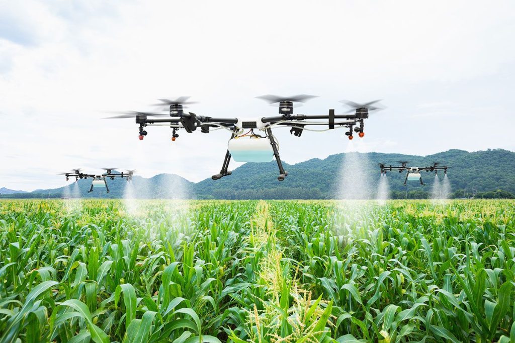
Agriculture: Precision for Increased Yield and Sustainability
The Challenge: Traditional agricultural practices can be resource-intensive, and optimizing crop health and yields requires detailed information about field conditions.
The Matrice 4 Solution: Equipped with multispectral and hyperspectral cameras, the Matrice 4 Series allows for detailed analysis of crop health, identification of nutrient deficiencies, and targeted interventions.
Real-World Impact:
- Crop Health Monitoring: Identify areas of stress or disease in crops early on, allowing for timely and targeted treatments, reducing the need for widespread chemical applications. Imagine identifying a fungal infection in a specific section of a field before it spreads.
- Variable Rate Application: Generate prescription maps for precise application of fertilizers, pesticides, and irrigation, optimizing resource use and minimizing environmental impact. Think of applying the exact amount of fertilizer needed in different parts of a field based on its specific requirements.
- Yield Prediction: Analyze crop health data to estimate yields, enabling better planning for harvesting, storage, and market forecasting. Envision accurately predicting the harvest output of a large farm.
Other Potential Applications: Expanding Horizons
The versatility of the Matrice 4 Series extends beyond these key areas. Consider its potential in:
- Energy: Inspecting solar farms for panel defects or wind farms for structural integrity.
- Mining: Monitoring progress, calculating stockpiles, and ensuring site safety.
- Environmental Monitoring: Tracking wildlife populations, assessing deforestation, and monitoring pollution levels.
- Construction: Site surveying, progress tracking, and safety inspections.
- Logistics: Delivery of critical supplies to remote locations.
The DJI Matrice 4 Series is not just a tool; it’s an enabler, empowering industries to achieve new levels of efficiency, safety, and insight. As payload technology continues to evolve, the potential applications of this powerful platform will only continue to expand.
Accessories and Ecosystem

DJI Dock 3: Autonomy at Its Finest
The DJI Dock 3 is a fully autonomous, weatherproof drone-in-a-box. It handles takeoff, landing, recharging, and relaunching without human help. Ideal for remote or mobile operations like on trucks or boats, it enables 24/7 missions with real-time data uploads—perfect for construction, inspections, and emergency response.
Battery Charging Hub: Stay in the Air Longer
Designed for the Matrice 4 Series, this hub fast-charges multiple batteries at once using smart tech to balance speed and battery health. It’s essential for high-frequency missions where downtime isn’t an option.
DJI RC Plus: Rugged Control with a Pro Touch
This pro-grade remote has a bright screen, ergonomic design, and supports dual-operator use—great for long field days and complex missions like filming or inspections.
DJI Terra: Smarter Mapping and Modeling
DJI Terra works with the Matrice 4 to turn aerial data into maps, 3D models, and reports. Ideal for surveying, construction, and agriculture, it helps you visualize and act on data fast.
DJI SkyPort: Plug-and-Play Payloads
SkyPort lets you easily swap in third-party sensors like LiDAR or thermal cameras. It gives the Matrice 4 Series flexibility for diverse tasks—from utility inspections to environmental monitoring.
Cloud and Fleet Management: Your Drone HQ
DJI FlightHub and DJI Pilot offer real-time drone tracking, mission planning, and data
D-RTK 2 Mobile Station: Precision Down to the Centimeter
This base station provides centimeter-level GPS accuracy for mapping and construction. It corrects satellite data in real time—even in weak-signal areas—for pinpoint precision.
Unlock the Future of Aerial Operations
The DJI Matrice 4 Series sets a new standard for enterprise drones with its powerful performance, flexible payloads, and smart features built for demanding tasks. From precise mapping to safer inspections and emergency support, it brings unmatched efficiency to every mission.
Backed by a full suite of software and accessories, it’s the all-in-one solution for industries ready to elevate their operations.
Ready to see what the Matrice 4 can do for your team?
Contact us today to learn more or get a personalized introduction to the system.