

Modern surveying projects demand more than simply collecting point cloud data. Survey teams need accurate measurements, efficient field workflows, reliable georeferencing, and imagery that provides enough context for clients and project teams to understand the final deliverable. At the same time, large sites, complex structures, tunnels, and feature-poor environments can make conventional surveying workflows slow and difficult to repeat consistently.
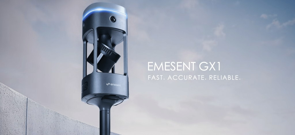
The Emesent GX1 is designed to address these challenges by combining LiDAR, SLAM, RTK positioning, 360° imagery, and processing software into one mobile mapping solution. With reported 5–10 mm global accuracy, a 300 m LiDAR range, four 20 MP cameras, and multiple deployment options, GX1 allows surveyors to capture detailed spatial data while moving through a site rather than relying solely on stationary scanning positions.
The result is a flexible workflow that can be used across road and topographic surveys, construction progress monitoring, Scan-to-BIM projects, tunnels, and infrastructure surveys. Understanding how to use the system effectively is key to getting the most from mobile LiDAR technology.
Why Mobile LiDAR Changes the Surveying Workflow
Traditional terrestrial surveying methods can require multiple setups, repeated instrument positioning, and significant time in the field. Mobile scanning approaches the problem differently. Instead of collecting data from a series of fixed positions, the surveyor can move through the environment while the scanner continuously captures spatial information.
The GX1 combines Emesent’s proprietary SLAM technology with integrated RTK georeferencing. SLAM helps the scanner determine its position relative to the surrounding environment, while RTK can provide georeferenced positioning and real-time quality monitoring. Emesent states that GX1 can achieve 5–10 mm global accuracy depending on environmental conditions, with 2 mm scan precision and up to 1.92 million LiDAR points per second using triple returns.
This combination is particularly useful when survey teams need both speed and dependable spatial accuracy across changing environments.
Topographic and Road Survey Tips Using the Emesent GX1
Road corridors and open topographic environments can present an interesting challenge for SLAM-based scanning because long, open stretches may contain relatively few environmental features. Emesent specifically demonstrates GX1 in a 250-meter feature-poor road environment, where a 500-meter round-trip scan was completed in six minutes using a survey pole and local base station.
For road and topographic surveys, begin by establishing the required coordinate system and georeferencing workflow. Integrated RTK can be used during capture, while PPK or control points can support post-processing workflows where required.
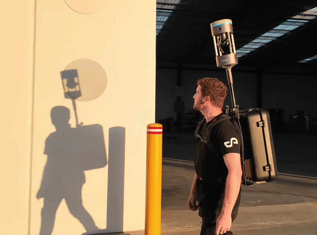
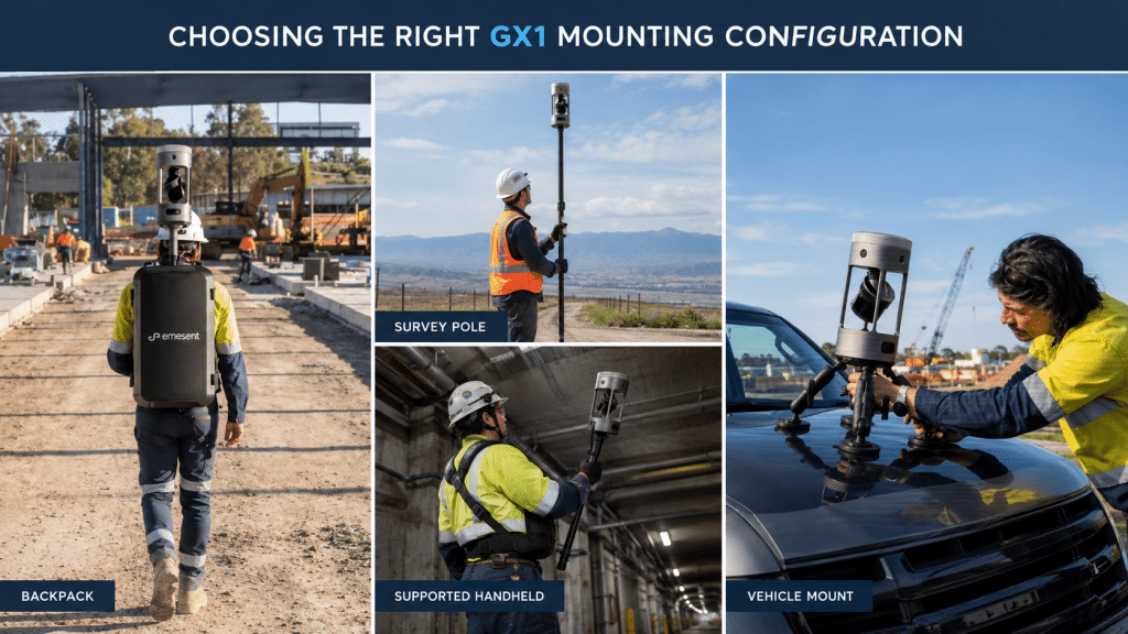
Select the mounting configuration based on the size and characteristics of the site. A survey pole provides additional reach and control, while the backpack configuration allows the operator to cover larger areas on foot. For extensive corridors and sites, the vehicle mount can help cover large areas more efficiently.
During scanning, maintain a steady walking or driving pattern and keep environmental features visible to the scanner. Where practical, incorporate loop closures by returning through previously scanned areas. This helps the SLAM system reduce accumulated drift and strengthens the consistency of the final point cloud.
For long road corridors, bridges, intersections, and other open environments, this workflow can significantly reduce the amount of time spent setting up and relocating traditional surveying equipment.
Scan-to-BIM Workflow with the GX1
Scan-to-BIM projects require more than a dense point cloud. The captured data needs to provide enough geometric and visual context for architects, engineers, BIM specialists, and other project stakeholders to work with the information efficiently.
The GX1 combines LiDAR with four 20 MP cameras providing 360° horizontal and 284° vertical coverage. This allows the system to capture spatial geometry alongside high-resolution imagery during the same scanning workflow. Emesent also integrates 360° panoramas into E57 files and provides automated people masking to simplify downstream data preparation.
A practical Scan-to-BIM workflow begins with defining the areas and elements that need to be captured. Move systematically through rooms, corridors, structural areas, and other spaces while maintaining adequate overlap and visibility between sections.
For complex buildings, revisit important areas from different directions. This can help fill gaps around columns, equipment, walls, ceilings, and other obstructions.
The workflow has also been used in high-volume residential scanning. Emesent reports that Sonto, whose survey deliverables include a large proportion of BIM projects, recorded a 30% reduction in field errors during its GX1 beta-program experience.
The key advantage is not simply the point cloud itself, but the ability to move from field capture toward a usable BIM workflow with fewer manual steps.
Construction Progress Monitoring Best Practices
Construction sites change continuously, making repeatable data capture important for tracking progress. Survey teams need to document what has been built, compare current conditions with previous scans, and provide project stakeholders with information they can understand.
The GX1 can be used to establish repeatable scanning routes across construction sites. Integrated RTK and Emesent SLAM support consistent positioning, while the 360° cameras add visual context to the LiDAR data.
Before each scan, define the areas that need to be compared with previous datasets. Follow a similar route and scanning pattern where possible. Pay particular attention to structural elements, installed equipment, floor levels, service areas, and other project milestones.
After capture, process the data and compare it with previous scans or project models. Consistent scanning procedures make it easier to identify changes and provide stakeholders with an updated view of site conditions.
For large projects, this repeatable approach can reduce the amount of manual documentation required during regular progress inspections.
Tunnel and GPS-Denied Survey Workflows
Tunnels and other enclosed environments introduce another challenge: GPS availability can be intermittent or completely unavailable.
This is where SLAM becomes particularly valuable. Emesent developed its SLAM technology for challenging environments, including underground applications, and GX1 brings that technology into a ground-based mobile scanning platform. Emesent states that GX1 is designed to maintain reliable, repeatable results in tunnels and feature-poor environments where conventional positioning methods can become difficult.
Before entering a tunnel, establish the scanning route and identify areas where additional coverage may be required. Keep fixed environmental features visible throughout the scan and avoid moving too quickly through areas where detailed capture is important.
For critical sections, pause briefly to allow the scanner to collect sufficient detail. When working under low ceilings or around structures, changing the scanner’s position or mount can also help capture areas that may otherwise be obstructed.
The same approach can be applied to underground passages, infrastructure corridors, utility spaces, and other areas where satellite positioning is limited.
Choosing the Right GX1 Mounting Configuration
One of the GX1’s practical advantages is that the same scanner can be deployed in different ways depending on the project.
Backpack Mount
The backpack configuration is suited to walking surveys across buildings, construction sites, roads, and larger areas. Mounting the scanner above the operator also helps improve visibility of overhead features.
Survey Pole
A survey pole provides additional reach and is useful when capturing elevated features, overhead structures, or areas where the scanner needs to be positioned at a specific height.
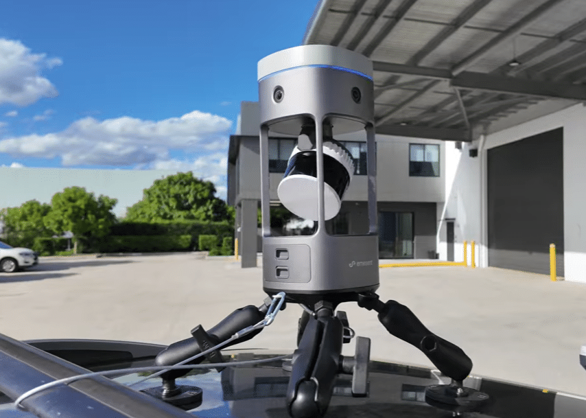
Vehicle Mount
For large road corridors, infrastructure routes, and expansive sites, vehicle mounting allows teams to cover significantly more ground without requiring the operator to walk the entire survey area.
Supported Handheld
Handheld operation provides greater maneuverability in confined or difficult-to-reach spaces where a backpack or vehicle configuration may not be practical.
Using the appropriate mounting method for each project allows survey teams to adapt the same GX1 system to different environments without changing their core scanning platform.
General Best Practices for Every GX1 Survey
Regardless of the application, a consistent workflow helps improve data quality and reduce repeat site visits.
Before Scanning
- Define the survey area and required deliverables.
- Establish the coordinate system and georeferencing method.
- Select the appropriate GX1 mounting configuration.
- Check battery capacity and available storage.
- Review environmental conditions and potential obstacles.
- Plan entry and exit routes for enclosed or restricted areas.
During the Mission
- Maintain a steady scanning speed.
- Keep fixed environmental features within the scanner’s field of view.
- Capture important areas from multiple positions where necessary.
- Use loop closures when appropriate to strengthen SLAM results.
- Monitor scan quality and positioning information during the mission.
- Pause briefly in areas where additional detail is required.
After Scanning
- Review the captured data before leaving the site.
- Confirm that all critical areas have been scanned.
- Check georeferencing and accuracy information.
- Process and organize the point cloud and imagery.
- Compare repeat surveys using consistent workflows.
- Back up project data and prepare the required deliverables.
A standardized workflow helps survey teams make mobile scanning more repeatable and gives project stakeholders greater confidence in the resulting data.
Conclusion
The Emesent GX1 brings LiDAR, SLAM, RTK, 360° imagery, and data processing into a single mobile mapping workflow. With 5–10 mm global accuracy, 2 mm scan precision, a 300 m LiDAR range, four 20 MP cameras, 2 TB of onboard storage, and multiple deployment options, it is designed to support a wide range of surveying and AEC applications.
From road and topographic surveys to Scan-to-BIM, construction progress monitoring, and tunnel mapping, GX1 allows survey teams to capture detailed spatial information while moving through the environment. Its combination of SLAM and RTK also provides flexibility when projects move between open outdoor areas, buildings, and environments where GPS availability is limited.
For organizations looking to improve field efficiency without separating speed from accurate spatial data, the Emesent GX1 provides a versatile mobile scanning solution.
If your team is evaluating mobile LiDAR for surveying, construction, infrastructure, or reality capture projects, Dynatech Innovations can help you determine the appropriate GX1 configuration and workflow for your application. Contact the Dynatech team to discuss your project requirements and explore how Emesent GX1 can fit into your existing surveying operations.