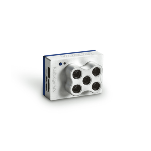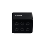
Yusense 6-BAND UNIVERSAL VERSION MULTISPECTRAL MS600 V2 (6-band spectrum, deep plowing industry application)
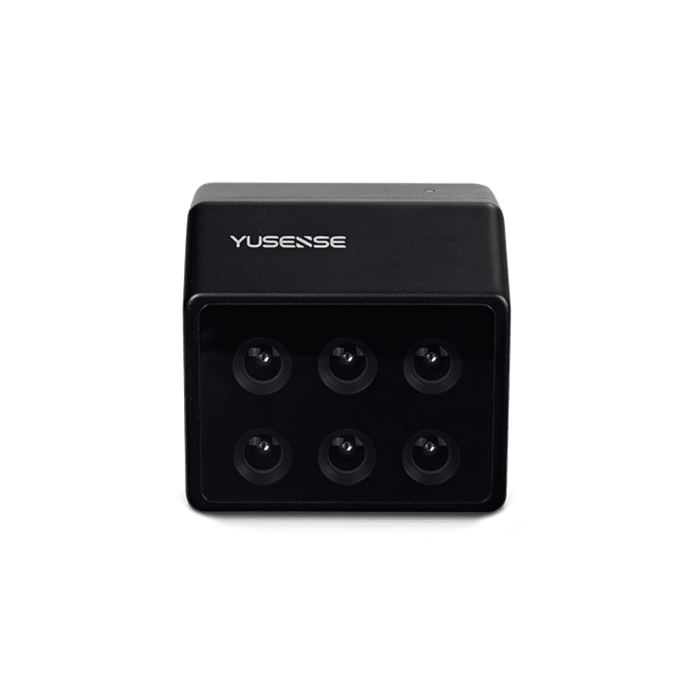
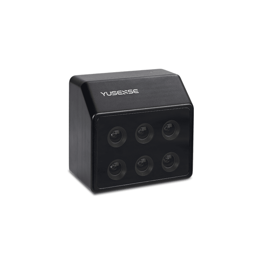
Yusense 6-BAND UNIVERSAL VERSION MULTISPECTRAL MS600 V2 (6-band spectrum, deep plowing industry application)
Product features
- 6 multispectral
- 1.2 million pixels
- 12bit global shutter
- Ethernet port/TTL serial port
- On-board real-time reflectance calculation
- The fastest 1s synchronous imaging of all channels
- Standard downlink light sensor (DLS)
- 10W@12V power supply, 64G TF card
- Multiple trigger modes of external, timing and overlap rate
- Compatible with multi-rotor and fixed-wing UAV platforms
-
Description
Six 1.2M pixel multi-spectral channels, sapphire optical window, large aperture, low distortion, broadband transmission, all-glass lens, aluminum alloy body, large dynamic range intelligent dimming, to meet precision agriculture, forestry monitoring, river and lake ecology, goals Identification and other industry application requirements.
Technical Parameters
Indicator name |
MS600 V2 index parameters |
| Configuration method | 6 multispectral channels |
| Target size | 1/3″ |
| Effective Pixels | 1.2Mpx |
| shutter type | global |
| quantization bits | 12bit |
| field of view | 49.5°×38.1° |
| ground resolution | 8.65cm@h120m |
| coverage width | 110m×83m@h120m |
| Spectrum channel[1] | 450nm@30nm, 555nm@27nm, 660nm@22nm, 720nm@10nm, 7 50nm@10nm, 840nm@30nm |
| optical window | Sapphire Optical Glass Window |
| Host size | ≤80mm×75mm×55mm |
| Host weight | 275±5g |
| installation interface | 4×M3 |
| powered by | 7VDC~30VDC |
| power consumption | ≤10w@12V |
| Image Format | 16bit original TIFF & 8bit albedo JPEG |
| video format | — |
| storage medium | Standard 64G, maximum support 128G capacity (transmission speed U3 and above rating) micro SD card |
| processing software | Yusense Map/Yusense Map Plus |
| parameter settings | WIFI (WEB interface access)/UART |
| shooting trigger | External trigger, timing trigger, overlap rate trigger, |
| shooting frequency | 1Hz (related to the actual read and write speed of the storage medium) |
| Working temperature | -10°C~+50°C (relative wind speed ≥1m/s) |
| storage ambient temperature | -30℃~+70℃ |
| environment humidity | RH(%)≤85%(non-condensing) |
| certified product | CE, FCC, RoHS |
Remarks: [1] The wavelength is standard, and the following 18 wavelengths are allowed to be customized (please consult Yuchen marketing personnel for details on the combination method and cost): 410nm@35nm, 450nm@30nm, 490nm@25nm, 530nm@27nm, 555nm@27nm , 570nm@32nm, 610nm@30nm, 650nm@27nm, 660nm@22nm, 680nm@25nm, 720nm@10nm, 720nm@15nm (Qualcomm), 750nm@10nm, 780nm@13nm, 800nm@35nm, 840nm@30nm, 900nm@ 35nm, 940nm@35nm (tolerance ±5nm). Shooting frequency: test results using storage media with a new transmission speed of U3 and above (sketch speed ≥ 60MB/s).
typical application
Growth assessment
Use vegetation factors such as NDVI and LAI to quantitatively describe the consistency of vegetation canopy states at different spatial scales, assist the characteristic spectra of vegetation in different health states, quantitatively evaluate the growth of vegetation, and provide data for irrigation, fertilization, plant protection, and yield assessment. support.
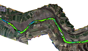
Black and odorous water body monitoring
With reference to the evaluation standards for surface black and odorous water bodies, the characteristic spectrum is used to construct a classification index to realize the graded inversion of black and odorous water bodies and spatial information statistics, to assist in the analysis of the impact of domestic sewage and industrial wastewater on surrounding water bodies, and to assist in the investigation of pollution sources and water environment assessment
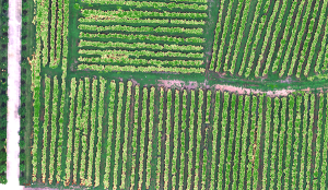
Coverage Evaluation
Construct the vegetation index based on the fingerprint of the vegetation, complete the spatial distribution and area statistics of the target vegetation in the designated area, and provide quantitative vegetation canopy density data for scientific research and production in the fields of agriculture, forestry and grassland, and ecology.
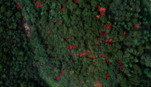
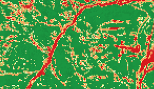
Pine wood discoloration monitoring
Comprehensive use of spectrum and texture information to achieve efficient suppression of soil, hay and other environmental backgrounds and high-precision identification of discolored standing trees, and accurately extract information such as the position, spatial distribution, and canopy area of discolored standing trees to provide data support for the control
Related products
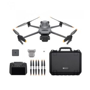
-
DJI Mavic 3 Multispectral
AED17,525.00 VAT Excl -