For decades, Real-Time Kinematic (RTK) surveying has been the gold standard for high-precision GNSS work. But what happens when the job demands speed, the environment is challenging, or safety is a concern?
If you’ve ever faced signal loss in an urban canyon, spent extra minutes leveling a pole, or needed to capture data from a hazardous spot, you already know the limits of traditional RTK methods.
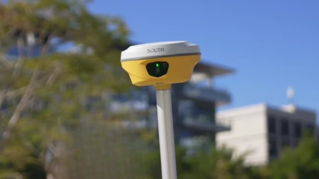
The surveying landscape is changing and South’s new ALPS1 system is leading the charge. This isn’t just another GNSS receiver; it’s a paradigm shift.

Meet the ALPS1: The Future of High-Speed, High-Precision Surveying
In a profession where every second counts and every millimeter matters, the South ALPS1 stands out as a groundbreaking leap forward. It’s not just a GNSS receiver — it’s an intelligent hybrid system that unites GNSS precision, visual positioning, and laser measurement into a single, adaptable workflow.
The ALPS1 was built for real-world conditions where traditional RTK struggles — whether it’s surveying under dense tree cover, near tall structures, or in rugged terrain. Instead of slowing down or compromising accuracy, the ALPS1 keeps surveyors moving. Its visual and laser-assisted modes empower professionals to measure from a distance, capture inaccessible points safely, and complete more work in less time.
This is the next generation of surveying — faster, safer, and smarter — designed to keep pace with the modern field professional. Whether mapping open terrain or working in complex urban environments, the ALPS1 ensures precision never stops, even when conditions do.
Breaking the Limits of Traditional RTK
RTK surveying provides centimeter level accuracy but is often hindered by poor satellite geometry or signal obstructions. In dense urban areas, under bridges, or near large metal structures, data quality drops sharply.
The ALPS1 solves these limitations with multi constellation and multi frequency tracking, supporting:
- GPS: L1C, L1C/A, L2C, L2P(Y), L5
- GLONASS: G1, G2, G3
- BDS: B1I, B2I, B3I, B1C, B2a, B2b
- Galileo: E1, E5a, E5b, E6, AltBOC
- QZSS, SBAS, and IRNSS for total global coverage
This means the ALPS1 can lock onto up to 60 satellites simultaneously, ensuring strong performance even in areas with heavy multipath or partial sky visibility.
In practical terms, the RTK initialization time is just 2 to 8 seconds, with positioning precision reaching 8 mm plus 0.5 ppm horizontally and 15 mm plus 0.5 ppm vertically using NTRIP. Static accuracy can reach 2.5 mm under optimal conditions, which is impressive for field operations where time and conditions are rarely ideal.
Visual Positioning: When GNSS Fails, Vision Takes Over
ALPS1’s Visual Positioning System (VPS) is its standout feature. Using a built in 8 MP camera and AI assisted image recognition, the device identifies and measures targets without relying solely on satellite signals.
Key advantages of visual positioning:
- Capture up to 50 points per minute without the need to level your pole manually
- Record visual data for each point, ensuring full traceability and quality control
- Continue surveying in GNSS denied zones like tunnels, building interiors, or shaded alleys
Example scenario:
A city survey team working in a dense urban center loses GNSS lock due to high-rise interference. Instead of pausing, they switch to Visual Positioning and continue mapping curbs and manholes. Within 10 minutes, they collect more than 300 data points, a task that would have taken over 40 minutes using conventional RTK.
Laser Measurement: Precision From a Safe Distance
The ALPS1 is built to handle the entire spectrum of real-world environments, offering exceptional versatility whether you’re in a sunny field or a cramped indoor site.
Versatility in Time and Place
The integrated Laser Measurement makes work possible when traditional GNSS fails. It allows professionals to collect target points in dark or semi-indoor environments where satellite reception is blocked, ensuring critical site details can be documented at any hour. Additionally, stored image data is reusable, offering a permanent record for verification.
Flexibility by Design with Real-World Scenarios
The system eliminates physical constraints. Video Shooting allows for remotely measuring points up to 10 to 15 meters away, dramatically reducing physical effort over large areas. Conversely, Laser Measurement is ideal for quick, non-contact measurements in very limited spaces where setting up a pole is impossible.
Scenario Example: If a point is needed on a busy highway overpass, a surveyor can use Visual Shooting from the roadside to capture the point safely and quickly. If the point is inside a small drainage culvert, the laser provides a fast, accurate, non-contact measurement. The built-in, calibration-free IMU also provides accurate data within a generous 120∘ tilt angle, speeding up work on uneven terrain.

Built to Perform: Hardware and Connectivity
The ALPS1’s strength lies in its robust design and intelligent power management. Weighing just 860 grams, it is light enough for all day use yet durable enough to withstand a 2 meter drop onto concrete. Its IP68 rating means complete dust resistance and protection from water immersion, while the magnesium aluminum body ensures excellent heat dissipation from −45∘C to +75∘C.
Key Specifications
| Category | Specification |
| Weight | 860 g |
| Durability | Survives 2 m drop |
| Ingress Protection | IP68 (dustproof and waterproof) |
| Operating Temperature | -45°C to +75°C |
| Battery Life | 25 hrs (static), 20 hrs (rover) |
| Internal Radio | 2W UHF (410–470 MHz), 12–15 km range (Farlink protocol) |
| Storage | 16 GB internal SSD + external USB OTG |
| Data Formats | RINEX 2.01/3.02, RTCM 3.2, NMEA 0183 |
| Connectivity | Bluetooth 5.0, Wi-Fi 802.11 b/g/n, NFC, USB-C |
| Interface | 1.14-inch display with multilingual voice guidance |
The ALPS1 isn’t just tough on paper, it’s built to outperform in the field. With up to 25 hours of continuous power, a radio range reaching 15 kilometers, and full protection against dust, water, and impact, it delivers dependable performance even in harsh environments. This combination of strength, endurance, and smart connectivity means surveyors can cover more ground, collect more data, and stay productive longer without worrying about downtime or equipment failure.
Smart Software Integration
The ALPS1 operates on a stable Linux system built for professional surveying performance. Its built-in Web UI allows quick access via Wi-Fi or USB, enabling users to monitor satellite tracking, change receiver settings, and download data directly from the field without needing additional tools.
For daily operations, the ALPS1 works seamlessly with SOUTH SurvStar, a next-generation field software designed for speed and precision. SurvStar offers real-time control, coordinate collection, and stakeout visualization in a clear, map-based interface. It also supports automatic cloud synchronization, ensuring that every survey record is securely stored and accessible anytime.
Through the SOUTH Cloud Service, users can remotely manage receivers, perform firmware updates, and track device status across multiple teams. This integration keeps survey projects efficient and well-coordinated, even across large work areas.
Additional features like voice guidance in multiple languages, an electronic bubble display, and automatic temperature monitoring make the ALPS1 simple to operate in all conditions. Together, ALPS1 and SurvStar deliver a fully connected, intelligent workflow that enhances accuracy, safety, and productivity from setup to data delivery.

The Future of Surveying is Hybrid
The ALPS1 marks a new era in professional surveying. It combines high precision GNSS technology with Visual Positioning and Laser Measurement to overcome the usual limits of traditional RTK systems.
This system enables surveyors to collect hundreds of accurate data points within minutes, even in areas with weak satellite signals or complex environments. It also improves safety by allowing measurements from a distance in risky or hard-to-access locations.
With its speed, accuracy, and intelligent design, the ALPS1 stands out as the complete solution for professionals who demand reliable results in every condition. For teams working under pressure or across diverse terrain, the ALPS1 is redefining what survey speed and efficiency truly mean.📩 Contact Dynatech Innovations today to learn more about the South ALPS1, schedule a demo, or get expert guidance on how this hybrid GNSS solution can transform your surveying workflow.