No products in the cart.
Back

In stock

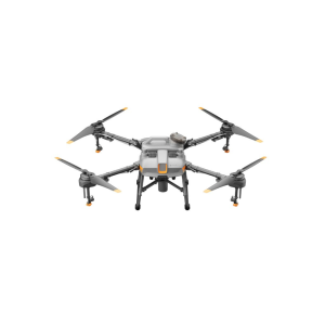
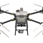
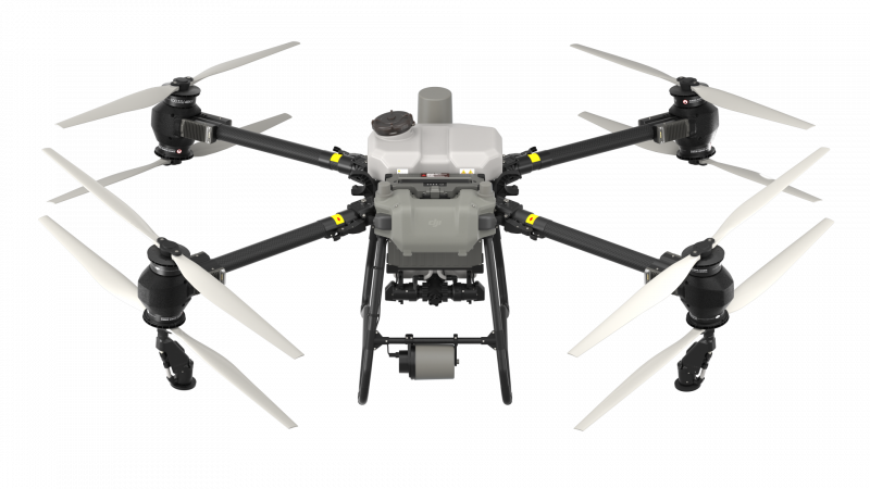
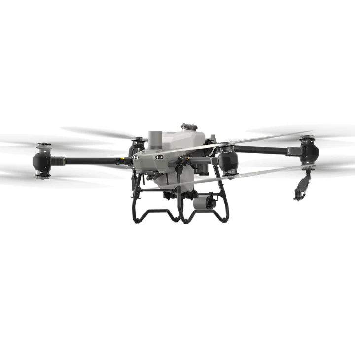
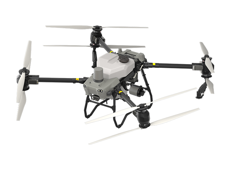
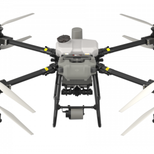
DJI Agras T50
AED39,780.00 VAT Excl
One Drone for Surveying, Spraying, and Spreading
- 40kg Spraying & 50kg Spreading
- 16L/min Spraying & 108kg/min Spreading
- 21 Hectares per hour for Field Operations
- 4 Hectares per hour for Orchard Operations
- 1,500kg of granules per hour for Spreading Operations
- Dual Atomizing Spraying System
- Coaxial Twin-Rotor Propulsion System
- Binocular Vision System
This item: DJI Agras T50
AED39,780.00 VAT Excl
AED39,780.00 VAT Excl
- Description
DJI AGRAS T50 elevates drone agricultural operations to new heights. It inherits a powerful coaxial twin-rotor propulsion system and a split-type torque resistant structure for next level stability when carrying 40 kg spraying or 50 kg spreading payloads.DJI AGRAS T50 leverages a Dual Atomizing Spraying System, Front and Rear Phased Array Radars, and a Binocular Vision System. DJI AGRAS T50 excels across multiple scenarios, from surveying to spraying and spreading, guaranteeing stable operations and steady performance.
| Heavy Payload | High Flow Rate | Signal Stability |
| 40kg Spraying 50kg Spreading | Spraying 16L/min Spreading 108kg/min | Offline operations 2 km O3 Transmission Optional DJI Relay |
| All Scenario Adaptability | Multidirectional Obstacle Sensing | Four Sprinkler Kit (Optional) |
| Fully automatic and manual operation Orchard Mode Variable Rate Application | Multidirectional Obstacle Avoidance Terrain Following up to 50° | Reverse Directional Spray During Flight 4-sprinkler spraying, flow rate 24 L/min |
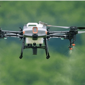
Spraying System
High Rate, Atomized Spray, Leak Free
Magnetic Drive Impeller Pump
Dual pump flow rate of up to 24 L/min. This is a 100% increase compared with the previous generation, to meet demands of fields, orchards, and high-temperature environments.
Dual Atomizing Centrifugal Sprinklers
Droplet size can be adjusted between 50-500 μm, depending on the chemicals used.
Brand-New Solenoid Valves
Precision starting and stopping eliminates leaking.
DJI AGRAS T50 Spreading System
1,500 kg per hour
DJI AGRAS T50’s new spreader and spiral channel spinning disk significantly improve spreading efficiency and smoothness.
| 50kg Payload | Smooth Spreading | Uniform Spreading |
| 75 L max capacity and an expanded loading gate for quick refills. | The torque of the spreader is doubled and the discharge hatch is enlarged to enable a flow rate up to 108 kg/min. | DJI AGRAS T50's spiral channel spinning disk makes spreading more uniform. |
| Low Rate Spreading | Real-Time Weighing | Fast Disassembly and Cleaning |
| You can also switch to small hopper gates to improve spreading accuracy with a low flow rate. | DJI AGRAS T50 is equipped with a weighing sensor which allows you to monitor the remaining payload in real time. | The spreader can be quickly disassembled and cleaned for easy maintenance. |
Tested for reliability, durability, and safety
Spraying and spreading operations are frequent, intense, and take place in complex environments. DJI AGRAS T50 has passed hundreds of reliability tests and its main body is durable to help ensure safe operation.
Double your peace of mind with Binocular Vision and Dual Radar
DJI AGRAS T50 is equipped with front and rear Active Phased Array Radars with double the number of RF channels for higher detection precision. Together they enable Multidirectional Obstacle Sensing, elevating operating safety. Two sets of Binocular Vision sensors enable DJI AGRAS T50 to accurately sense terrain and depict obstacles in detail, for automatic obstacle bypassing and Terrain Following over steep slopes.
Obstacle Detection
Terrain Projection
Obstacle Bypassing
One drone for surveying, spraying, and spreading
DJI AGRAS T50 integrates aerial surveying, spraying, and spreading into a single drone. A high-resolution FPV gimbal camera enables real-time capture of field and orchard images. Paired with DJI RC Plus and RTK service, you can generate high definition maps which underpin subsequent automatic flight routes. DJI AGRAS T50 can take off and perform automatic operations, all at the push of a button.
Orchard Aerial Survey
DJI AGRAS T50 supports obstacle bypassing and Terrain Following for surveying of orchards on slopes up to 20°. With DJI RC Plus and its real-time mapping capabilities, it can automatically identify fruit trees and obstacles. Based on the distribution of the fruit trees, it can generate accurate and fully automatic 3D flight routes.
5 hectare orchard mapped in 10 minutes
Orchard 3D Map
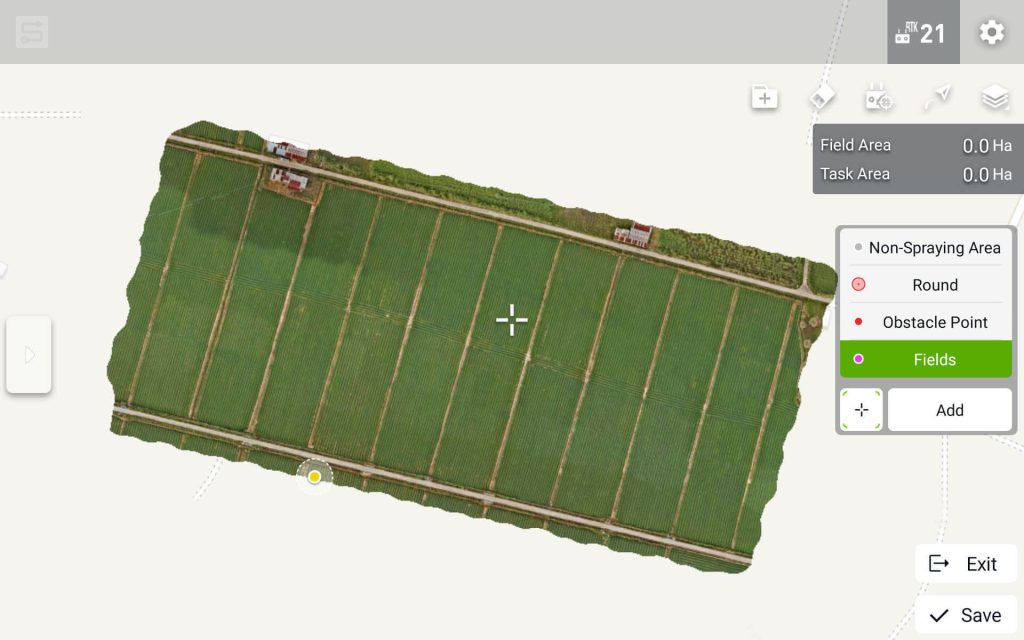
Field Aerial Survey
Area Route
13 hectare field mapped in 10 minute
Survey the entire field, automatically identify field boundaries and obstacles, and plan more precise flight routes.
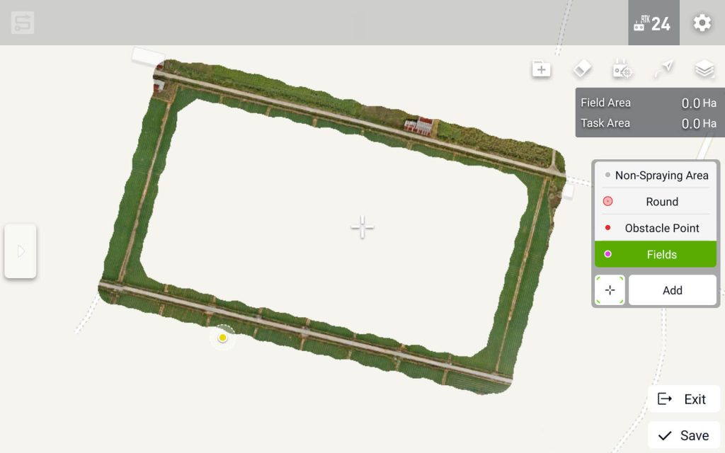
Boundary Route
13 hectare field boundary mapped in 3 minutes
Suitable for fields without obstacles in the middle.
High Brightness Widescreen Remote Controller
DJI RC Plus has a 7-inch high brightness screen and an 8-core processor for smooth operations. Intelligent route planning minimizes distances flown with a full tank, greatly increasing operation efficiency. Manual mode allows you to control operations at will.
Multi-Pilot Operations
Orchard Route Segmentation
Orchard Mode Spreading
Sided Spraying
Signal Stability
The new and upgraded quad-antenna O3 Transmission system works offline even in areas without cellular coverage, offering a transmission range of 2 km. Its anti-interference ability helps ensure high signal quality during operations over tall crops.
DJI Relay (Optional)
DJI Relay ensures smooth real-time video transmission for safer flights even in complex operation scenarios with signal obstructions
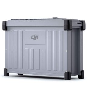
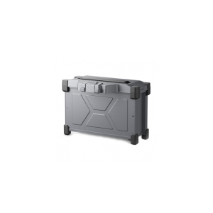
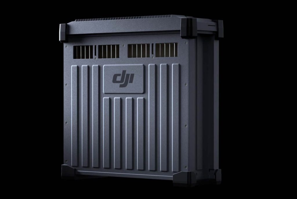
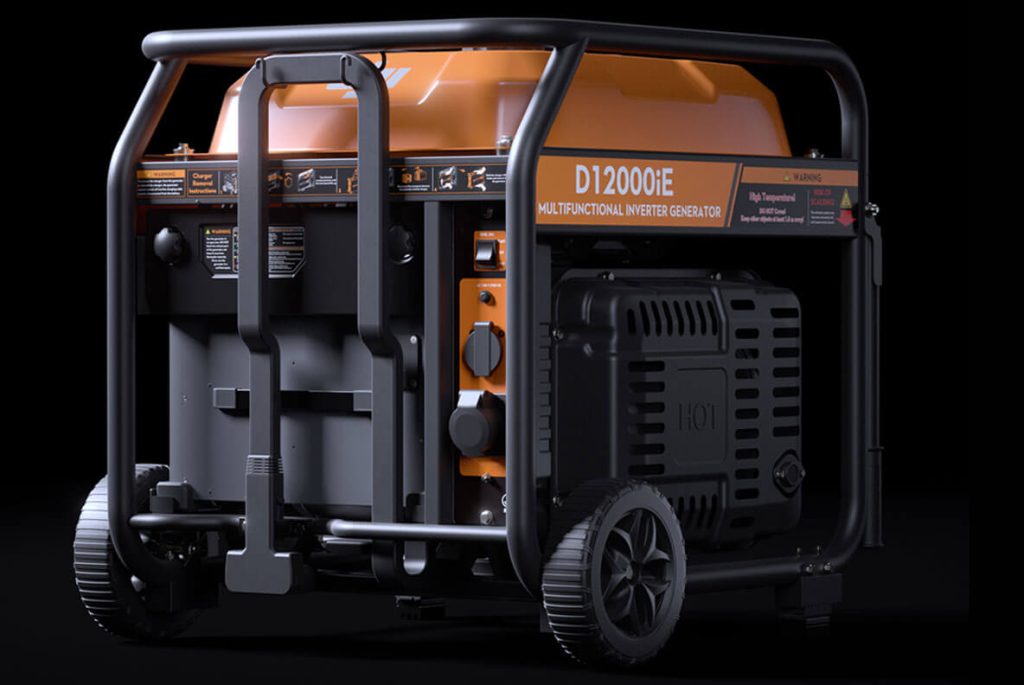
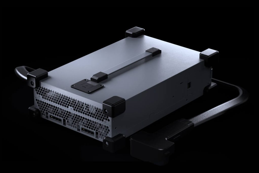
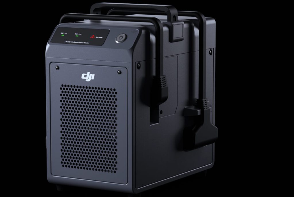
Fuel-Efficient Fast Charging
The D12000iE Multifunctional Inverter Generator features electronic fuel injection (EFI) technology and saves fuel use by 15%. The DB1560 Intelligent Flight Batteries charge in an Air-Cooled Heat Sink, enabling ultra-fast charging in 9 minutes. The C10000 Intelligent Charger can charge batteries directly with utility power.
DB1560 Intelligent Flight Battery
Capacity increased to 30 Ah Up to 1,500 charging cycles
D12000iE Multifunctional Inverter Generator
15% overall fuel savings
1,500 W AC output
9-min ultra-fast charging
1.5 m long charging cable
C10000 Intelligent Power Supply
9,000 W fast charging
Power-adaptive protection
1.5 m long charging cable
C8000 Intelligent Power Supply
Up to 7,200 W charging
Dual-channel alternated charging
Power-adaptative protection
Smart Agriculture Ecosystem
Pair DJI AGRAS T50 with the new Mavic 3M and leverage multispectral data to minimize inputs and maximize yields. Survey your farm and generate prescription maps to guide variable rate fertilization and crop protection. Quickly patrol fields to identify growth stress.
Related products
-
-
DJI Agras T25 Intelligent Flight Battery (DB800)
AED5,795.00 VAT Excl