-
1× $3,131.68
Subtotal: $3,131.68
Subtotal: $3,131.68
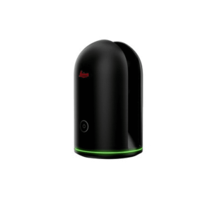
Key Features:
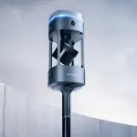
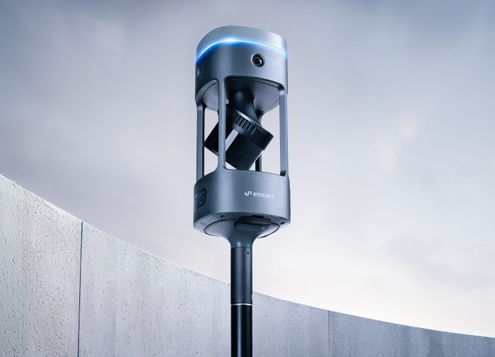
Emesent GX1 gives surveyors what they’ve been asking for: mobile scanning speed with accuracy you can rely on, time and time again. Delivering 5-10mm global accuracy with integrated premium RTK georeferencing, GX1 eliminates the choice between fast scanning and accuracy you can trust – with GX1, you get both.
Rapid RTK quality monitoring and accuracy reports, plus 4x20MP cameras mean you can scan faster, prove accuracy instantly, and deliver professional-grade imagery that impresses clients.
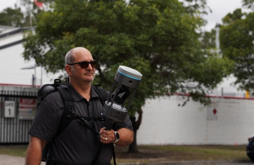
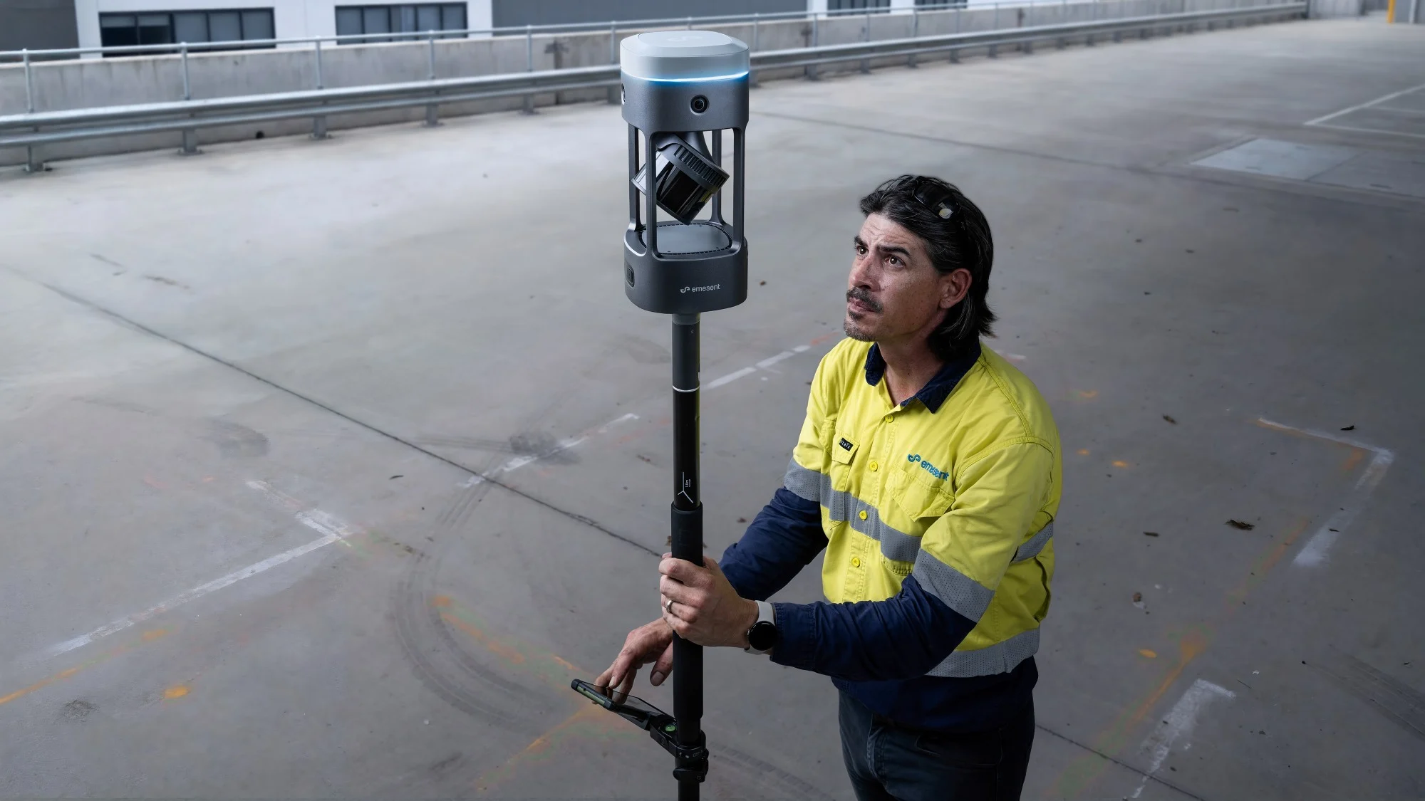
Deploy GX1 on backpack, survey pole, vehicle, or handheld depending on your project – road topographic surveys, construction progress tracking, Scan-to-BIM, or GPS-denied tunnels – with the same reliable Emesent SLAM proven in autonomous underground drone operations.
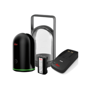
With integrated removable batteries (no cables), flexible georeferencing with user selected targets in Aura, unlimited on-prem data processing with no additional charges, 360° walkthroughs of your data available in Aura Cloud, and continuous software improvements, GX1 is the complete solution for surveyors who refuse to compromise on speed and accuracy.
Delivering <10mm global accuracy both indoors and out, Emesent SLAM excels across the widest range of environments – from confined spaces to expansive outdoor sites where other SLAM systems lose reliability.
Now, with pioneering improvements to Emesent SLAM in GX1 such as enhanced accuracy, reduced drift and improved repeatability – you gain access to an unparalleled experience, delivering your most accurate mobile scanner results to date.
GX1’s mobile SLAM technology and user-driven design dramatically reduces time on-site compared to traditional surveying methods.
Complete complex scans in hours instead of days, freeing your team to take on more projects without adding headcount.
Faster capture means faster project turnaround and more revenue opportunities per quarter.
GX1 is a complete integrated solution where LiDAR, RTK, cameras, and software work together seamlessly from capture to validated deliverable.
Simple enough for juniors to operate confidently within days, yet powerful enough for experienced surveyors. Aura and Aura Cloud extend the experience with enhanced data visualization, shareability and cloud access from anywhere.
When every component is designed to work together, everything works better.
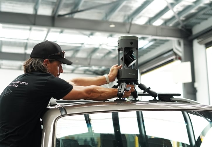
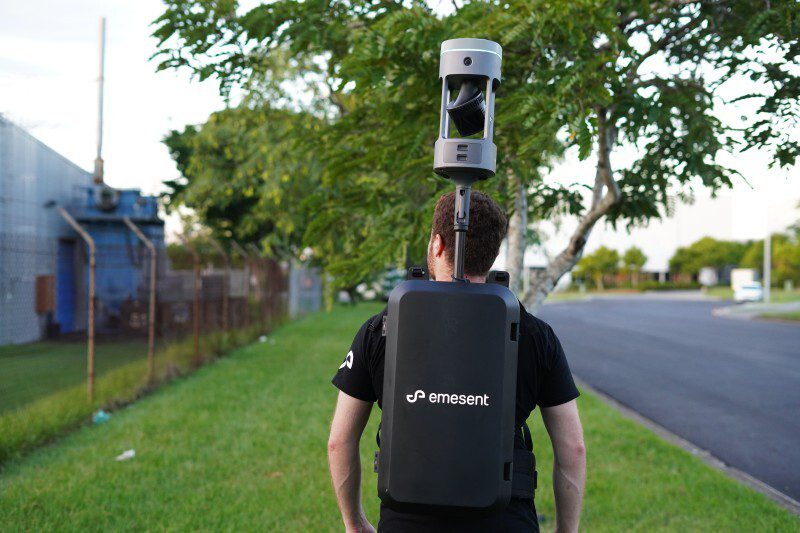
One device, four purpose-built deployment modes: backpack, survey pole, vehicle mount, and handheld harness.
Plus, access flexible georeferencing that works your way. Capture with integrated RTK in the field, use PPK back at the office, or select your own targets and check points in post-processing – minimizing the risk of returning to site for rework.
Proprietary Emesent SLAM technology, proven in autonomous underground drone navigation now powers terrestrial scanning. Where GPS fails and feature-poor environments challenge other systems, GX1 maintains 5-10mm global accuracy – delivering the accuracy surveyors demand and an additional tool in the kit without the constraints of satellite coverage.
GX1’s premium 448-channel RTK receiver delivers 0.6cm + 0.5ppm horizontal and 1cm + 0.5ppm vertical accuracy with real-time monitoring through the Commander app. PPK support means you get high quality georeferencing whether you’re within mobile signal or processing post-mission.

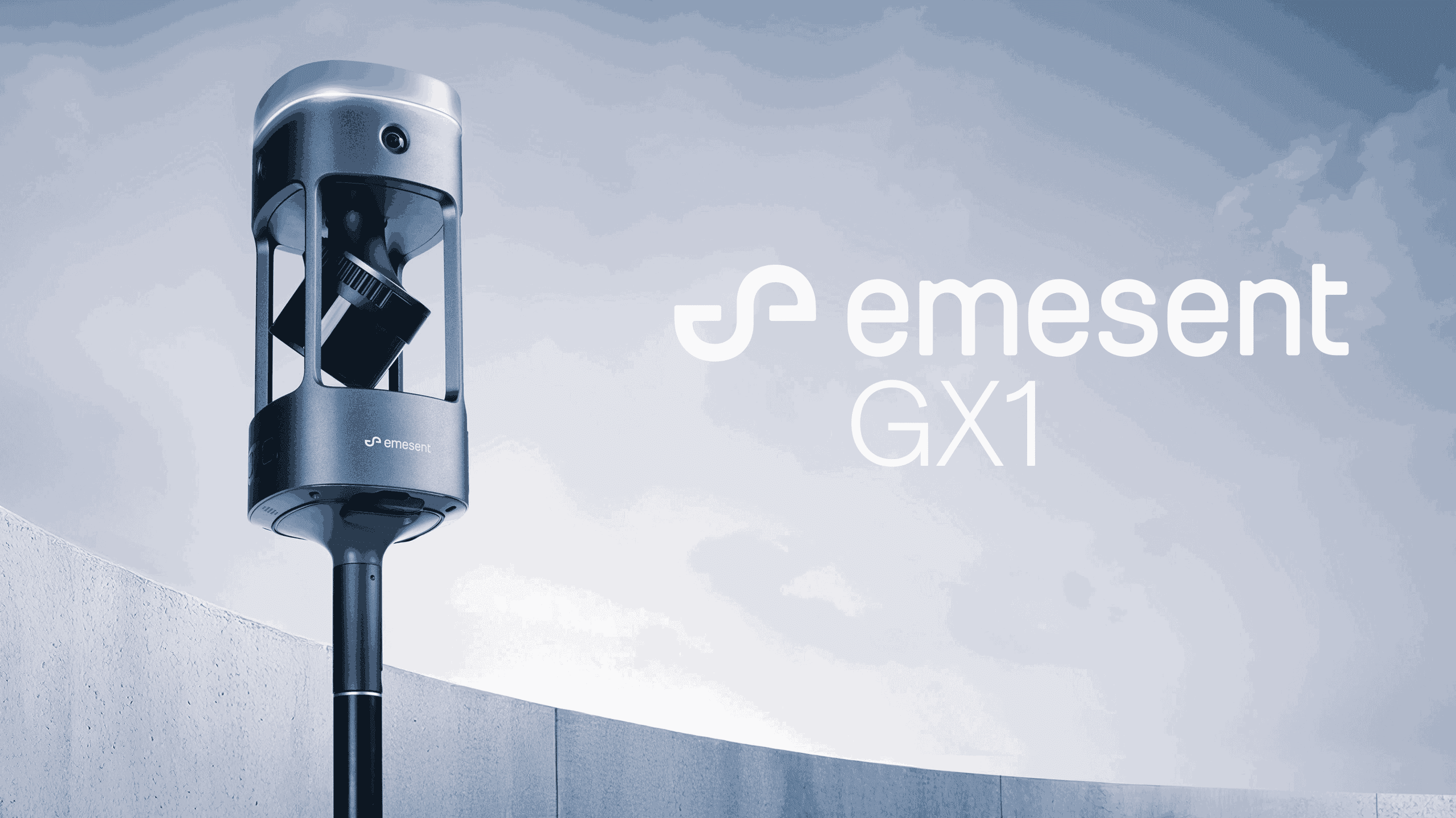
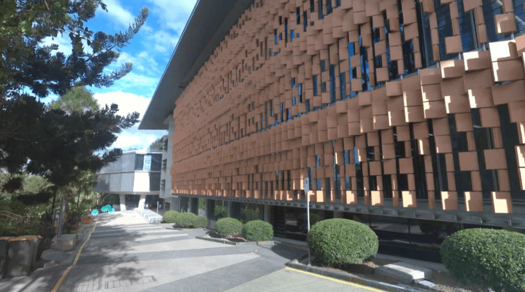
Delivering 360° horizontal and 284° vertical coverage, GX1 captures every detail in a single pass, near eliminating blind spots and return visits.
Automated people masking and 360° panoramas embedded directly in E57 files mean your point clouds deliver the context clients need to get to work drawing up BIM or understanding construction progress, without post-processing clean-up.
Process unlimited datasets on-premises with no per-scan charges or cloud processing costs that eat into project margins. Concurrent user licensing means your entire team can work simultaneously without purchasing individual seats—scale your operations without scaling your software costs.
A complete ecosystem from Commander, your in-field scan monitoring app, to Aura point cloud processing, backed by Emesent technical support, and seamless integrations with industry platforms like Revit. Access continuous software updates and optimizations – meaning your GX1 output keeps getting more sophisticated over time.
The GX1 carries double cases as your backpack mount – designed to store multiple batteries, quick mount and handheld accessories as well as enabling backpack scans with the GX1 mounted above your head – delivering detailed scans and 360-degree image outputs that your clients will love.
With the quick mount accessory and backpack frame, access maximum maneuverability for confined areas and any projects or environments handheld scanning is preferred.
GX1 mounts on any industry standard survey pole, providing extended reach and ergonomic control for elevated features and overhead capture. Reduces fatigue during extended scanning sessions while maintaining stability and precision.
Cover vast areas at vehicle speed for large-scale projects like roadways, infrastructure corridors, and expansive sites. Transform hours of walking into minutes of driving without sacrificing data quality.
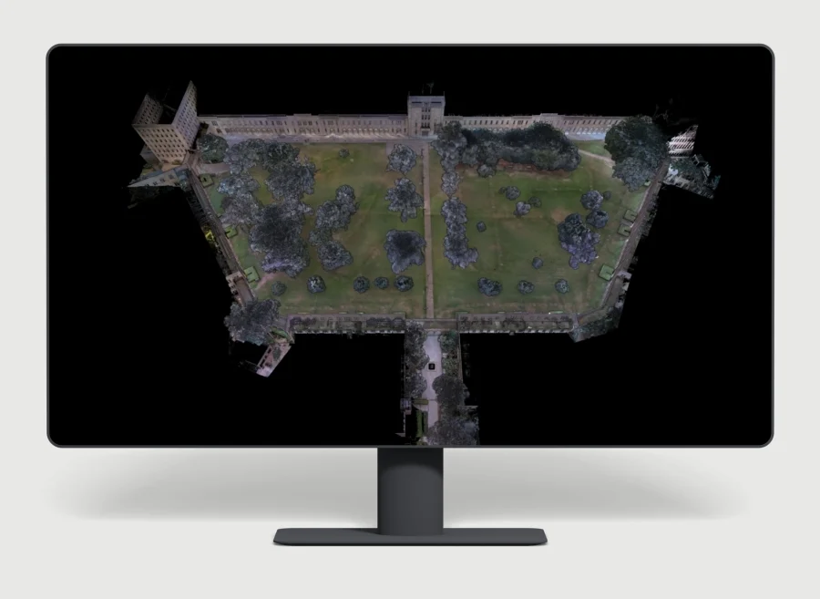
Wide, open environments with minimal features are notoriously challenging to scan.
GX1, powered by Emesent SLAM gives you the ability to capture with confidence.
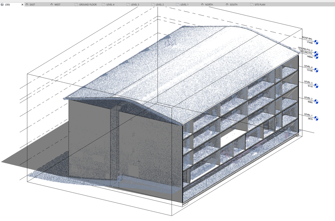
For many surveyors, exceptional point cloud quality and the ability to easily share data with BIM professionals is a critical step in your workflow.
GX1 makes that easy – with integrated data offload, cameras capturing 360 degree FOV, and speedier capture helping get projects handed over faster.
Higher resolution imagery, repeatable accuracy that meets the brief, and speed of capture are crucial for progress monitoring projects – minimising project delays and keeping stakeholders up to date with the latest project information.
In environments such as tunnels that demand reliable georeferencing where GPS is intermittent and repetitive geometry challenges traditional SLAM systems, Emesent’s proprietary SLAM maintains precision in feature-poor environments and delivers reliable, repeatable results.
| Accuracy | 5-10mm global accuracy 5mm local accuracy 15mm RTK/PPK accuracy |
| Precision | 2mm scan precision |
| LiDAR range | Hesai XT32M2X LiDAR (300m range, up to 1.92M points/sec) |
| Image quality | 360° horizontal FOV with 4x20MP cameras |
| Durability | IP65 rating Wide operating temp range (-10°C to 45°C) |
| Capacity | 2TB onboard storage |
| Power | Removable (internal) 54Wh 10.8V smart Li-ion battery 60 minutes of battery life |
Created by Tomsher