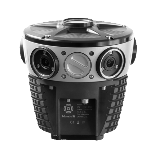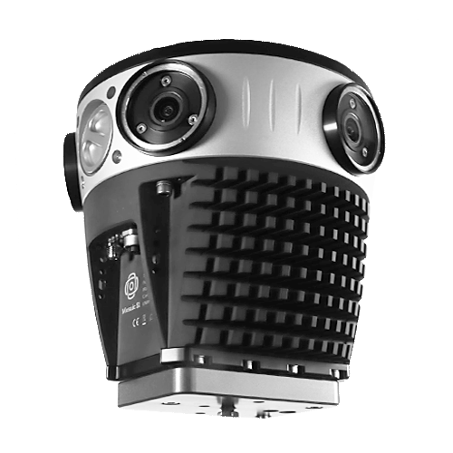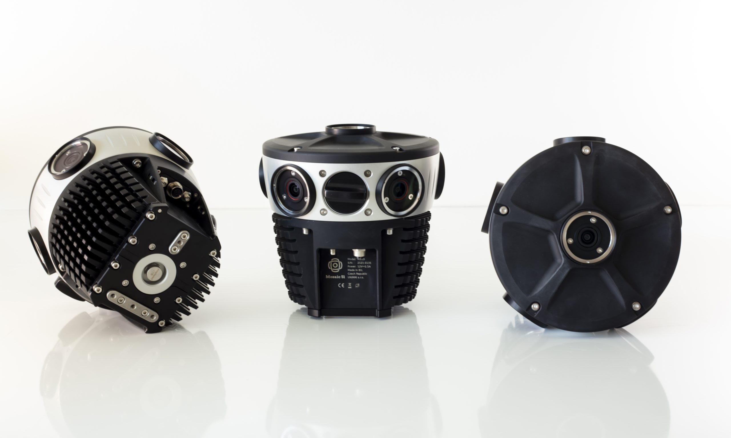
Mosaic 51
Key Features:
- 6 x 12.35 MP sensor camera
Equirectangular Pano: 12.3K - Pixel dimensions: 1.55 μm (H) × 1.55 μm (V)
- Rolling shutter sensors
- Internal GNSS & storage (1-2TB)
- Integrate with external IMUs, GNSS, and LiDAR
-
Description
Most durable, precise and practical panoramic 360° camera for urban mapping and surveying.

Built to get dirty
Purpose-built, AI-compatible, rugged 12.3K-resolution panoramic 360º camera for HD surveying, GIS, and infrastructure inspection.
- Easily manageable, standalone unit, single manned operation with minimal training.
- Robust industrial frame & connectors to withstand the cold, the heat, water, dust, and poor road conditions.
- Onboard GNSS receiver, built-in computer, and large internal storage to capture all day without a dedicated workstation.
- Proudly designed and manufactured in Europe.
How can you get benefit from rugged Mosaic 51?
- Gain greater insight of your environmentWith the highest resolution, standalone unit, you can quickly capture the necessary street-level images of your sites, streets, and towns to make better informed decisions.
- Decrease operational costs & increase efficiency
The Mosaic 51 was built to be easy to use, requiring only one person who is both driver and operator. No need for lengthy training, a computer on board, or repeat side visits. Capture one time and utilize tenfold. - Increase your project capacity & sales
With a robust device, you can count on and which collects data faster, win more proposals, fulfill deadlines on time and build more trust with clients.
Capture 360° street-level images to provide the solutions for you projects.
See who benefits from purposely built Mosaic 51:
- Land Surveying & Mapping Companies
Travel more places, collect data faster than before, and ensure that you are mapping all the streets, roads and trails within your scope, with a street-level view in 360°.
- Telecommunications & Utility Companies
Gain a better view of your powerlines, right of way, telephone poles and more. Capture the highest quality images with the least amount of work.
- Local Governments & Municipalities
Know what services are or aren’t already in your community. Keep an inventory of street furniture and their conditions. Create a better environment for your citizens.
- Road & Infrastructure Maintenance Crews
Ensure greater safety and prolong life of current infrastructure with more consistent maintenance checks. Have the data to react faster to potential risks.