
Mosaic Meridian 2
Key Features:
- 91.2 MP Images
- Permanent Calibration
- Survey-grade Accuracy
-
Description
Introducing Mosaic Meridian 2
The Most Portable, Rigidly Calibrated,
Professional-Grade Mobile Mapping System.
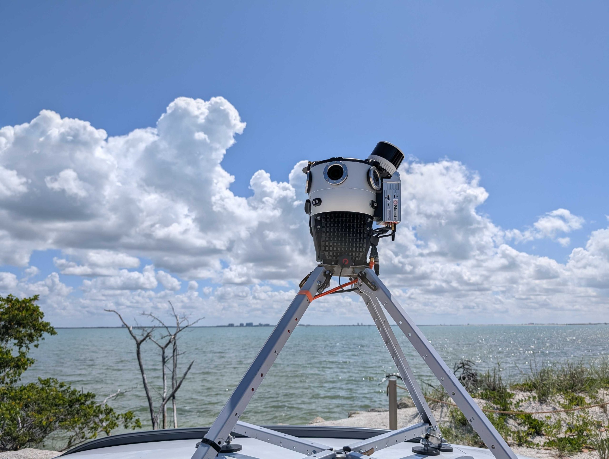
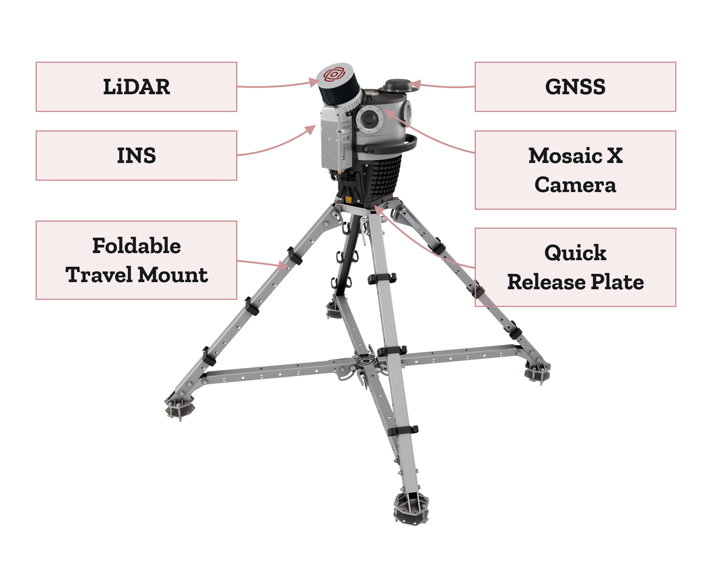
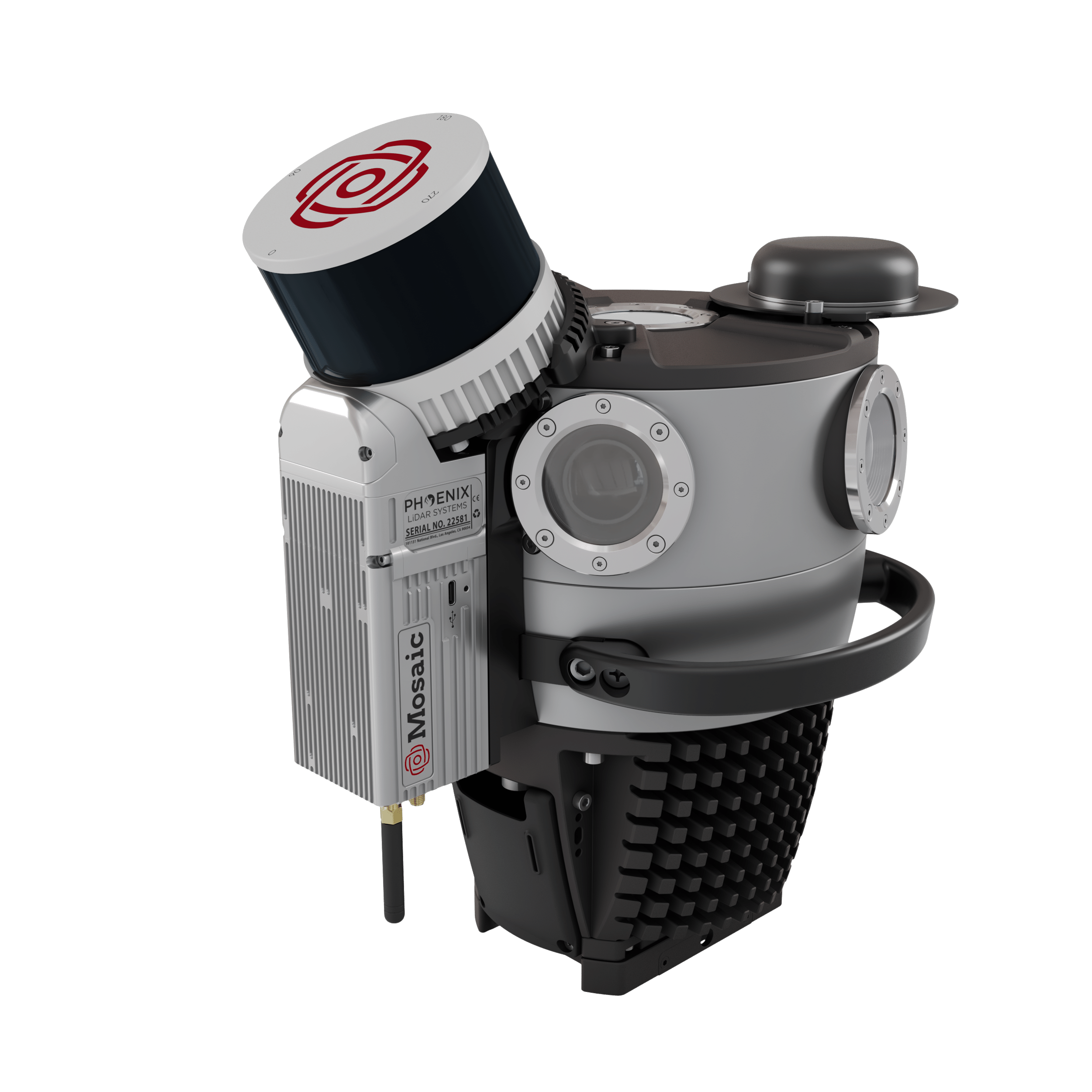
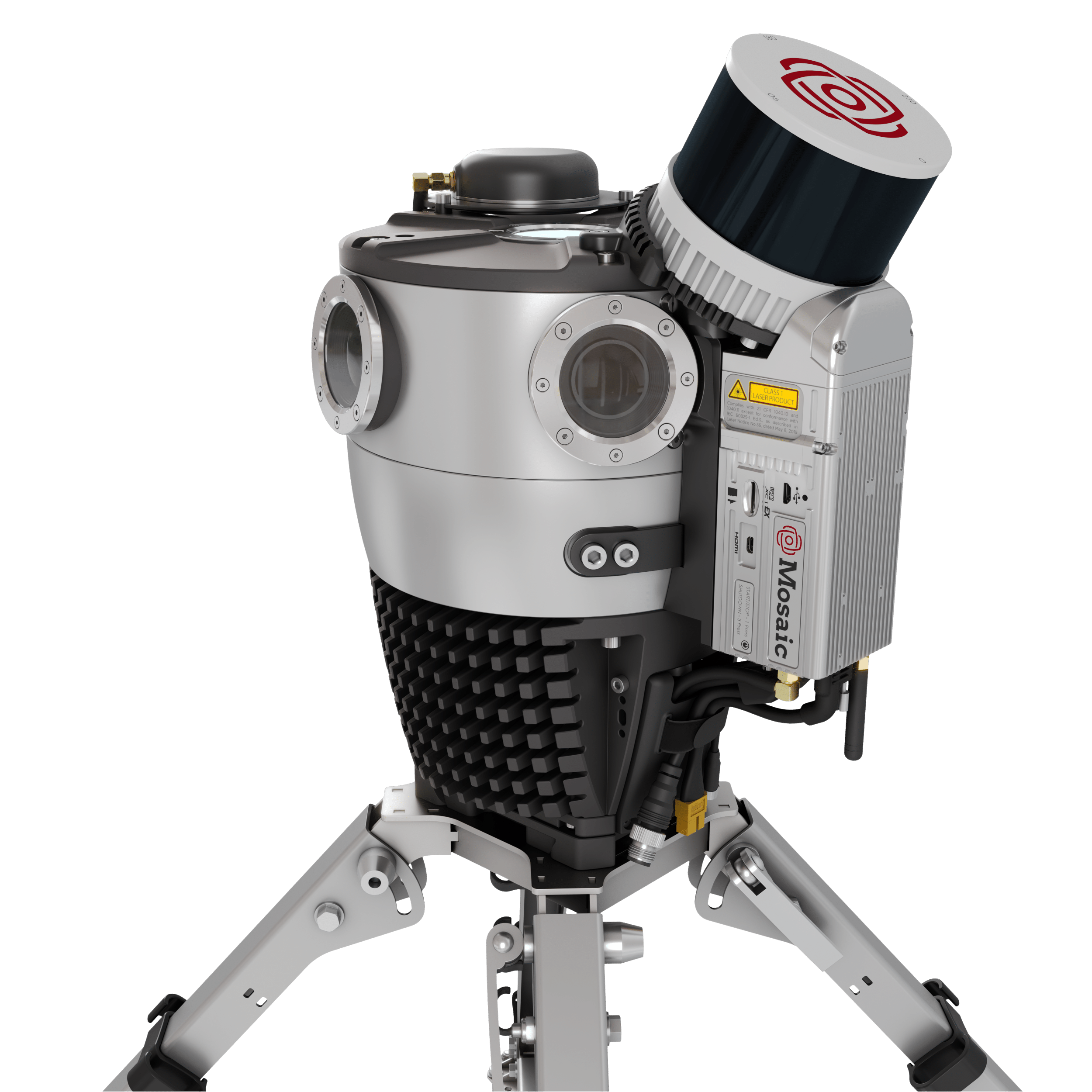
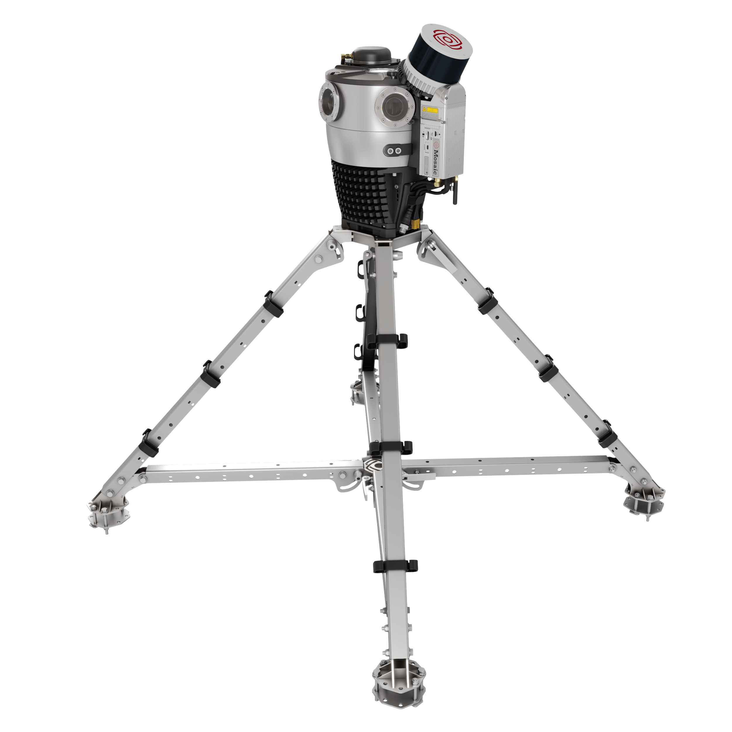
Mosaic Meridian 2 is a fully integrated 360° panoramic imaging and LiDAR mobile mapping system.
One operator, two cases, calibration built to last, and professional-grade results.
Mobile mapping that is actually mobile.
How We Set New Paths
Proven Foundation. Constantly Evolving.
Meridian 2 pairs our in-house designed and built Mosaic X camera – six global-shutter sensors for producing 91.2 MP equirectangular panoramas – with 32-channel LiDAR and survey-grade GNSS/INS, the same class of sensors trusted across the mobile mapping industry.
That foundation doesn’t sit still: we keep refining how these systems work together, so the core you already trust keeps getting more capable, without asking you to relearn anything.
- PORTABILITY
Two Cases. One Operator. That’s It.
The complete system packs into two cases you carry yourself – no large crew, no separate cargo shipment. If you can carry a suitcase, you can deploy Meridian 2.
A mobile mapping system that is genuinely mobile.
- CALIBRATION
Rigidly Aligned. Trusted Every Time.
LiDAR is fixed directly to the camera, moving as a single unit. No boresight ritual before a job – alignment holds through transport, temperature, and everyday field use.
Mount it, move out, and trust it on every acquisition after that.
- POINT OF VIEW
Elevated LiDAR. Full Coverage.
Mounted above the camera and clear of the roofline, the LiDAR gets an unobstructed 360° view.
Get stronger returns and reliable capture of building façades and overhead assets, with nothing in its way.
- WORKFLOW
Fast Setup. Faster Processing.
The Quick-Release mount slides in and clicks secure in seconds – no tools, no second person.
Premium systems can take 3–5× longer to process than to capture. Meridian 2 holds a simple 2:1 ratio.
Why Choose the Mosaic Meridian 2?
Every Meridian 2 acquisition pairs sharp 360° imagery with precise LiDAR data, captured together in the same pass – so your imagery and your point cloud always line up.
- Unmatched Efficiency
Rapidly onboard any staff to operate solo. Streamline data collection and cut fieldwork time. Capture more of your project area in fewer trips.
- When High-Res Imagery Matters
91.2 MP panoramas are sharp enough to read street signs, asset tags, and building details straight from the vehicle. No need to send a crew back out for a closer look.
- Pinpoint Accuracy
1-3 cm accuracy for both imagery and point clouds, ensuring confidence in your data and decisions.
- Built for Corridor-Scale Production
Built to hold up across long shifts and changing conditions – IP64-rated, 0–45°C operating range, from city corridors to remote sites.
- Privacy, Built In
Automatic face and license-plate blurring, built into the Meridian 2 pipeline – ready for GDPR-sensitive municipal and telecom projects.
- Confidence in the Field
Watch imagery and LiDAR return live as you capture – know it’s working before you ever leave the site.
How Meridian 2 Compares
Survey-Grade Data. Priced for Real-World Projects.
The highest-end mobile mapping systems are excellent instruments, and for the handful of projects that genuinely need sub-centimeters absolute accuracy, they’re worth the premium – often 5× the cost of Meridian 2 or more.
For everyone else – surveying firms, utilities, infrastructure contractors, municipalities, and geospatial service providers – Meridian 2 professional-grade 360° imagery and LiDAR data built for the work most projects actually require, without the enterprise budget.
| Entry-Level / DIY | Mosaic Meridian 2 | Enterprise MLS (Leica / Riegl / Trimble) | |
|---|---|---|---|
| Integrated 360° imagery + LiDAR | Rarely integrated | ✓ Fully integrated, calibrated | ✓ Integrated |
| Single-operator deployment | One person | ✓ One person, one vehicle | Often requires 2+ operators |
| Near-permanent calibration | - | ✓ LiDAR fixed to camera - always aligned | - |
| Survey-grade GNSS/INS | Typically not included | ✓ Survey-grade GNSS and IMU | ✓ High-end GNSS/INS |
| LiDAR point cloud accuracy | Low to moderate | ✓ 2–3 cm vertical accuracy | accuracy Sub-cm on premium configs |
| 360° panoramic resolution | Low to moderate | ✓ 91.2 MP equirectangular panorama | Varies - typically lower MP |
| Obstruction-free LiDAR coverage | - | ✓ Elevated above roofline | ✓ System-dependent |
| Compact transport (2 cases) | Varies | ✓ Two carry cases | Typically larger transport |
| Non-proprietary data formats | Varies | ✓ Open formats, no lock-in | Sometimes proprietary |
| Compatible with standard GIS/eng. tools | Varies | ✓ PLS-CADD, O-Calc, ESRI, etc. | ✓ Yes |
| Typical system price range | Lower upfront, limited | Contact us for pricing | Up to 5× or more |
Note: Enterprise MLS comparison is generalised across Leica TRK-700, Riegl VMX series, and Trimble MX90. Specifications vary by configuration. Meridian 2 is designed to meet the requirements of the majority of asset capture, infrastructure inspection, and corridor mapping projects – not to replace ultra-high-precision instruments where sub-centimetre absolute accuracy is a hard requirement.
Who Uses Meridian 2
Built for Real-World Projects.
- Utility & Telecom Infrastructure
Capture pole inventories, verify attachments, and support make-ready engineering at driving speed. Replace stop-and-go handheld surveys with continuous corridor capture – covering in hours what would take days on foot.
- Highway & Road Asset Management
Collect pavement condition data, roadside asset inventories, and safety barrier inspections up to 90 km/h. Covers large networks efficiently with the detail needed for condition monitoring and compliance documentation.
- Municipal Asset Inventory & Digital Twins
Map street furniture, signage, ADA infrastructure, and utilities across an entire city network. The 91.2 MP equirectangular panoramas resolve asset tags and sign text from the vehicle – no bucket trucks, no lane closures.
- Corridor Mapping & Construction Verification
Document rights-of-way, capture as-built conditions, and produce survey-grade deliverables for engineering design. Ideal for broadband buildout verification, grid hardening, and infrastructure planning.
- Geospatial Service Providers
Expand your service offering without expanding your crew. A single operator can mobilise, collect, and deliver professional-grade LiDAR and 360° imagery data – in open formats that work with your existing processing pipeline.
- Rail Corridor Survey & Asset Inspection
Map track-side assets, document vegetation encroachment, and build accurate digital twins of rail corridors at speeds up to 90 km/h – mounted on hi-rail vehicles or directly on train cars. Replace manual lineside inspections with continuous corridor capture that delivers LiDAR point clouds and 360° panoramic imagery in a single pass, supporting asset inventory, clearance analysis, and construction progress reporting.
A Look Under the Hood
Technical Specifications
| Mosaic X Camera | |
|---|---|
| Equirectangular Resolution | 91.2 MP |
| Field of View | 360° × 139° |
| Shutter Type | Global |
| Maximum Frame Rate | 10 FPS |
| Rendered Panorama Width | 13.5k pixels |
| IP Rating | IP64 |
| Storage | Removable 1TB micro-SD Express |
| LiDAR Sensor | |
| Laser Channels | 32 |
| Pulse Rate | 640k / 940k / 1,200k pts/sec (single / dual / triple return) |
| Laser Range | 0.5 to 150m (80m @ 10% reflectivity, all channels) |
| FOV Horizontal | 360° |
| FOV Vertical | 40.3° |
| Scan Angle (Vertical) | −20.8° to 19.5° |
| Number of Returns | 3 |
| Ranging Precision | 0.5 cm (1σ, typical); 1 cm standard |
| Ranging Accuracy | ± 1 cm |
| System Vertical Accuracy | 2–3 cm |
| INS – Inertial Navigation System | |
| GNSS | GPS, GLONASS, BEIDOU, GALILEO |
| Frequencies | L1, L2, L5(6) |
| Operation Modes | RTK and PPK |
| Position Accuracy | 1-2.5 cm + 1 ppm RMS (RTK); 0.5 cm (PPK) |
| Pitch / Roll Accuracy | 0.03° RMS |
| Heading Accuracy | 0.01° RMS |
| Example Acquisition Performance | |
| Urban – 40 km/h (25 mph) | Up to 900 pts/m² @ 10 m |
| Highway – 90 km/h (55 mph) | Up to 400 pts/m² @ 10 m |