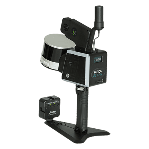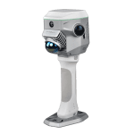
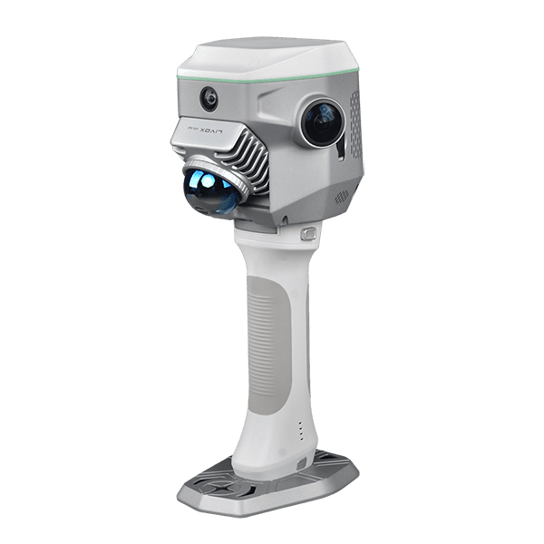
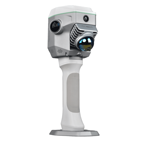
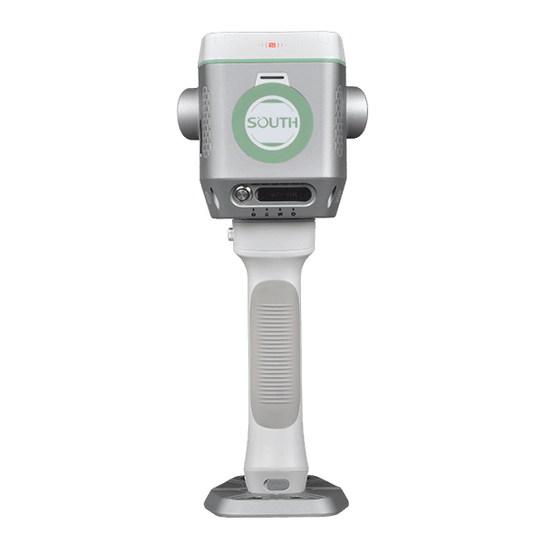
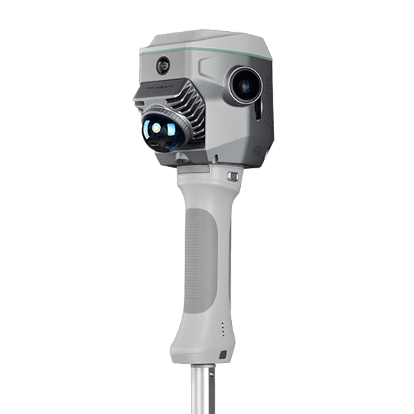
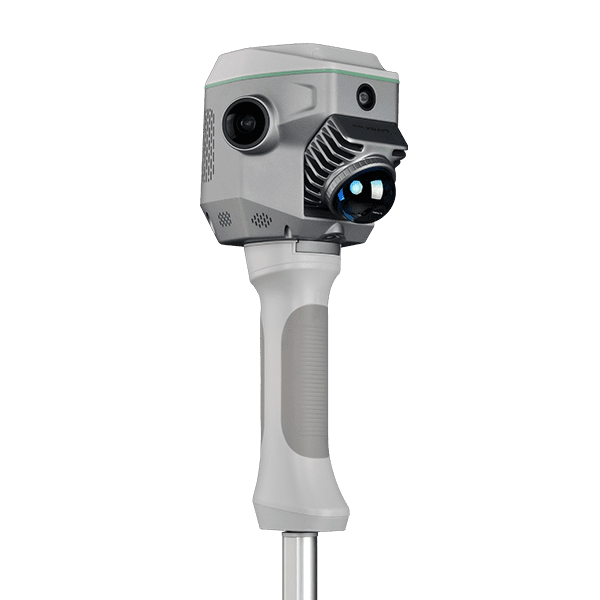
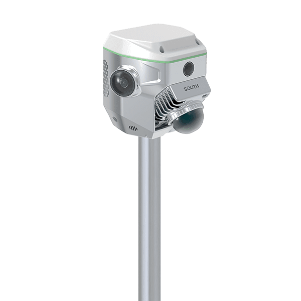
South GNSS RTK Hybrid Supreme ME
Key Features:
- 1698 channels GNSS Engine
- Absolute Accuracy<5 cm
- Scanning Rate 200,000 pts/s
- Maximum Detection Range 70 m
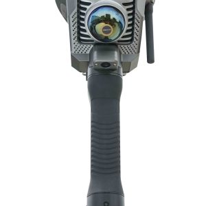
- 12 MP panoramic camera
- 8 MP +2 MP for visual positioning
-
Description
Integrates SLAM and RTK, Improving Your Capability
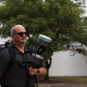
When combing the power of GNSS RTK Positioning and SLAM LiDAR Scanning, surveyors can work in both outdoor and indoor environments, performing contact or non-contact measurements according to their work need, to tackle tasks they couldn’t accomplish previously.
Equipped with a professional graphic card by Nvidia and dual 12 MP panoramic cameras by SONY, ME can realistically restore scenes. The 8 MP front camera and 2 MP downward camera help surveyors to perform photogrammetry measurement and CAD-AR stakeout efficiently.
- GNSS Receiver1698 channels GNSS Engine, Antenna, IMU sensor, UHF radio, internet module, Bluetooth.
- LiDAR ScannerAbsolute Accuracy<5 cm, relative accuracy ,1cm, Scanning Rate 200,000 pts/s, Maximum Detection Range 70 m
- Camera (4 units)12 MP panoramic camera 2 units, by SONY, for colorization. 8 MP +2 MP for visual positioning.
- Graphic Processorby NVIDIA, for real-time, true-color image processing
- Interface Portconnecting telescopic pole or battery handle grip.
Uninterruptible Power Supply
The ME can get power from the internal battery, handle batteries, and external power supply.
This uninterruptible power supply design eliminates the need for system restart or reinitialization, ensuring continuity for large-scale, long-duration operations and improving operational efficiency.
Air Meas., Capture A Lot of Points Contactless and Easily
The Air. Meas. function combines laser sensing technology and AI image matching engine. It collects 200,000 points data per second and enables users to collect multiple 3D coordinates by capturing a photo once.
Measuring from a range of 15 meters, while the accuracy remains 5 cm. This data collection method is a ideal solution for many complex environments, for example hard-to-reach areas and hazardous areas.
Measuring with Air Meas. function, users don’t need to stay steady and aim precisely, don’t need to walk in the prescribed manner, don’t need to level the range pole.
The data collection efficiency of Air Meas. is several times over traditional methods of Laser RTK or Visual Positioning RTK.
Magical, GNSS Positioning Anywhere
ME system is capable to maintain 5 cm accuracy for a few minutes when GNSS satellite signals are out-of-reach, the solution status will change from “fixed” to “Mixed Solution”.
This innovative function enables users to seamlessly capture data in areas with limited GNSS signals, such as under overpasses, in tunnels, or in underground garages.
Accurate Earthwork Volume Calculation
The ME system allows users to perform earthwork calculations by capturing 3D point clouds.
The simple and streamlined workflow is very practical and efficient for excavation, stockpile measurement, mining, constructions.
Field Software for Data Collection
SurvStar app, Data collection control software, supports collection control, project management, real-time point cloud browsing and processing, visual positioning, CAD & AR stakeout, other measurement and calculation functions.
Data Collector H9
- 8 Cores, 2.0 GHz CPU
- 7700 mAh high capacity battery
- 6 inches touch screen
- QWERTY full keyboard
- Android 12
Optimized for processing SLAM data and Photogrammetry data.
Office Software for Post-processing
AcuteLas Studio software is designed to process AcuteLas series aerial LiDAR system data and 3D laser scanner data, including the functions one-key trajectory processing and laser scanner/ LiDAR data processing and fusion, point cloud classification, data quality check, quality report output, coordinate system conversion, point cloud classification, topographic survey module, etc.
Operating System: Windows 10 IoT Enterprise or higher
Processor: Intel® 13th Gen Core™ i7 processor or better
RAM: 32 GB or better
Storage: SSD 1 TB or better
User Case: from a Municipal Surveying Department
User Demand: Working under viaducts, to measure or stake out road center lines and side lines, green belts, manhole covers, etc.
Before: Using both conventional GNSS RTK and total station, procedures are complicated
Now: Taking advantage of the “MagiCalc” function and “Mixed Solution”, seamlessly capture data in areas with limited GNSS signals. Using the “AirMeas.” and SLAM scanning function, remotely measure the targets that are hard to reach. Remaining a high efficiency in the job.
User Case: from a Real Estate Company
User Demand: Measuring the area of the exterior wall, for building renovation
Before: 1) for small building, using tapes to measure and draw sketches manually. 2) for large buildings, using drones to perform aerial photogrammetry surveying, but ground floor and lower floors are difficult to measure by aerial survey.
Now: Using ME to scan the facade of the building is much quicker and more precise than traditional methods. ME can scan up to eight floors high.
User Case: from City Gas Company and Water Company
User Demand: Coordinate data collection of pipelines, valves, tees, nodes, elbows, household meters, etc.
Before: Using conventional GNSS RTK and total stations
Now: 1) In GNSS signal-obstructed environments and GNSS signal-denied environments, conventional RTK cannot get fixed solution but ME system still can keep centimeter level accuracy by its Mixed Solution. 2) The coordinates of wall-mounted devices and pipes can be obtained in batches through SLAM scanning or AirMeas. function. 3) The real scene can be recorded for future reviewing.
User Case: from a Municipal Gardening Department User
Demand: Classifying the vegetation in the park
Before: Using conventional GNSS RTK, it takes one and half-day to measure a park
Now: Using ME to quickly obtain true-color point clouds of various targets in the park, the field work takes only one hour. When going back to office, import point cloud to processing and mapping software, clearly identify the types of vegetation and draw topographic maps based on the positions and boundaries of each vegetation.