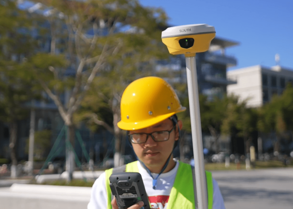
There is a specific kind of frustration that every field surveyor knows. You are mid-job, pole planted, waiting on a fix that is not coming. Maybe you are working under a steel structure, beside a concrete wall, or in a corridor where the sky above is more gap than open. The receiver is searching. The clock keeps moving.

Traditional GNSS RTK is brilliant when conditions cooperate. Give it a clear sky and a stable base, and it delivers centimeter-level positions all day. But surveying rarely happens in ideal conditions. It happens on construction sites with overhead obstructions, in urban corridors flanked by glass towers, and on terrain where satellite geometry shifts the moment you move twenty meters in any direction.
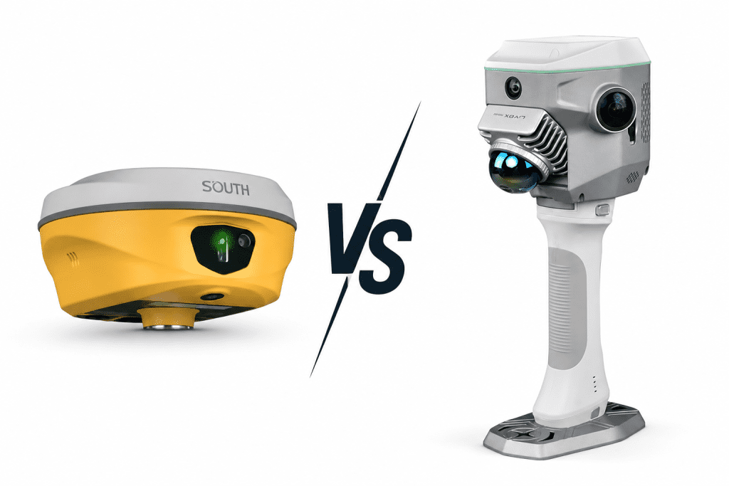
That is the gap the South GNSS RTK Hybrid Supreme ME was built to close. It combines full-constellation GNSS with an onboard SLAM LiDAR and a 200 Hz IMU so the unit does not stop working when the satellites do.
What a Traditional GNSS RTK System Actually Does
At its core, a traditional RTK setup is a two-piece system. A base station sits on a known point and continuously broadcasts correction data to a rover in the field. The rover receives that data alongside raw satellite signals, runs the math in real time, and outputs a corrected position down to the centimeter level. When everything lines up, it works exceptionally well.
The catch is that the whole system depends on one thing holding steady: satellite visibility. Drop below the threshold of visible satellites and the unit loses its solution. It does not degrade gracefully. It just loses it.
Most conventional receivers track two to four constellations, with initialization taking anywhere from thirty seconds to a couple of minutes in open sky. Move into an area with overhead obstruction, and that window stretches. Re-initialization after signal loss starts the process over from scratch. Traditional RTK also requires the survey pole to be plumb when recording a point. On slopes, in tight corners, or when reaching into awkward spots, keeping a pole perfectly vertical is not always practical.
For open-sky work, boundary surveys, and agricultural applications, it remains reliable and cost-effective. The limitations only become a real problem when the job site does not cooperate.
____________________________________________________________________________
What Makes the Hybrid Supreme “Hybrid”
The word hybrid gets used loosely in surveying equipment marketing, so it is worth being specific about what it actually means here. The South GNSS RTK Hybrid Supreme ME is not a traditional RTK receiver with a few extra sensors bolted on. It is a single integrated unit where three independent positioning systems run in parallel and feed into each other continuously.
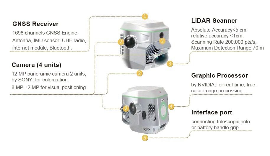
The first is full-constellation GNSS. The Hybrid Supreme ME tracks 1,698 channels across GPS, GLONASS, BeiDou, Galileo, QZSS, NavIC, IRNSS, and SBAS. Initialization takes under 10 seconds, cold restart under 12, and initialization reliability sits above 99.9%. For outdoor work with good sky exposure, it behaves like a premium RTK receiver and delivers horizontal accuracy at 8mm+1ppm RMS.
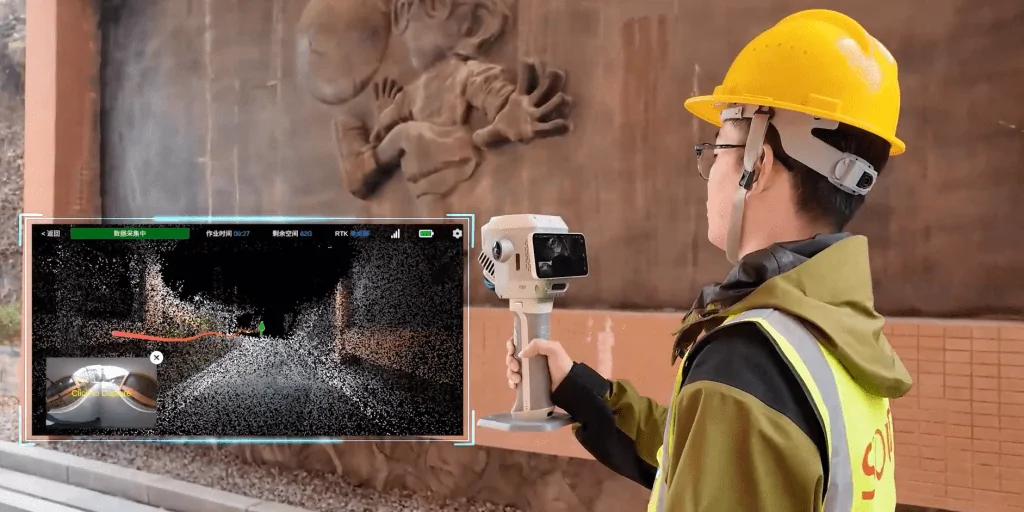
The second system is a Livox Mid-360 SLAM LiDAR built directly into the unit. SLAM stands for Simultaneous Localization and Mapping. The scanner reads the surrounding environment at 200,000 points per second across a 360-by-59-degree field of view, building a spatial map of everything around it in real time. That map becomes a positioning reference that does not rely on satellites at all.
The third is a 200 Hz IMU, which handles tilt correction and acts as a continuous bridge between the GNSS and SLAM outputs. When the unit is moving, tilted, or transitioning between environments, the IMU keeps the position estimate stable while the other systems catch up.
Where this combination pays off most is in South’s Magicalc technology. When satellite signals drop out entirely, the unit does not stop. It switches to SLAM and IMU fusion and maintains positional estimates at 2 to 3 centimeters in best conditions and 5 to 10 centimeters in more complex environments. No re-initialization. No waiting. The surveyor keeps working.
That shift from satellite-dependent to environment-aware positioning is what separates hybrid RTK from every conventional receiver that came before it.
____________________________________________________________________________
Side-by-side performance: Where the differences show up in the field
Specs on a product page only tell part of the story. The more useful lens is to walk through the conditions that actually slow surveyors down and see how each system handles them.
On open sky with a strong base connection, the Hybrid Supreme ME comes in at 8mm+1ppm RMS horizontal, tightening to 3mm+1ppm RMS in PPK mode and 2.5mm+0.1ppm RMS for static work. The difference over a mid-range traditional receiver is not dramatic in ideal conditions, but it is consistent across a full day of data collection.
When signal cuts out, the comparison stops being close. A traditional receiver losing satellite lock stops producing usable positions. The Hybrid Supreme ME hands off to Magicalc and keeps outputting positions without interruption. For a team working under a bridge deck, inside a partially roofed structure, or through a dense urban corridor, that continuity is the difference between a smooth day and a stop-and-start one.
On tilt, traditional RTK needs the pole plumb or the recorded point moves off its true location. The 200 Hz IMU on the Hybrid Supreme ME handles this continuously, so the surveyor can work on uneven ground or reach into tight spots without stopping to re-level.
For points that are physically inaccessible, the LiDAR enables contactless measurement accurate to within 5 centimeters at 15 meters. No equivalent exists on a conventional receiver.
The table below highlights how both technologies typically perform in this type of environment.
| Category | Metric | Traditional RTK | South Hybrid Supreme ME |
| Accuracy | RTK horizontal | 10-20 mm + 1ppm | 8 mm + 1ppm RMS |
| Accuracy | RTK vertical | 15-30 mm + 1ppm | 15 mm + 1ppm RMS |
| Accuracy | PPK horizontal | 5-10 mm (typical) | 3 mm + 1ppm RMS |
| Accuracy | High-precision static | 3-5 mm + 0.5ppm | 2.5 mm + 0.1ppm RMS |
| Accuracy | Under signal obstruction | No fix | 2-10 cm via Magicalc |
| Satellite Tracking | Constellations | GPS | GLONASS (2-4 typical) |
| Satellite Tracking | Tracking channels | 220-440 (typical) | 1698 channels |
| Satellite Tracking | Initialization time | 30 sec – 3 min | Under 10 sec |
| Satellite Tracking | Initialization reliability | 90-98% | Above 99.9% |
| Field Performance | Tilt correction | Manual leveling | 200 Hz IMU automatic |
| Field Performance | GPS-denied environments | Stops working | SLAM LiDAR takes over |
| Field Performance | Contactless measurement | Not available | 5 cm accuracy at 15 m |
| Field Performance | AR stake-out | Not available | Built-in |
| Field Performance | Indoor / tunnel use | Not supported | SLAM-enabled |
| Hardware | Positioning systems | GNSS only | GNSS + SLAM LiDAR + IMU |
| Hardware | LiDAR scanner | None | Livox Mid-360 at 200000 pts/sec |
| Hardware | IMU refresh rate | None or basic | 200 Hz |
| Hardware | PPP support | Varies | PPP-B2b (H. 10 cm / V. 20 cm) |
| Hardware | Unit weight | 0.9-1.5 kg (typical) | 1.38 kg |
Ease of use and practical workflow
More technology in a single unit raises a fair concern: does it add complexity that slows the crew down? For the Hybrid Supreme ME, the design choices answer that directly.
The unit weighs 1.38 kg and runs as a standalone system. No separate scanner to mount, no external tilt sensor to calibrate. NFC auto-pairing connects it to the controller by touch, cutting out the Bluetooth setup that eats time at the start of a job.
The iVoice audio system broadcasts positioning status out loud in the surveyor’s chosen language, so eyes stay on the terrain instead of the screen. The AR stake-out feature overlays guidance onto the physical landscape through the unit’s camera, reducing the back-and-forth that slows conventional stakeout in unfamiliar terrain. Super Stake-out mode combines RTK and SLAM for signal-challenged areas, holding horizontal accuracy at 10mm+1ppm RMS even where satellite geometry is poor.

____________________________________________________________________________
Who should consider making the switch?
The Hybrid Supreme ME is not a universal replacement for every RTK receiver in every kit. The case for it gets stronger the more a team’s regular work involves conditions where traditional RTK consistently falls short.
Urban and infrastructure surveyors working near tall buildings, under elevated structures, or alongside dense construction activity will feel the difference most. So will teams be doing layout inside partially covered buildings or tunnels? For those running combined GNSS and scanning workflows on the same site visit, the unit replaces two separate pieces of equipment with one, which has a direct impact on time and setup cost.
Traditional RTK still makes practical sense for open-sky work where conditions are predictable and budget is the primary constraint. Boundary surveys on flat rural land, simple agricultural stakeout, and any workflow where a clear sky is guaranteed throughout the day do not need the additional capability.
The honest dividing line is this: if signal dropout, manual workarounds, or inaccessible points are a regular part of the job, the hybrid architecture solves real problems. If they are not, a conventional receiver does the job well enough.
Every survey operation is different — terrain, project type, and team workflow all factor into which setup actually makes sense. If you’re unsure whether the Hybrid Supreme ME fits your specific conditions, the Dynatech Innovations team can walk you through it. Reach out at [email protected], call +971 56 654 1303, or visit dynatech.ae to speak with a specialist about the right solution for your work.