

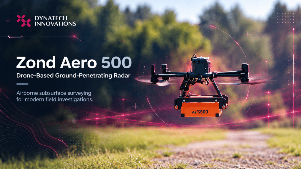
What if surveying the ground below didn’t always require your team to work directly on the surface?
Understanding what lies beneath the ground is essential for infrastructure planning, utility detection, geological investigations, and construction projects. Yet, traditional subsurface surveys can become challenging when terrain is difficult to access, the survey area is extensive, or ground conditions make fieldwork more demanding.
Drone technology is opening up new possibilities for these investigations. By combining unmanned aerial vehicles (UAVs) with ground-penetrating radar (GPR), survey teams can collect subsurface data from above, helping them investigate areas that may be difficult or inefficient to survey using conventional ground-based methods.
The Radar Systems Zond Aero 500, available through Dynatech Innovations, brings these technologies together in a compact GPR system designed for drone integration.
What Is Drone-Based Ground-Penetrating Radar?
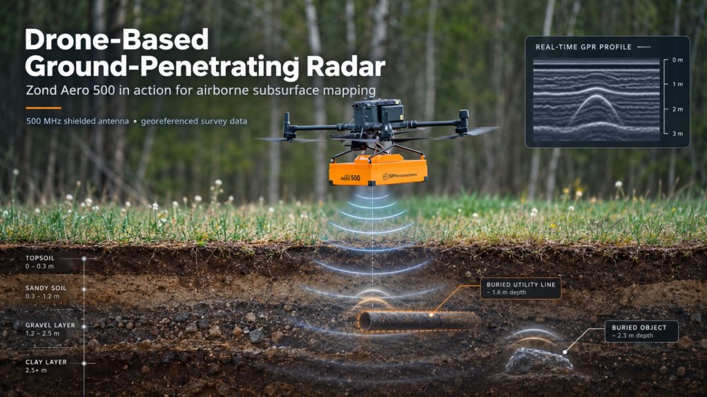
Ground-penetrating radar is a geophysical technique that uses electromagnetic signals to investigate subsurface conditions. When radar signals encounter changes in underground materials or buried objects, some of the energy is reflected back to the receiving antenna. These reflections can be processed and interpreted to help identify subsurface features.
GPR is used in applications ranging from underground utility mapping and archaeological investigations to geotechnical surveys and geological studies.
Traditionally, GPR equipment is moved across the ground using a cart or another ground-based setup. With an airborne configuration, the radar system is carried by a drone, allowing survey teams to collect measurements along planned flight paths without moving the sensor directly across the surface.
This approach can be particularly valuable where direct ground access is restricted or where covering the survey area on foot would require considerable effort.
Meet the Zond Aero 500
Developed by SPH Engineering, the Zond Aero 500 is a lightweight, single-channel ground-penetrating radar (GPR) system designed for integration with professional drone platforms. Featuring a shielded 500 MHz antenna, it brings airborne radar technology to subsurface investigations, including underground utility mapping and engineering geophysical surveys.
Its 500 MHz centre frequency offers a practical balance between penetration depth and resolution, while the shielded antenna helps reduce unwanted interference. The system is designed for integration with compatible drone platforms, including the DJI Matrice 300 RTK and DJI Matrice 350 RTK.
Key specifications include:
- 500 MHz centre frequency: Provides a balance between penetration depth and resolution for subsurface investigations.
- 200–900 MHz operating bandwidth: Defines the system’s specified frequency range.
- Up to 50 scans per second: Supports continuous radar data collection during surveys.
- 512 samples per trace: Captures radar signal information for processing and interpretation.
- Georeferenced data: Helps associate radar measurements with their survey locations.
- Lightweight system: Weighs approximately 2.1 kg, excluding the drone mounting kit.
Beyond airborne applications, the system can also be configured for ground-based investigations, offering flexibility for teams working across different survey environments.
Penetration depth varies depending on soil composition, moisture, conductivity, target characteristics, and survey configuration. Although the manufacturer’s specifications indicate penetration depths of up to four metres under average soil conditions at a 100 ns time range, actual results from drone-based surveys may be shallower. Survey requirements and expected performance should therefore be evaluated against the specific site conditions and intended application.
Where Can the Zond Aero 500 Be Used?
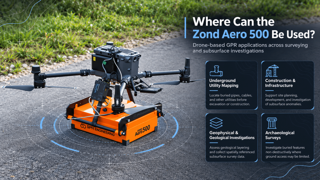
The combination of GPR and drone technology creates opportunities across several surveying and investigation workflows.
1. Underground Utility Mapping
Buried pipes, cables, and other utilities can complicate excavation, construction, and infrastructure maintenance. GPR can help survey teams investigate subsurface features and identify potential utility locations before ground disturbance begins.
When deployed on a drone, the Zond Aero 500 can support surveys across selected areas without requiring the radar to be physically pushed over every section of the ground.
The resulting data can help guide further investigation and support more informed planning. Detected features should still be interpreted carefully and verified using appropriate methods before excavation.
2. Construction and Infrastructure Projects
Reliable subsurface information is important when planning new infrastructure, assessing existing sites, or preparing areas for development.
Drone-based GPR can help teams investigate selected ground sections and identify potential subsurface anomalies that warrant closer examination. This can complement conventional surveying and ground-based GPR, particularly when access or terrain presents operational challenges.
3. Geophysical and Geological Investigations
Geophysical surveys often require consistent data collection across defined areas. An airborne GPR setup provides another way to collect spatially referenced measurements that can be analysed alongside other survey information.
For suitable ground conditions and target depths, the Zond Aero 500 can support investigations into geological layering and other subsurface features relevant to engineering and environmental studies.
4. Archaeological Surveys
Archaeological investigations may involve searching for buried structures and other features without disturbing the ground unnecessarily.
GPR offers a non-destructive means of investigating subsurface variations. A drone-mounted configuration may provide an alternative for selected sites where ground access is difficult, subject to terrain, flight constraints, and the survey’s required resolution.
The suitability of airborne GPR depends on the depth, size, and composition of the target, as well as the site’s ground conditions.
Why Integrate GPR with Drone Technology?
The value of drone-based GPR goes beyond simply carrying a sensor in the air. It changes how survey teams can approach certain field conditions.
Improved access to challenging terrain
A drone can reach selected survey areas that are difficult to traverse on foot or with ground-based equipment, provided flight conditions and safety requirements allow it.
More efficient area coverage
Automated flight planning and repeatable survey lines can help teams collect measurements systematically over defined areas. Productivity gains depend on the site, flight configuration, and required data density.
Georeferenced subsurface data
When integrated with suitable positioning and data acquisition systems, collected radar measurements can be linked to their locations. This supports spatial analysis and comparison with other geospatial datasets.
Reduced need for direct surface contact
Airborne collection can reduce the need to move equipment directly over the surveyed ground. This can be useful in selected environments where physical access is restricted or surface disturbance should be minimised.
These advantages do not eliminate the need for sound survey planning, appropriate data processing, and field verification. Instead, they give professionals another tool for selecting the most suitable approach to a subsurface investigation.
Integrating the Zond Aero 500 into a Drone Survey Workflow
Successful airborne GPR operations require more than the radar unit alone. The system must be integrated with a compatible drone, suitable mounting hardware, positioning and data acquisition components, and the appropriate software.
The Zond Aero 500 is listed with mounting hardware for the DJI Matrice 300 RTK and Matrice 350 RTK. Other mounting configurations may be available upon request.
Additional components and software are required for drone operations, so a complete system configuration should be selected according to the intended application.
A typical workflow involves planning the survey area and flight lines, configuring the drone and radar payload, collecting measurements along the planned route, and processing the resulting radar data for interpretation.
The collected data can then support further investigation and decision-making, depending on the project’s objectives and the quality of the results.
Bringing Subsurface Surveying Forward
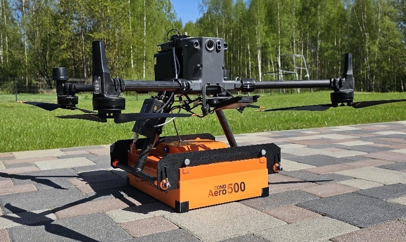
The future of subsurface surveying is about combining proven technology with smarter, more flexible ways to collect data. The Zond Aero 500 brings this approach to life by integrating 500 MHz ground-penetrating radar with professional drone platforms, opening new possibilities for underground utility mapping, construction and infrastructure projects, geological investigations, and archaeological surveys. By enabling data collection in areas where traditional ground-based surveys may be difficult or impractical, the Zond Aero 500 offers surveying professionals an additional tool for investigating subsurface conditions and supporting informed project decisions. Successful deployment starts with selecting the right configuration for the survey objectives, target depth, and site conditions.
Ready to explore how airborne GPR can support your next project? Discover the Zond Aero 500 at Dynatech Innovations or explore SPH Engineering’s GPR solutions, and contact the Dynatech Innovations team to discuss the right solution for your surveying requirements.
