Imagine capturing the world from above with unprecedented precision and detail. From urban planning to environmental monitoring, the ability to acquire accurate geospatial data has become indispensable in various industries. Enter the DJI Zenmuse L2, a groundbreaking solution that elevates aerial data acquisition to new heights.
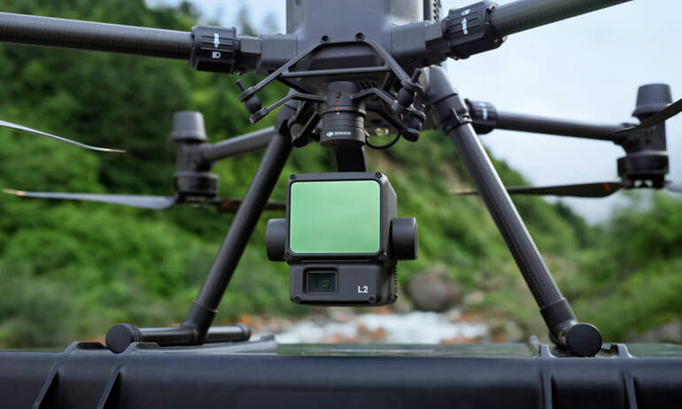
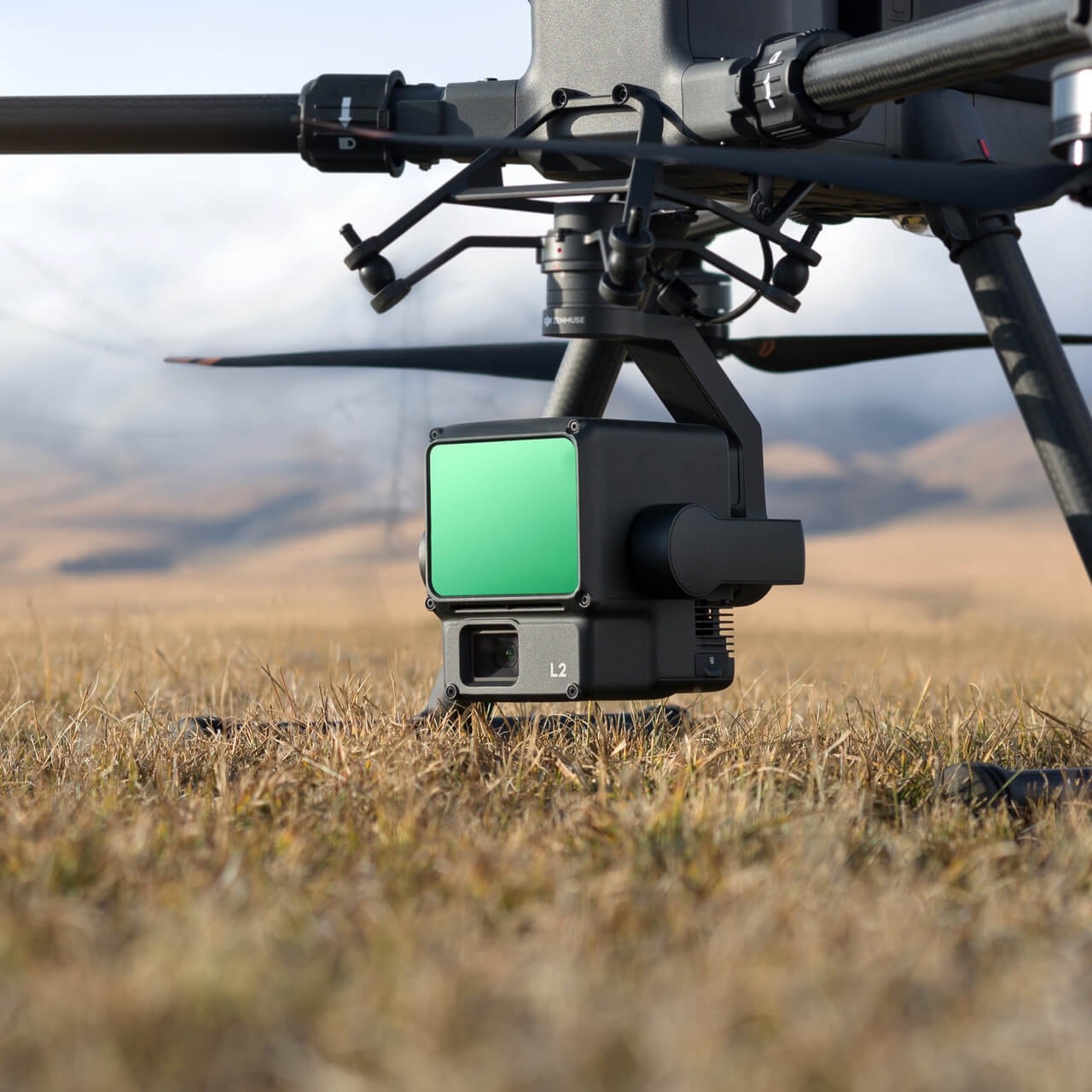
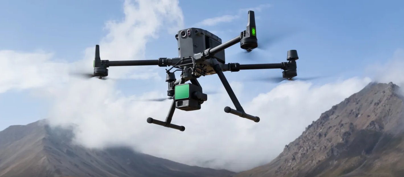
Introducing the DJI Zenmuse L2, the high-precision aerial LiDAR system that’s changing the game in geospatial data acquisition. With its integration of frame LiDAR, a self-developed high-accuracy IMU system, and a 4/3 CMOS RGB mapping camera, the Zenmuse L2 offers more precise, efficient, and reliable data collection capabilities than ever before.
In this post, we’ll delve into how the Zenmuse L2’s integration of advanced technologies provides a comprehensive solution for 3D data collection and high-accuracy post-processing. Moreover, when paired with DJI Terra software, it delivers a turnkey solution that streamlines the entire process, from data acquisition to analysis. Let’s explore how the Zenmuse L2 is revolutionizing aerial data capture and reshaping the future of geospatial mapping.
Cutting-Edge Technology of DJI Zenmuse L2
The DJI Zenmuse L2 stands as a marvel of engineering, integrating advanced technologies to deliver a comprehensive aerial LiDAR system.
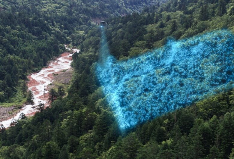
- Frame-based LiDAR system – At its core lies a frame LiDAR system boasting a detection range of up to 450 meters and a maximum point cloud rate of 1,200,000 points per second, ensuring thorough and detailed data collection.
- High-accuracy IMU system – Operating at 200 Hz, DJI Zenmuse L2 offers precise positioning and orientation data, further enhanced with RTK compatibility on DJI drones.
- 4/3 CMOS RGB mapping camera – Captures high-resolution color images, facilitating real-time point cloud coloring for easier interpretation and analysis, useful for applications like topographic mapping and infrastructure inspection.
- Laser ranging accuracy – With an RMS of 2 cm at 150 meters, DJI Zenmuse L2 ensures reliability for precise measurements and analyses.
- Versatile Scanning Modes – Offers a diverse range of scanning modes tailored to various surveying needs, providing a comprehensive view of the surveyed area, enhancing data collection efficiency and accuracy.
These technological strides position the DJI Zenmuse L2 as an industry leader in aerial surveying, empowering professionals with the high-precision geospatial data necessary for a myriad of applications.
Precision and Performance
The DJI Zenmuse L2 is engineered to deliver exceptional precision and performance in aerial LiDAR surveying, boasting detailed specifications that underscore its capabilities.
With a detection range of up to 450 meters under optimal low-light conditions, it ensures extensive area coverage, capturing even distant objects with clarity. Its impressive point cloud rate of up to 1,200,000 points per second for multiple returns results in dense, detailed scans, providing a rich dataset for analysis.
The system’s accuracy is remarkable, with horizontal accuracy within 5 cm and vertical accuracy within 4 cm at 150 meters, crucial for applications requiring precise measurements like topographic mapping and infrastructure inspection. Real-time point cloud coloring enhances data visualization, facilitating easier interpretation and analysis. With a LiDAR ranging accuracy of 2 cm at 150 meters and support for up to five returns, the Zenmuse L2 ensures reliable spatial data collection. Offering both non-repetitive and repetitive scanning patterns, it provides flexibility in data collection, catering to diverse surveying needs. Laser beam divergence measurements of 0.2 mrad horizontally and 0.6 mrad vertically highlight its precision in measuring distances.
These specifications underscore the Zenmuse L2’s ability to efficiently and reliably provide high-precision data, making it an ideal choice for professionals requiring accurate geospatial information for their projects.
Versatility and Applications
The DJI Zenmuse L2 is not just a LiDAR system; it’s a versatile tool that can be adapted to a wide range of applications across various industries. Here’s an expanded look at its potential uses:
- Topographic Surveying and Mapping: The Zenmuse L2 excels in creating detailed topographic maps, which are essential for urban planning, construction, and environmental research. Its high-precision data helps in accurately modeling terrain and landscapes.
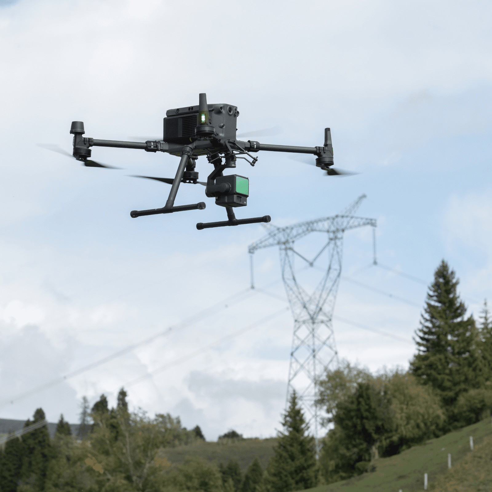
- Power Line Modeling: For the energy sector, the Zenmuse L2 can be used to model power lines, aiding in the maintenance and inspection of electrical grids. This is crucial for preventing outages and ensuring the reliability of power supply.
- Forestry Management: In forestry, the Zenmuse L2 aids in tree counting, biomass estimation, and forest health monitoring. It provides valuable data that can help in sustainable management practices and conservation efforts.
- Surveying Measurement: The system’s precision makes it ideal for surveying and measurement tasks. It can be used for boundary surveys, construction site monitoring, and volumetric measurements.
- Infrastructure Inspection: The Zenmuse L2 is also used for inspecting critical infrastructure such as bridges, roads, and buildings. It helps in identifying structural issues and planning maintenance work.
- Cultural Heritage Documentation: The system can document and preserve cultural heritage sites by creating detailed 3D models. This is important for restoration projects and historical studies.
- Environmental Monitoring: The Zenmuse L2 can monitor environmental changes over time, such as erosion, deforestation, or the impact of natural disasters. This data is vital for environmental protection and policy-making.
- Agriculture: In agriculture, the Zenmuse L2 can assist in crop analysis, yield estimation, and land management, helping farmers to optimize their practices and increase productivity.
- Public Safety: For public safety, the Zenmuse L2 can be used in search and rescue operations, disaster response, and law enforcement, providing a bird’s-eye view that can save lives and resources.
- Research and Development: Researchers use the Zenmuse L2 for various studies, including geology, archaeology, and spatial sciences, where detailed spatial data is required.
The DJI Zenmuse L2’s ability to adapt to different operational needs and environments makes it a valuable asset in any professional’s toolkit. Its wide range of applications demonstrates its capacity to provide precise, efficient, and reliable geospatial data acquisition, making it a standout choice for any project requiring aerial LiDAR technology.
Enhancing User Experience with the DJI Zenmuse L2
Unlocking the full potential of aerial surveying, the DJI Zenmuse L2 revolutionizes user experience through seamless integration, advanced technology, and comprehensive support features.
- Using DJI Terra – Seamlessly integrates with DJI Terra for efficient post-processing, streamlines workflow to transform raw data into actionable insights.
- Advanced Integration of GNSS – Ensures exceptional vertical and horizontal accuracy, critical for mapping complex landscapes and conducting thorough surveys.
- Operational Efficiency – Swiftly covers large areas without compromising data quality, particularly valuable for time-sensitive operations and vast-scale projects.
- Comprehensive Firmware Updates – Supported by regular firmware updates to enhance performance and functionality, ensures users have access to the latest features and improvements.
Responsive and helpful customer support further enriches the user experience, addressing any issues promptly. Moreover, users benefit from a vibrant community of professionals and enthusiasts, facilitated by DJI, fostering collaboration, learning, and the sharing of experiences. Together, these elements create a user experience characterized by ease of use, reliability, and comprehensive support, showcasing the Zenmuse L2 as a technologically advanced yet user-centric tool tailored to the needs and satisfaction of its operators.
Conclusion
The DJI Zenmuse L2 emerges as a groundbreaking solution revolutionizing aerial LiDAR surveying. Its integration of advanced technologies, including frame LiDAR, high-precision GNSS, and a 4/3 CMOS RGB mapping camera, enables unparalleled precision and performance in geospatial data acquisition. From topographic mapping to infrastructure inspection, forestry management to cultural heritage preservation, the Zenmuse L2 proves its versatility across diverse industries and applications.
Notably, its ease of integration within DJI’s ecosystem, operational efficiency, and robust design ensure a seamless and reliable user experience. Supported by comprehensive educational resources, responsive customer support, and an engaged community, users are empowered to leverage the full potential of the Zenmuse L2 for their projects.
In essence, the DJI Zenmuse L2 not only represents a technological marvel but also embodies a user-centric approach, prioritizing the needs and satisfaction of its operators. As professionals continue to push the boundaries of geospatial data acquisition, the Zenmuse L2 stands ready to meet the evolving demands of the industry, empowering users to capture the world from above with unprecedented precision and detail.