

Surveying today is no longer just about measuring land. It is about delivering fast, accurate, and reliable location data in environments that are often unpredictable. From open construction sites to dense city centers, surveyors need tools that can maintain precision even when conditions are not ideal.
Traditional GNSS RTK systems already improved surveying accuracy by using satellite corrections. However, they can still struggle in areas with signal blockage or interference. This is where hybrid RTK systems bring a major advantage.
The South GNSS RTK Hybrid Supreme, developed by South Surveying & Mapping Technology Co., Ltd., combines satellite positioning, inertial sensors, and real-time correction networks to maintain stable accuracy in both simple and challenging environments.

SOUTH ME SLAM RTK Review: RTK + SLAM + LiDAR in One Surveying Device | Mixed Environment Scanning
How Hybrid RTK Technology Works in Simple Terms
At its core, RTK (Real-Time Kinematic) is a method that improves GPS accuracy by comparing signals between a fixed base station and a moving receiver (rover). This allows centimeter-level positioning instead of meter-level accuracy.
The hybrid system improves this by adding extra layers of intelligence:
- Multi-constellation GNSS, meaning it connects to multiple satellite systems like GPS, Galileo, GLONASS, and BeiDou for stronger coverage
- An IMU (Inertial Measurement Unit), which helps track movement even when satellite signals are weak
- Real-time correction via UHF radio or NTRIP internet networks
- Sensor fusion, which blends satellite and motion data to maintain continuity
In simple terms, if one system becomes weak, another takes over to keep the position accurate.
Open Terrain Surveying: Where RTK Performs at Its Best
In open fields or wide construction areas, GNSS signals are strong and stable. This is where RTK systems perform efficiently, and hybrid technology helps make them even faster.
With strong satellite visibility, the system quickly locks onto multiple satellites and delivers accurate positioning in seconds. The multi-constellation GNSS support improves this by increasing the number of available satellites, which reduces waiting time for a fixed solution.
For surveyors, this means smoother workflows in tasks like land subdivision, boundary marking, and topographic mapping. Work becomes faster because the system spends less time searching for signals and more time capturing data.
Even in ideal conditions, the hybrid system ensures stability when minor signal disruptions occur due to weather or temporary obstructions.
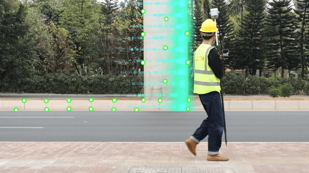
Urban Environments: Handling Signal Blockage and Reflections
Cities are much more challenging for GNSS systems. Tall buildings can block signals or reflect them, causing positioning errors known as multipath effects.
To solve this, the Hybrid RTK system uses a combination of technologies:
The IMU continues tracking movement even when satellite signals are briefly lost. This means the system does not stop working when passing between buildings or under structures. Once the signal returns, the GNSS system corrects any small drift automatically.
At the same time, multipath mitigation algorithms reduce errors caused by reflected signals bouncing off buildings.
In practical use, this allows surveyors to continue working in dense urban environments such as road corridors, bridges, and utility networks without frequent interruptions.

Challenging Terrain: Forests, Hills, and Obstructed Areas
In forested or mountainous areas, satellite signals are often partially blocked by trees or terrain. This makes it difficult for traditional RTK systems to maintain a stable fix.
Hybrid RTK solves this by combining multiple systems at once:
When GNSS signals weaken, the IMU takes over and estimates movement based on speed and direction. At the same time, multi-constellation satellite support increases the chance of maintaining at least partial satellite coverage.
This combination, called sensor fusion, helps prevent data gaps. Even if the signal is not perfect, the system continues producing usable positioning data.
For surveyors working in forestry, mining, or environmental studies, this means fewer re-surveys and more complete datasets
Workflow Efficiency: Faster Setup and Less Downtime
Beyond accuracy, survey teams also care about speed and simplicity in the field. The Hybrid RTK system improves workflow efficiency in several ways.
Instead of setting up a physical base station every time, surveyors can use network RTK through NTRIP, which sends correction data over the internet. This reduces setup time significantly.
The system also connects quickly and maintains stable communication between the rover and correction source, reducing delays during initialization.
In real terms, this means survey teams spend less time preparing equipment and more time collecting actual data, which improves productivity across the entire project.

Comparison: Traditional RTK vs Hybrid RTK
To understand the difference more clearly, here is a simple comparison of how both systems perform in real-world conditions.
| Feature | Traditional RTK | South GNSS RTK Hybrid Supreme |
| Satellite Systems | Limited constellations | Multi-constellation (GPS, GLONASS, Galileo, BeiDou) |
| Signal Stability | Drops in urban/forest areas | Stable with IMU + hybrid correction |
| Tilt Compensation | Not available or limited | Built-in IMU tilt compensation |
| Signal Loss Recovery | Slow re-fix time | Instant re-acquisition + continuity |
| Productivity | Moderate | High-efficiency workflow |
| Environmental Performance | Open areas only | Open + urban + obstructed terrain |
| Data Continuity | Gaps during loss | Continuous tracking via INS |
The comparison shows that hybrid systems perform especially better in unstable environments such as cities and obstructed terrain, while still improving efficiency in open-field conditions.
If you want a deeper dive into how these two systems compare in real-world use, we’ve published a full breakdown here: South GNSS RTK Hybrid Supreme vs Traditional GNSS: What’s the Difference?
Future of Surveying Technology
Surveying technology is moving toward smarter systems that combine satellite positioning, sensors, and cloud computing.
Hybrid RTK systems represent this shift by integrating multiple technologies into one platform. Future improvements may include AI-based error correction, better integration with drones for mapping, and faster cloud-based corrections.
This evolution will continue to make surveying faster, more accurate, and easier to perform even in difficult environments.

Reliable Accuracy in Every Environment
The South GNSS RTK Hybrid Supreme shows how modern surveying technology can adapt to real-world challenges. By combining satellite systems, inertial sensors, and real-time correction networks, it ensures reliable accuracy across open fields, urban environments, and obstructed terrain.
For professionals, it improves productivity and reliability. For new users, it simplifies complex surveying tasks.
In the end, hybrid RTK technology does not just improve accuracy. It makes precision possible in places where it was previously difficult to achieve.
To learn more about how Hybrid RTK solutions like the South GNSS RTK Hybrid Supreme can improve your surveying workflow, contact Dynatech Innovations for expert guidance and product support. Dynatech can help you choose the right configuration based on your project requirements and field conditions. Get in touch today to explore accurate, efficient, and reliable surveying solutions tailored for your needs.