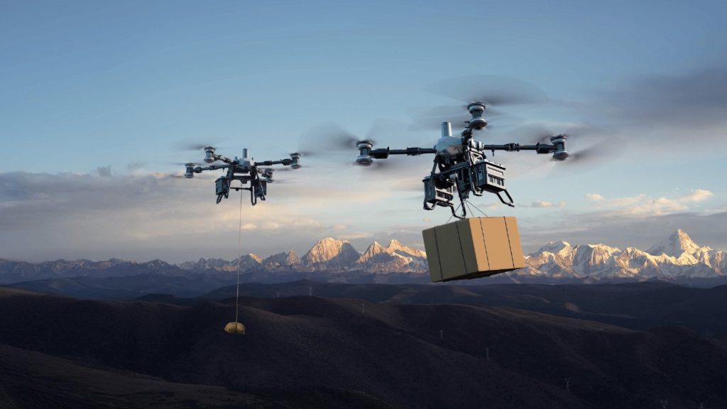
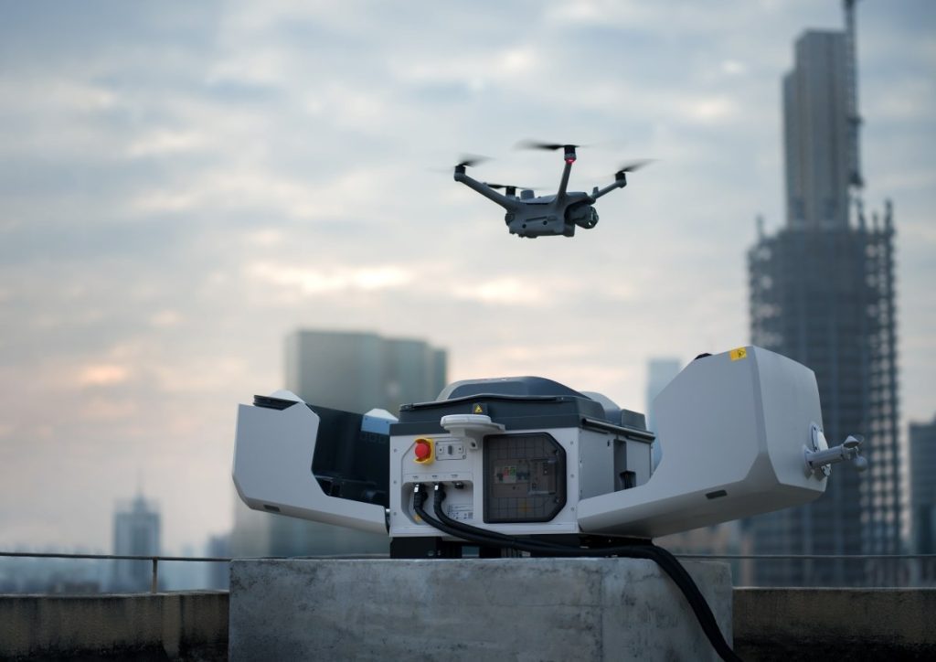
Organizations responsible for infrastructure and environmental assets are moving beyond scheduled inspections and shifting to constant awareness. The DJI Dock 3, paired with the Matrice 4D, makes this possible by combining rugged hardware with intelligent automation to deliver truly continuous geospatial monitoring.
With rapid charging, reliable performance in extreme temperatures, and full support for automated missions, this partnership eliminates the need for on-site crews and ensures data is always up to date. For professionals who need accurate, repeatable insights day and night, it represents a major step forward in efficiency, safety, and operational readiness.
What Makes DJI Dock 3 Different
The DJI Dock 3 is engineered for resilience, capable of running 24/7 even when conditions are far from ideal. With an IP56 weather rating, it operates reliably in rain, dust, and strong winds, and its wide temperature tolerance from -30°C to 50°C makes it suitable for extreme environments. Rapid charging keeps the Matrice 4D ready for frequent flights, reducing downtime and enabling continuous coverage.
When paired with automated mission planning, the Dock 3 becomes more than a storage hub; it turns into the backbone of an always-on monitoring system. In infrastructure inspection, it can track changes in power lines, bridges, or pipelines without sending crews into hazardous areas. For environmental monitoring, it ensures regular data collection on forests, coastlines, or mining zones, helping teams spot changes quickly and act before issues escalate.
Automated Missions and 24/7 Operations
The DJI Dock 3 paired with the Matrice 4D removes the need for manual flights and routine field crews by delivering a fully autonomous workflow. This system ensures missions run without interruption, maintaining a constant and reliable data stream for professionals.
Fully Automated Workflow
With DJI FlightHub 2, missions can be pre-programmed, leaving the Dock 3 to handle everything automatically:
- Automated Launch: The Dock opens, the Matrice 4D powers up, completes checks, and takes off along its scheduled path.
- Rapid Recovery and Charging: After landing with high-precision RTK, the drone charges from 15% to 95% in just 27 minutes, minimizing downtime for continuous operations.
- Automatic Data Transfer: Data uploads directly to the cloud, eliminating the need for crews to retrieve SD cards.
Continuous Monitoring and Safety Benefits
This automation cuts labor costs and improves safety by keeping personnel out of dangerous or remote areas. Dock 3’s durability ensures uninterrupted operation in extreme environments, from −30° C to 50° C, withstanding winds up to 12 m/s.
Real-Time Response and Critical Insights
When urgent issues arise, the Matrice 4D can be deployed instantly from FlightHub 2. This rapid response allows stakeholders to access high-resolution imagery or thermal data within minutes. Instead of waiting for manual deployments, organizations benefit from immediate situational awareness.
By enabling round-the-clock coverage, the Dock 3 and Matrice 4D shift monitoring from reactive checks to proactive intelligence, giving organizations the efficiency, safety, and speed required for today’s most demanding missions.
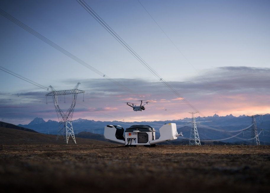
Key Advantages for Infrastructure Inspection
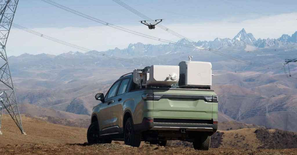
For infrastructure managers overseeing massive networks of power lines, pipelines, and bridges, the Dock 3 and Matrice 4D partnership provides operational benefits that redefine efficiency and safety.
Precision Mapping of Critical Assets
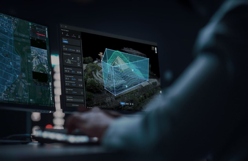
The system allows for the creation of intricate, pre-programmed, fixed-route flights tailored specifically for continuous monitoring of large-scale assets like power grids, bridges, and energy pipelines. This capability moves beyond simple surveillance by supporting advanced high-precision mapping requirements. The Matrice 4D’s comprehensive camera system supports a new 5-direction oblique photography function, 3-direction orthophoto photography, and real-time terrain following, ensuring that every inch of complex structures is covered according to a meticulous schedule.
Consistent Data for Accurate Trend Analysis
The automated nature of the system ensures consistent, repeatable flight paths for every mission. This guaranteed precision is vital for trend analysis because it ensures that any small change in the collected data is a true change in the physical asset, not a product of positional variability. By leveraging the Matrice 4D’s high-resolution 48 MP cameras and its 1800 m Laser Range Finder, the system captures high-fidelity comparative data, enabling operators to accurately track the growth of a crack or the progress of corrosion over time.
Enhanced Autonomous Flight Safety
Operational safety is significantly enhanced by the integration of cutting-edge technology into the drone itself. The Matrice 4D is equipped with an advanced Obstacle Sensing Module that combines rotating LiDAR and millimeter-wave radar for precise avoidance in complex airspace. This unique sensor fusion allows for 12 mm wire-level obstacle avoidance at speeds up to 15 m/s in intricate environments like power line crossings, ensuring that the critical, continuous mission remains secure and uninterrupted.
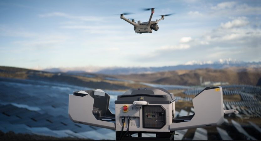
Transforming Environmental Monitoring
The constant, round-the-clock availability provided by the Dock 3 and Matrice 4D partnership is a game-changer for environmental and conservation efforts. It turns reactive observation into proactive stewardship, making vast, inaccessible areas manageable.
Continuous Tracking of Sensitive Habitats
The autonomous system enables the continuous tracking of sensitive habitats, forests, and water resources that are often too remote or extensive for regular human patrols. Instead of relying on infrequent, costly site visits, the Matrice 4D can fly scheduled aerial surveys—using its high-resolution 48 MP cameras or the 640×512 Infrared Thermal Camera (on the Matrice 4TD)—to build a complete, long-term historical record of the environment. This constant data collection is vital for understanding natural cycles and population shifts without causing disturbance.
Rapid Detection of Environmental Changes
The ability to perform 24/7 automated missions provides rapid detection of detrimental changes that demand an immediate response. By comparing sequential autonomous scans, the system can quickly identify localized events such as illegal logging, localized flooding, or erosion caused by weather events. This instant comparative capability shortens the detection window from days or weeks to hours, allowing authorities to intervene before minor infringements escalate into major environmental disasters.
Timely Data for Policy and Response
Autonomous data collection provides reliable, frequent updates for policy-making on land use and conservation. In emergencies, drones can be dispatched instantly, delivering real-time aerial intelligence on wildfires, floods, or hazardous spills, enabling faster, more effective response and improving safety for first responders and communities.
Integrating Data into One Workflow
With DJI Dock 3 and Matrice 4D, captured data uploads instantly to FlightHub 2, streamlining access and processing. Imagery can be transformed into 2D maps or 3D models in DJI Terra or exported to GIS platforms. This unified system ensures integrity, reduces compatibility issues, and accelerates actionable insights.
Shaping the Future of 24/7 Monitoring
The DJI Dock 3 paired with the Matrice 4D sets a new benchmark for 24/7 geospatial monitoring. With its rugged design, ability to withstand extreme temperatures, and support for fully automated missions, it delivers reliable operations around the clock without constant human oversight. Organizations gain efficiency by reducing field deployments, improve safety by keeping crews out of hazardous environments, and unlock faster, more actionable insights with real-time data access.
For industries that depend on continuous awareness — from infrastructure inspection to environmental monitoring — moving toward autonomous operations is no longer just an option, but the clear path forward. With Dynatech Innovations as your trusted partner, you gain access not only to cutting-edge DJI technology but also to expert training and support that ensures your team is ready to deploy this system to its full potential.
📩 Contact Dynatech Innovations today to explore how DJI Dock 3 and Matrice 4D can transform your monitoring operations.