No products in the cart.
Back

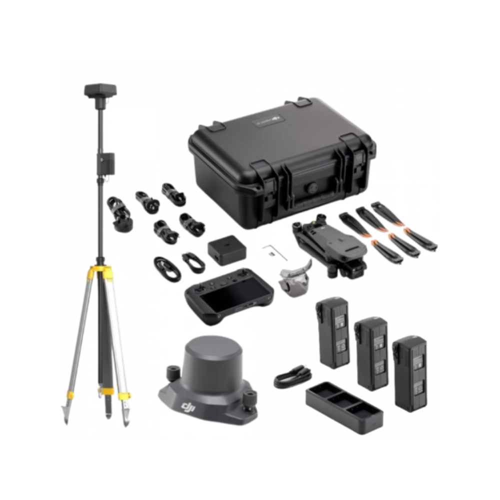
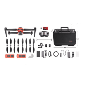
DJI MAVIC 3 ENTERPRISE SURVEY KIT
AED30,500.00 VAT Excl
In stock
DJI MAVIC 3 ENTERPRISE SURVEY KIT
AED30,500.00 VAT Excl
- The Ultimate Mapping Package
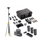
- RTK Module, Battery Kit, D-RTK 2 Mobile Station & Tripod
- 4 Batteries in Total! 45 Mins Flight Time Each
- Map Up To 2km Per Battery
- Mechanical Shutter
- Description
Compact drone optimised for aerial surveying
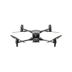
The DJI Mavic 3 Enterprise is a new generation of portable drone, recognized as one of the best drone for land surveying and mapping.
Optimised for drone mapping, this lightweight all-in-one solution features a 4/3 inch 20MP sensor with mechanical shutter.
The DJI M3E is a highly-efficient surveying solution: A large pixel size, 0.7s shooting shutter interval and a 45 minute flight time means that it can cover up to 16km2 in a single day.
Combine with the RTK Module to achieve GCP-free, centimetre accurate mapping data.
A versatile solution, the Mavic 3 Enterprise can achieve up to 56x hybrid zoom, making it ideal for inspection missions.
Benefit from enhanced flight safety features, robust data security protocols and access to a full software suite, including DJI FlightHub 2.
Key Features
- Optimised for Surveying: Large pixel size
- Wide Camera: 4/3 CMOS camera; 20MP; Mechanical shutter
- Tele Camera: 12MP; 56x hybrid zoom
- Lightweight, compact, and portable: 915g airframe
- Ultra-long battery life: 45 minutes maximum flying time
- Enhanced Flight Safety: Omnidirectional obstacle sensing and advanced Return to Home
- Exclusive Controller: New DJI RC Pro Enterprise smart controller with high-bright screen.
- Accessories: Including RTK Module for centimetre-level precision.
- Full Software Suite: DJI Pilot 2; DJI FlightHub 2; DJI Terra.
- Entry-level Survey Drone: The price point and size makes the M3E a great entry level surveying drone.
Camera
High-class sensor engineered for precision drone surveying
The camera on the Mavic 3 Enterprise enables it to be deployed as a specialised tool for aerial surveying and precision inspection missions.
Its integrated payload features wide and tele cameras.
The Mavic 3E’s large pixel size and Intelligent Low-Light Mode combine to offer significantly improved performance in dim conditions.
Wide Camera
- 4/3 CMOS sensor, 20MP
- Large pixel size (3.3um) and shooting interval of 0.7s increase surveying efficiency
- Mechanical shutter: Prevents motion blur and ensures no jelly effect under high-speed movement
- Equivalent focal length: 24mm
Tele Camera
- ½ inch CMOS, 12MP
- 162mm Equivalent Focal Length
- Up to 56x hybrid zoom
Enhanced surveying efficiency
More data in a single flight
The Mavic 3 Enterprise is more portable, efficient and expandable compared to DJI’s other compact drone mapping solution: The Phantom 4 RTK.
With greater battery life, larger pixel size and shorter shooting interval, the Mavic 3 Enterprise is up to eight times more efficient than the P4 RTK (1cm GSD).
Tests show that, with a 5cm GSD, the orthophoto efficiency of the Mavic 3 Enterprise can reach 2.25 square kilometres: 1.9 times that of the Phantom 4 RTK.
Next generation transmission and safety features
Greater peace of mind during flights
The Mavic 3 Enterprise has enhanced safety features, including improved obstacle sensing and navigation systems and equipped with a robust transmission system.
DJI O3 Enterprise Transmission: Benefit from a maximum control range of 8km (CE). DJI O3 Enterprise Transmission enables operators to transmit signals with higher stability and obtain a high frame rate live feed at 1080p/30fps.
DJI AirSense: Receive ADS-B signals from traditional aircraft in the area to warn of other air traffic nearby, for greater airspace awareness.
DJI APAS System 5.0: The new improved DJI APAS system 5.0 for obstacle sensing with zero blind spots is supported by six omnidirectional fish-eye sensors.
Advanced RTH: The drone automatically determines the optimal route back to its home point and executes it quickly.
Flight Route
Real-time terrain follow
Automatically adjust altitude when mapping areas with variations in elevation, all without needing to import external elevation data thanks to Mavic 3E’s omnidirectional sensing.
Smart oblique capture
Elevate the efficiency of your oblique photography mission with Smart Oblique Capture. During flight, the gimbal automatically rotates in three directions: front, middle, and back. Two routes can collect all photos at the angles needed for high-precision 3D modeling.
Live mission recording
Record mission actions such as aircraft movement, gimbal orientation, photo shooting, and zoom level to create sample mission files for future automated flights.
Linear mission planning
Create automated flight missions of highways, rivers, oil pipelines, and more with Linear Mission Planning. Simply draw a line on the map and it divides the area into mappable segments for straightforward surveying.
Data security
Protect your sensitive data
The Mavic 3 Enterprise offers state-of-the-art security features to protect the integrity of photos, videos, flight logs and other data generated during sensitive flight.
Local Data Mode: When activated, Local Data Mode stops the DJI Pilot 2 flight control app from sending or receiving any data over the internet. This provides added security assurances for operators of flights involving critical infrastructure, governmental projects or other sensitive missions.
AES-256 Encryption: The radio link between the aircraft and remote controller features robust AES-256 encryption, ensuring critical information exchanged between the drone and its remote is protected.
Controller
Professional remote controller for professional missions
The Mavic 3 Enterprise is compatible with the new DJI RC Pro Enterprise.
Key features of this professional remote controller include:
- 5.5-inch, 1,000-nit high-brightness screen for enhanced visibility in direct sunlight.
- Built-in microphone for clear communication. Can be used with the loud speaker module.
- 1.5 hours to fully charged, 3 hours of battery life
- Enhanced CPU and GPU performance
- Compatible with DJI Pilot 2, including route planning such as waypoint, mapping, oblique and linear.
Accessory ecosystem
Get more from each flight
The Mavic 3 Enterprise is compatible with a range of enterprise-level accessories, increasing the effectiveness of each drone mission.
RTK Module: Enables surveying professionals to achieve centimetre-level accuracy with support for network RTK, custom network RTK services, and D-RTK 2 Mobile Station.
The D-RTK 2 Mobile Station: The Mavic 3 Enterprise is compatible with the D-RTK 2 Base Station – DJI’s upgraded high-precision GNSS receiver that supports all major global satellite navigation systems, providing real-time differential corrections.
Loud Speaker: Broadcast a message from above, with support for text-to-speech, audio storage, and looping.
Supported by DJI enterprise software
The Mavic 3 Enterprise Series drones are at the centre of an advanced and growing ecosystem of software for drone operations, allowing the aerial platforms to reach their full potential as tools for data gathering, mapping, fleet management and flight operations.
DJI PILOT 2
The revamped flight interface is designed to improve piloting efficiency and flight safety.
Drone and payload controls can be easily accessed with one tap. Users can access the drone’s hardware, video live-stream, and photo data.
DJI FLIGHTHUB 2
This all-in-one cloud operations management software for drone fleets allows drone operators to efficiently manage flight operations with route planning and mission management.
DJI TERRA
The full-featured mapping software for all stages of work, from mission planning to processing of 2D and 3D models.
To mark the launch of the Mavic 3 Enterprise Series, receive a free DJI Terra Electricity Licence for three months.
DJI THERMAL ANALYSIS TOOL 3.0
Helps professionals analyse, annotate and process images captured by the Mavic 3 Thermal using DTAT 3.0 to detect temperature abnormalities during inspections.


