No products in the cart.
Back

Out of stock
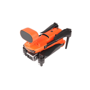
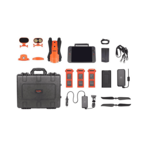
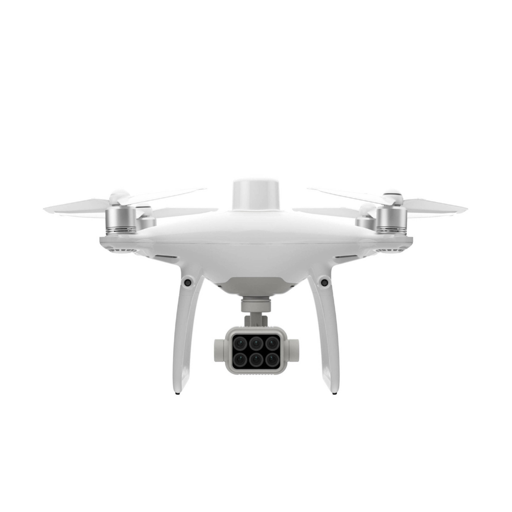
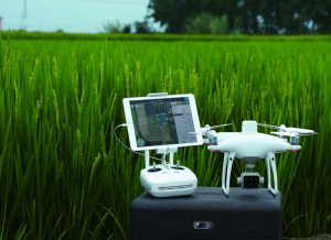
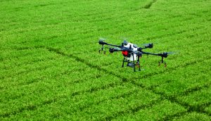
DJI Phantom 4 Multispectral
Precise multispectral imaging
Integrated spectral sunlight sensor
RGB and NDVI live view
Contact us for more information
-
Description
Collect accurate plant-level data using P4 Multispectral, a high-precision drone with a perfectly integrated multispectral imaging system for agricultural missions, environmental monitoring and more.
Farms
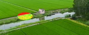
Get immediate information about plant health
P4 Multispectral consolidates the data acquisition process that provides information on crop health and vegetation management. DJI has created this platform with the same powerful performance standards for which DJI is known, including 27 minutes of maximum flight time and up to 7 km of transmission range with the OcuSync system.
See below the surface

Collecting agricultural images is now easier and more efficient than ever before with a built-in stabilized imaging system that collects complete data sets immediately. Access the information collected by 1 RGB camera and an array of multispectral cameras with 5 cameras covering the Blue, Green, Red, Red Edge and Near Infrared bands, all at 2 MP with global shutter, on a gimbal stabilized 3-axis.
Integrated spectral sunlight sensor for accurate results

A spectral sunlight sensor integrated into the top of the drone captures solar radiation, which maximizes the accuracy and consistency of data collection at different times of day. When combined with post-processed data, this information helps to produce more accurate NDVI results.
Significant data at your disposal
Displays both RGB and NDVI feeds
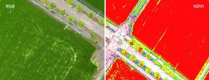
The simple fact of having aerial images is not enough for professionals who want to know more. Switch between a preliminary analysis of the vegetation index difference normalized (NDVI) and the RGB feed in real time to immediately display where attention is needed, so you can quickly make targeted treatment decisions.
Accuracy at centimetre level
Get accurate real-time positioning data on the images captured by all six cameras with DJI’s TimeSync system, providing accurate measurements at the centimeter level. The TimeSync system continuously aligns the flight controller, RGB and NB cameras and RTK module, fixing the positioning data in the center of the CMOS and ensuring that each photo uses the most accurate metadata. All cameras go through a rigorous calibration process where radial and tangential lens distortions are measured. The collected distortion parameters are saved in the metadata of each image, allowing the post-processing software to uniquely adapt to each user.
D-RTK 2 Mobile Station and NTRIP compatibility

Improves RTK positioning accuracy without Internet connection by connecting P4 Multispectral to the high-precision GNSS mobile station D-RTK 2 and NTRIP (network transport of RTCM via Internet protocol) or stores satellite data observation to be used for Post Processed Kinematics (PPK).
The beginning of the missions of intelligent agriculture
Plan your flights

Plan flights, perform automated missions and manage flight data using GS PRO, DJI’s leading iOS flight planning app.
Acquire data

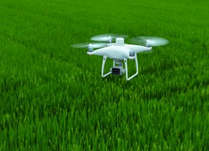
Collect multispectral images efficiently over a large area using P4 Multispectral and get an overview of problem areas.
Analyze data

Easily access and process aerial data by applying specific metrics and plant parameters to acquire the desired plant health results.
Acting on data
Implement targeted treatments on areas that require attention based on accurate drone data.
Applications
Precision farming
During all growing seasons, multispectral images can be useful for AG professionals by providing information invisible to the human eye through the electromagnetic spectrum. By having access to these data and to vegetation index data subsequently obtained as NDRE and NDVI, farmers can make timely and informed decisions on crop treatment, reduce costs, save resources and maximize yields.
Environmental monitoring and inspection

Routine inspections and maintenance involving plants can be made smarter and more efficient when using P4 Multispectral: use multispectral information to monitor forest health, measure biomass, map coasts or manage riverside vegetation protecting habitats or ecosystems and much more.
Compatible software
Use DJI Ground Station Pro to create automated and repeatable missions including flight planning, mission execution and flight data management. The collected data can be easily imported into DJI Terra and a third-party software suite.
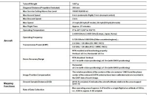
Specifications
Related products
-
DJI Matrice 350 RTK
AED23,200.00 VAT Excl -
-
Autel EVO II 640T Enterprise Bundle V3
AED25,750.00 VAT Excl