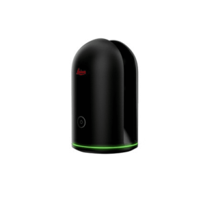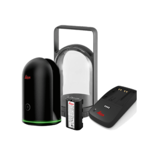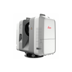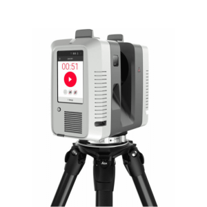
Emesent Hovermap STX
Key Features:
- LiDAR Range 0.5 to 300 m (1.6 to 984 ft)
- HesaiXT32M2X LiDAR
- Multi Return Mode (3 return): up to 1,920,000 points/sec
- 32 LiDAR Channels
- 360°x 290°Field of View
- IP65 Certified
-
Description
Emesent’s AI-Powered and Versatile Hovermap
Fast, accurate, high-detail mobile data capture
Featuring AI-powered autonomous mapping, Hovermap incorporates the latest in LiDAR sensing technology to generate high density point clouds with exceptional coverage. With a sensing range of up to 300 meters and the ability to capture more than a million points per second, Hovermap delivers detailed, survey-grade data over a wide area fast – accelerating your time to insight.
Emesent offers a choice of Hovermap business plans designed to match and support your specific LiDAR mapping and data visualization requirements.
Why choose Hovermap?
Fast time to insight
A LiDAR sensing range of up to 300 meters and triple returns capable of more than one million points per second allow you to capture detailed, accurate data over a greater area in less time – increasing efficiency.
Survey-grade accuracy
Emesent’s award-winning SLAM solution, automated ground control points and higher resolution LiDAR sensor provide a cleaner point cloud with sub-centimeter precision allowing you to obtain more accurate measurements and improved insights.
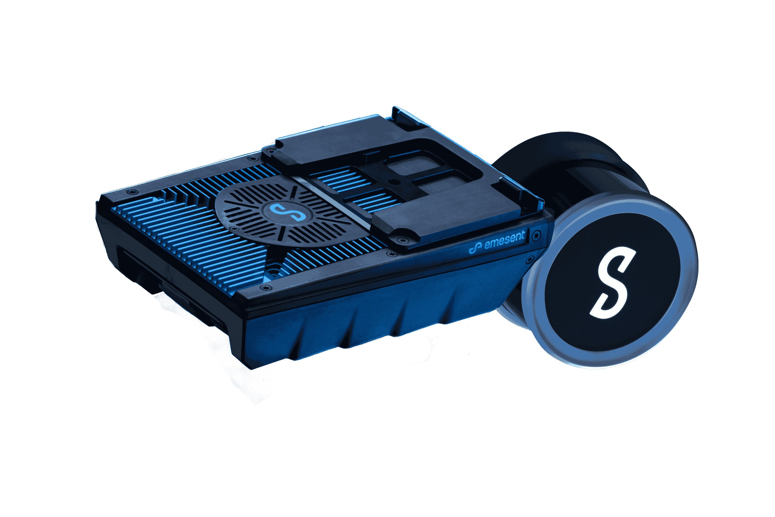
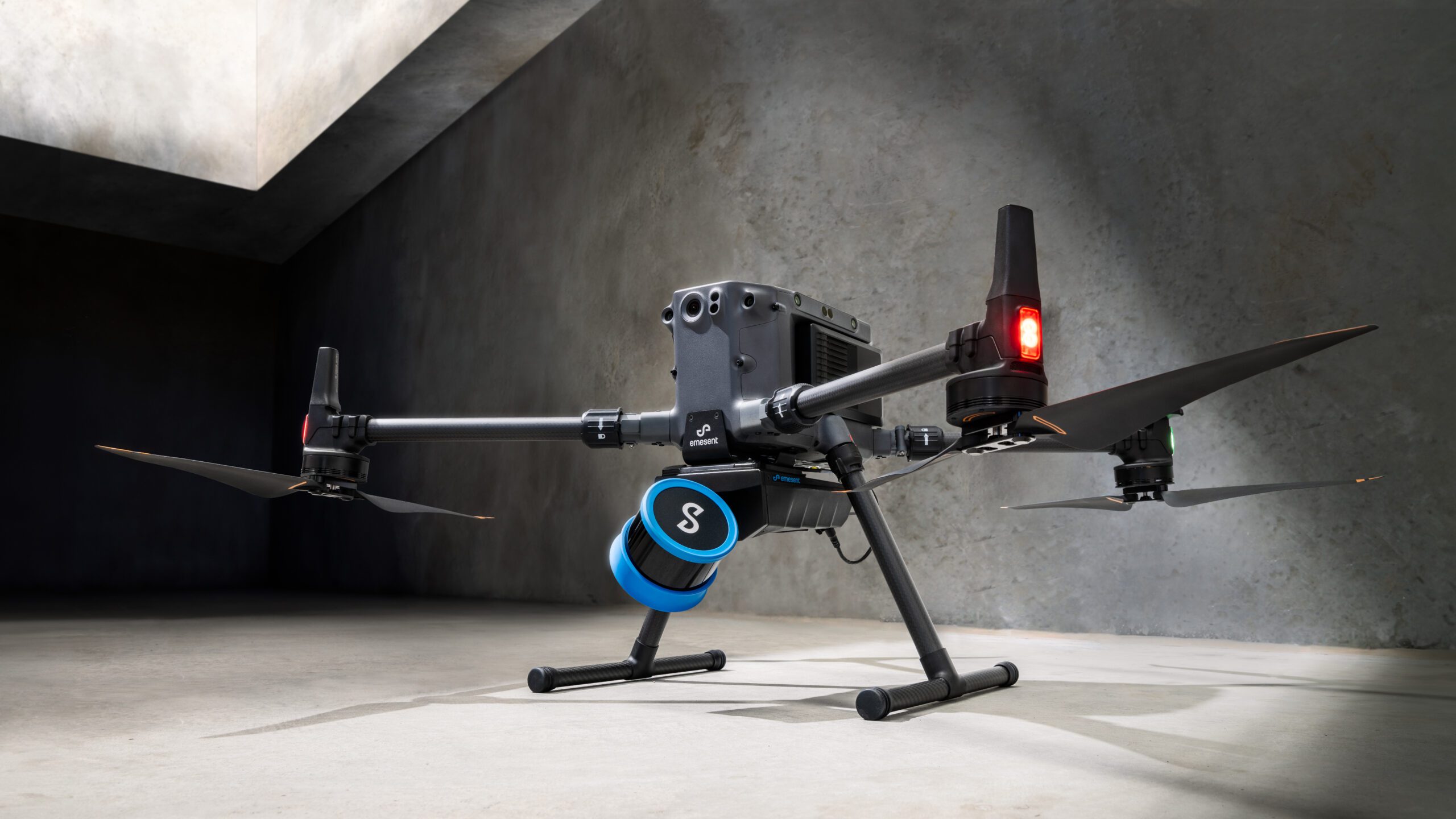
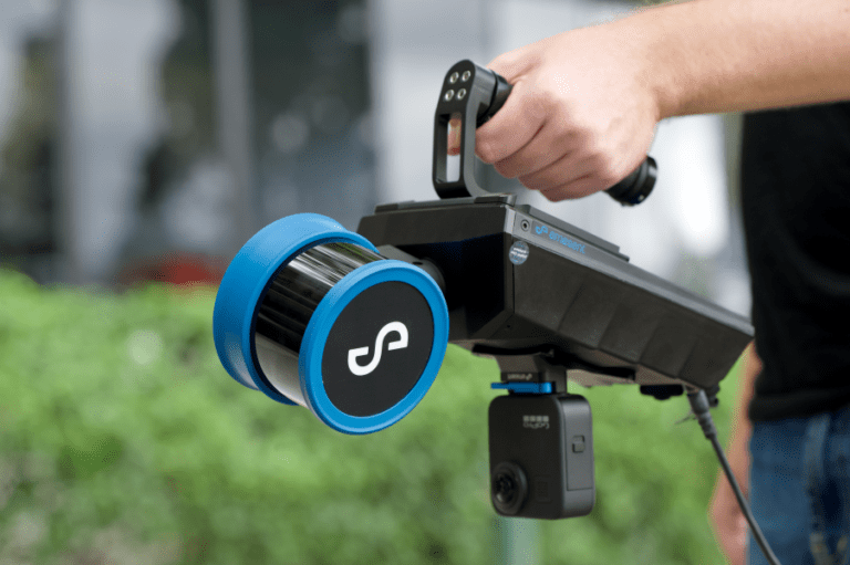
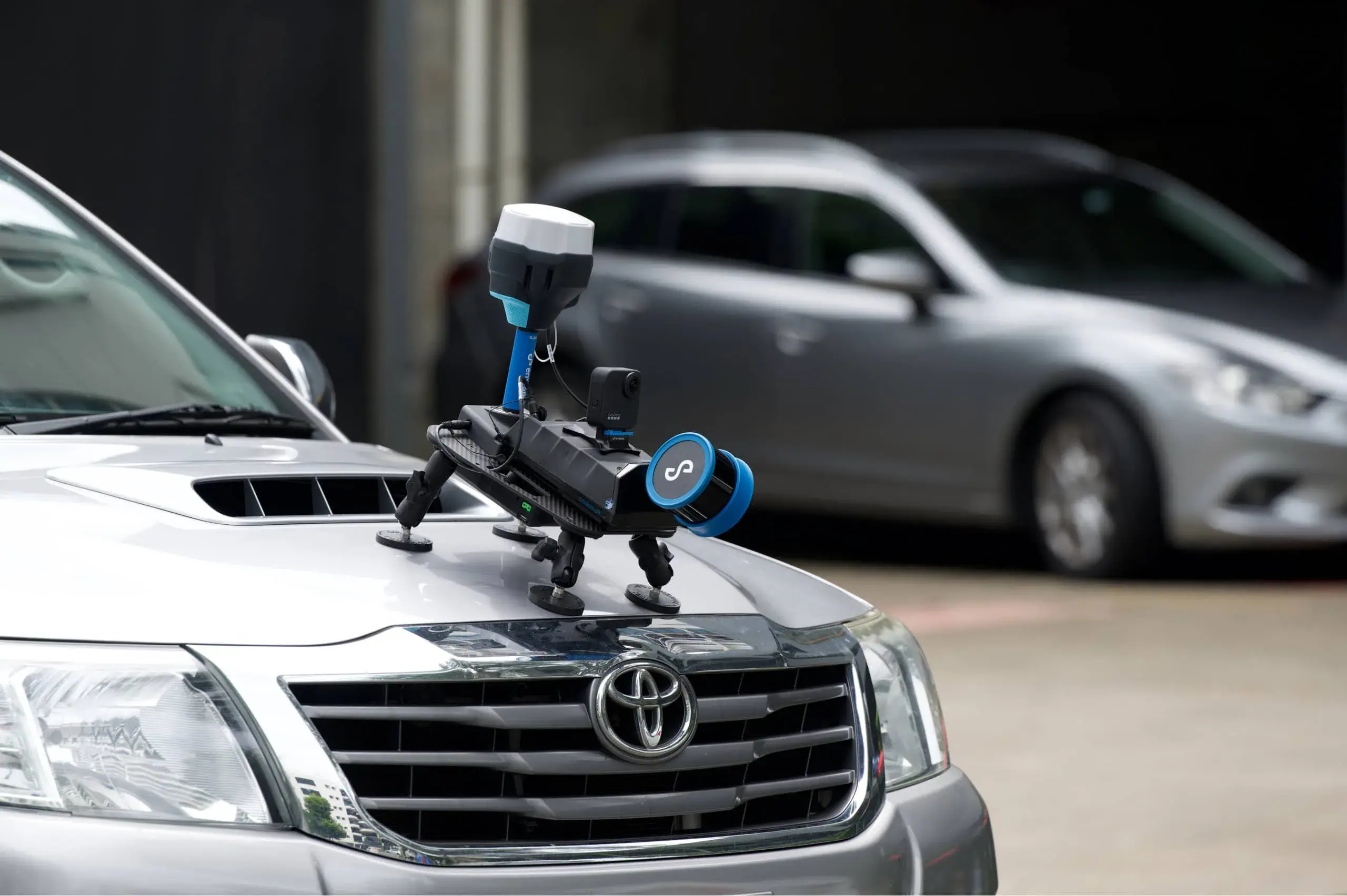
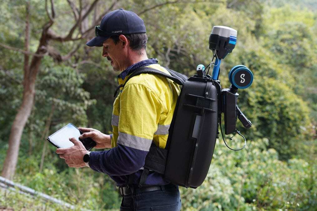
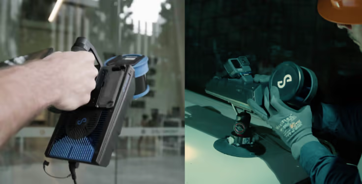
Uniquely versatile
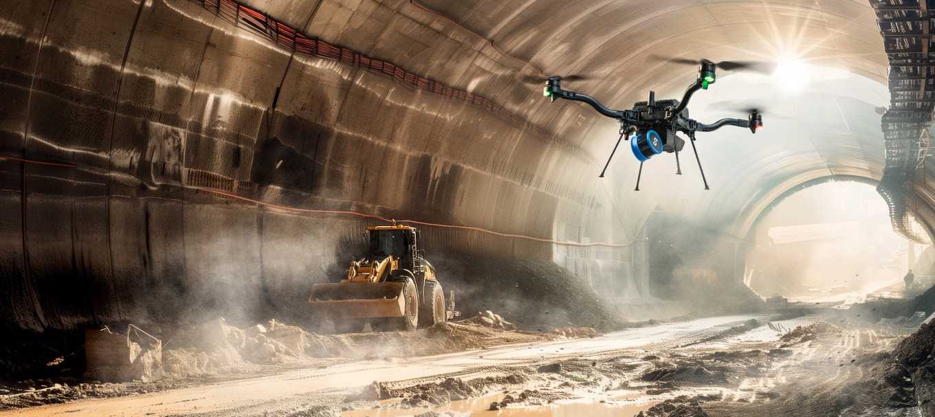
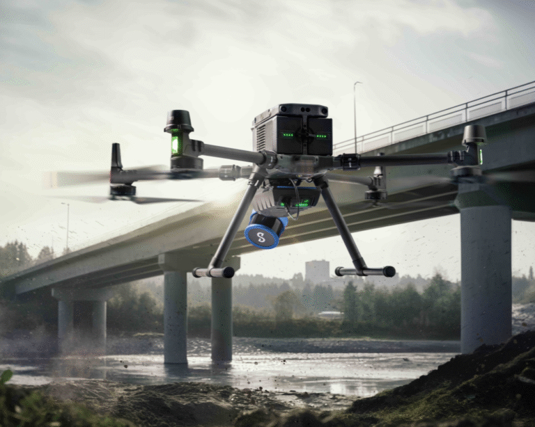
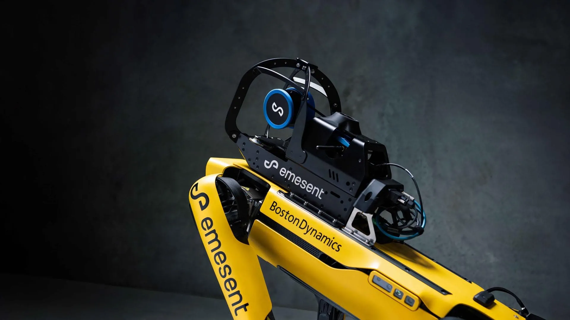
The plug-and-play design and quick-release mechanism allow easy switching between modes. Use Hovermap as a handheld scanner; attached to a drone, vehicle, or pole; lowered in a cage; or mounted to a backpack to easily collect data anywhere.
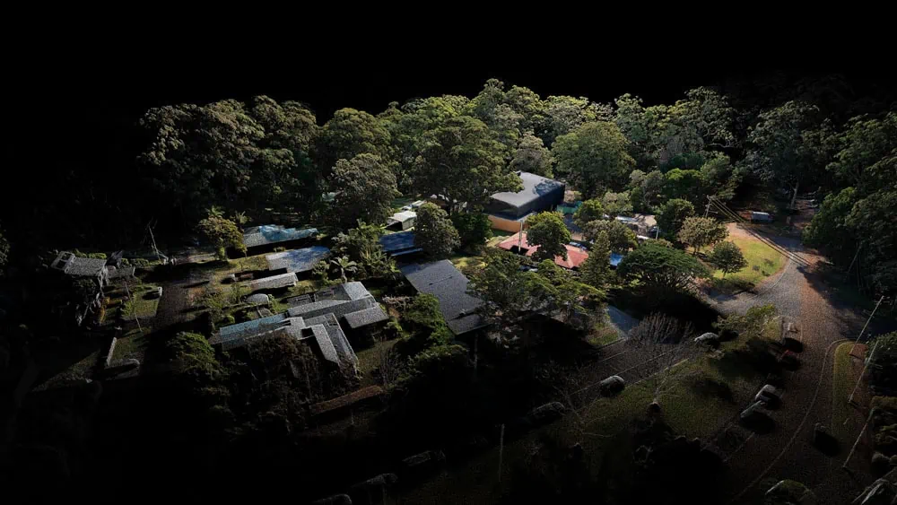
Superior detail
Capture shadowless, detailed, high quality point clouds of an entire complex asset with high density data sets to reveal richer features. Add a level of reality capture with colorization.
Mapping options for every scanning need
Hovermap’s autonomy levels give you the versatility to best capture the environment you need and the confidence to leave the site knowing you’ve captured everything you need.
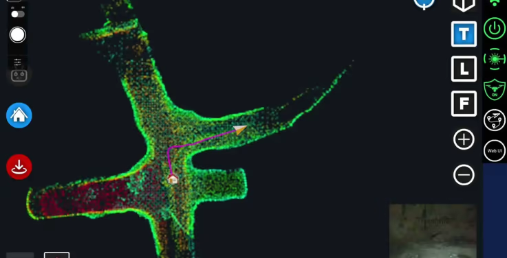
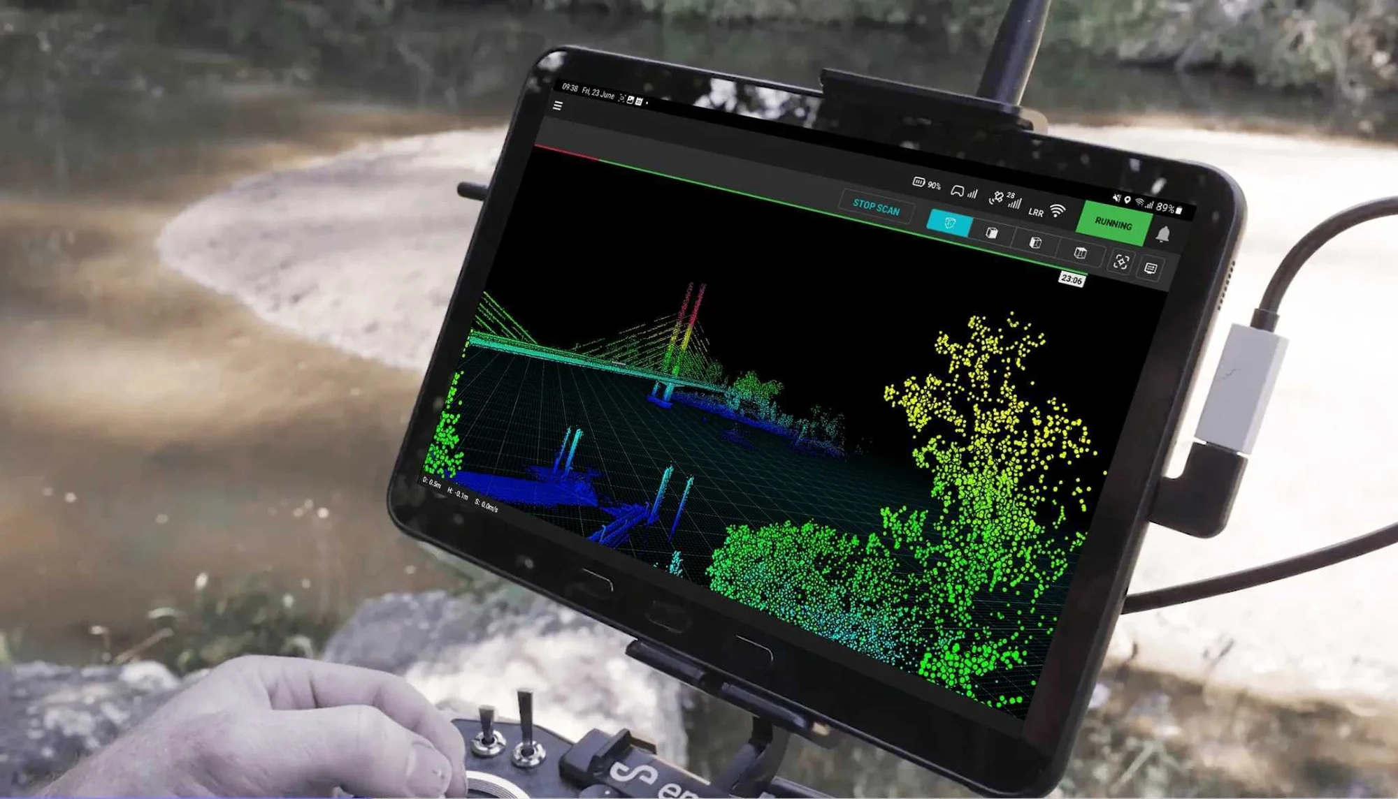
In all modes, Hovermap streams a live point cloud to the Hovermap app, providing a real-time preview of the data as it is captured when in communication range.
Autonomous waypoint mode
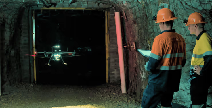
Autonomous waypoint mode provides beyond line-of-sight flight through smart waypoints and guided exploration. Simply tap on the map to set smart waypoints, and hovermap takes care of the rest, navigating to the waypoints, mapping the area, and keeping itself and the drone safe from obstacles.
Pilot assist mode
Pilot assist mode provides omnidirectional collision avoidance, line of sight gps-denied flight capability, and stability control, providing the confidence and stability for close, thorough inspections. It acts as a safety bubble for your drone, keeping the asset and your equipment safe. This mode is available in the plus subscription.
Mapping mode
Mapping mode offers fast, accurate, and high-resolution mobile scanning of environments where drone autonomy is unnecessary. Hovermap’s quick-release mechanism allows you to easily switch from a drone to handheld scanning or a backpack, vehicle, or protective cage for SLAM-based mobile mapping.
Leading LiDAR Mapping
Designed for tough missions
All Hovermaps are designed with the tough, lightweight, ip65 weather sealed design giving you the confidence to capture harsher areas. Emesent’s award-winning SLAM solution and autonomy algorithms ensure safety for the drone and asset, even in hazardous, GPS-denied environments.
Deployment options to suit your needs
Hovermap’s unique versatility allows users to capture data from previously inaccessible areas, either from the air or on the ground. The plug-and-play design enables easy switching from drone-based use to handheld, backpack, vehicle or ground robot-mounted scanning.
Robust, autonomous capability
Autonomy modes designed to suit your needs with pilot assist with omnidirectional collision avoidance or beyond line-of-sight guided exploration.
Live streamed point clouds
Hovermap streams the live point cloud to the Hovermap app, allowing a real-time preview of the data as it is captured.
Designed for fleet expansion
Accessories purchased for the older Hovermap ST remain compatible with the STX, meaning if you expand your fleet, you can use the same accessories on both versions of Hovermap.
Automated mission control
Emesent Commander makes mapping, pilot assist and autonomous mission planning and control effortless. Designed with user-friendly workflow prompts and built-in fail-safes, the Commander app gives you responsive control, ease of navigation and access to Emesent’s market leading autonomous capabilities via a touchscreen interface.
Point cloud processing
Emesent Aura allows the processing and visualization of scans in one intuitive platform, streamlining the way Hovermap users process, view, and analyze point clouds for faster insights and improved decision-making.
Specifications
| LiDAR range | 0.50 to 300 m (1.6 to 984 ft) |
| Mapping Accuracy | ± 15 mm (19/32 in) in general environments ± 10 mm (3/8 in) in typical indoor and underground environments ± 5 mm (7/32 in) isolated change detection capability |
| LiDAR Channels | 32 |
| LiDAR Data Acquisition Speed | Single Return Mode: up to 640,000 points/sec Multi Return Mode (3 return): up to 1,920,000 points/sec The triple return mode allows the detection beam to traverse several layers, revealing hidden details such as behind vegetation or below a forest canopy. |
| Storage | 512 Gigabytes – approximately 4 hours of sensor data |
| Weight | 1.57kg (3.4 lbs) |