-
1× AED11,600.00
Subtotal: AED11,600.00

Subtotal: AED11,600.00
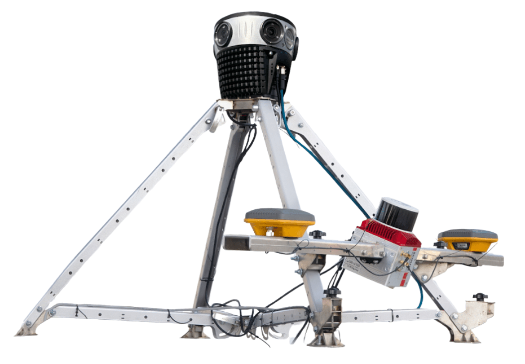
Key Features:
Urban data capture is at your fingertips with 75MP imagery + LiDAR, optimized for city-speed collection and rapid delivery.
Capture today. Deliver tomorrow.
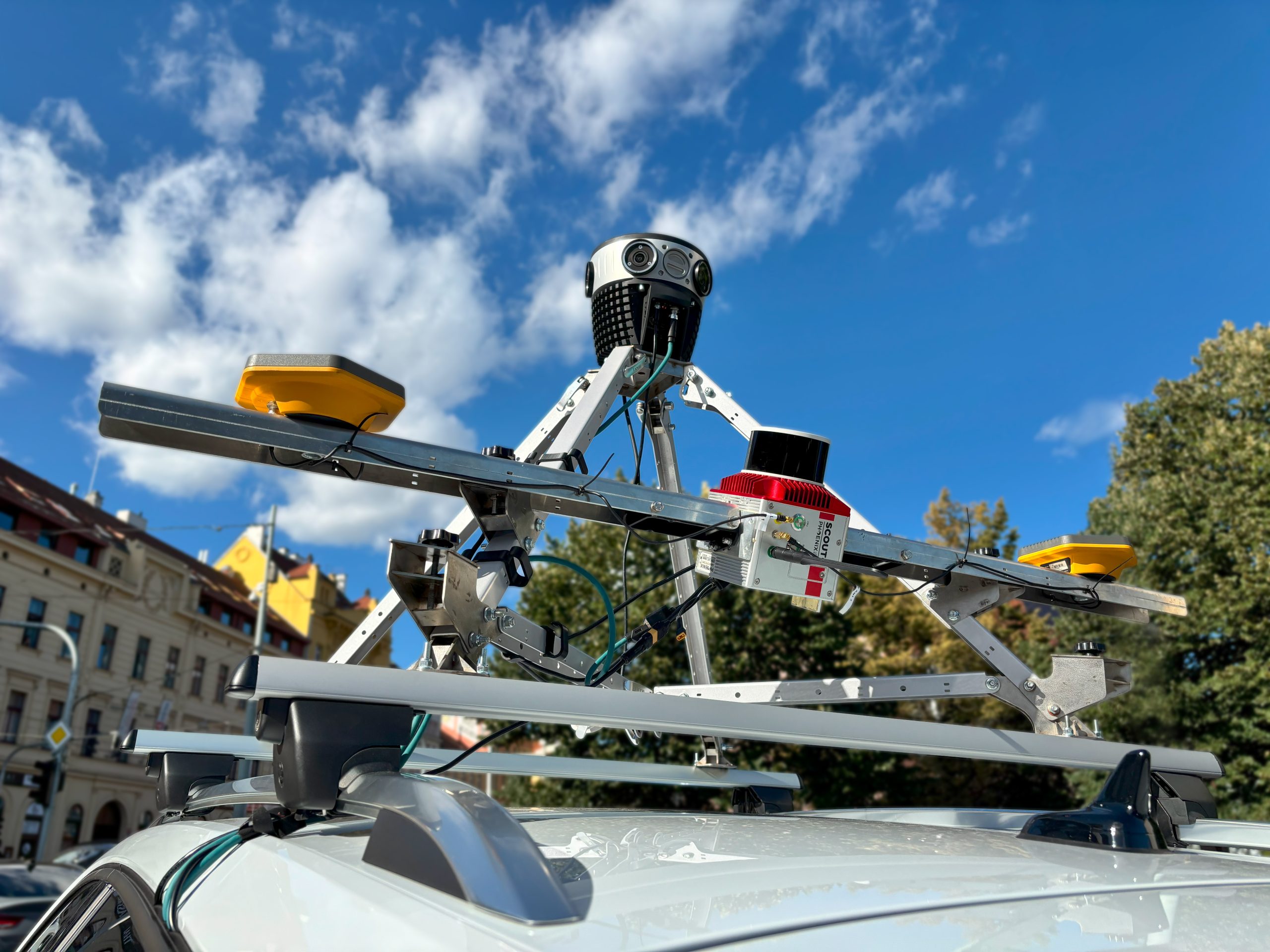
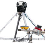
Mosaic, the industry leader in ultra-high-resolution 360° imaging technology, is proud to add the Meridian Lite Mobile Mapping System to our lineup.
The 75MP panos from rolling shutter sensors reduce your costs and speed up post-processing.
Ideal for large-scale, city scanning. Capture survey-grade LiDAR data with high-resolution imagery, all in one, easy-to-use MLS system.
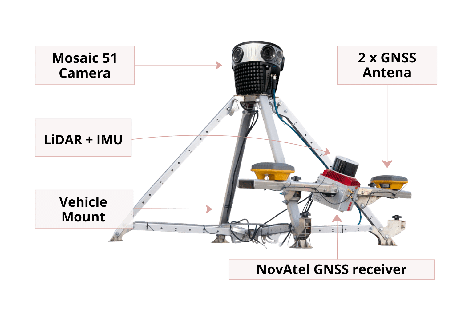
The Meridian Lite offers a flexible solution for your mobile mapping needs: an intuitive, easy-to-use LiDAR system and ultra-high resolution 75MP panoramic imagery.
Create higher ROI and achieve professional-grade mapping at an affordable price with the Meridian Lite.
The Meridian Lite is easy to set up and with a user-friendly design. Get on the road quickly and gather data with a single operator.
The Meridian Lite’s seamless integration and calibration deliver stunning 12.3K 360° imagery and precise LiDAR data.
With Mosaic, only capture what you need. Smaller datasets, faster processing, faster delivery.
The Meridian Lite is a streamlined, entry-level MLS system. It is an affordable solution, especially for city-scale mapping projects, creating GIS databases, and executing large, challenging mapping projects.
If you don’t need RGB colorized point clouds, the Mosaic 51 camera lets you lower your system cost while still collecting high-resolution 360° imagery + LiDAR for urban asset workflows.
While others chase 3–5 million pts/sec and end up with too much data that slows processing, transfer, and storage without adding real value, Mosaic Meridian captures around 800,000 pts/sec with 3 returns—enough for robust automation and clear interpretation.
You don’t need advanced knowledge of GIS to operate the Meridian Lite. A single operator with minimal training can install the system on the roof, collect data, and monitor the process from the vehicle’s cab.
| System Integrator MLS System | Industry standard MLS System | Meridian 2 MLS System | Meridian Lite MLS System |
|
|---|---|---|---|---|
| Pricing | $ | $$$ | $$ | $ |
| Ease of Use | Simple operation, but lacks advanced features | Requires specialized training, complex workflows | User-friendly, intuitive interface, single operator needed for data capture | User-friendly, intuitive interface, single operator needed for data capture |
| Data Quality | Lower resolution, limited accuracy | High accuracy, but often prioritize LiDAR over imagery | High-resolution 91MP panos, accurate LiDAR data | High-resolution 75MP panos, accurate LiDAR data |
| Processing Costs | High due to manual processes, not ideal for large projects | High due to proprietary software, vendor lock-in | Flexible workflows, compatible with various software | Flexible workflows, compatible with various software |
| Overall Value | Limited for professional use, best for casual capture | Cost-prohibitive and over-engineered for standard needs | Optimal balance of quality, affordability, and usability | Ideal for city-scale mapping and quick post-procesing |
Meridian Lite is purpose-built for municipalities, city contractors, and asset teams collecting street-level reality capture at urban speeds – without enterprise MLS cost or complexity. Make smarter decisions, optimize workflows, and unlock new possibilities through precise, accessible 360° imagery and LiDAR data for these industries:
Improve traffic stats, transportation options, utilities, public safety, and community services with up-to-date data.
project management, improve site surveys, and create comprehensive as-built documentation.
Accelerate projects, improve accuracy, and reduce costs with streamlined data collection and analysis.
Efficiently document and monitor infrastructure, ensuring optimal maintenance and informed decision-making.
Mosiac 51 Camera
LiDAR+INS
Created by Tomsher