-
1× $6,225.24
Subtotal: $6,225.24
Subtotal: $6,225.24


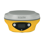
ALPS1 allows you to shoot a group of photos or videos in realtime, obtaining coordinates for hundreds of points within minutes. It outpaces traditional RTK in data acquisition speed.
With laser measurement, ALPS1 has a broader working range and fewer blind spots, enabling remote measurements in areas with poor GNSS signal quality. Previously challenging spots, like spaces under rooftops and areas with obstacles, are now easily measurable.
Measure at Day or Night, Real-time or Non-Real-time, by Your Need
Image data, stored for an extended period, is reusable at any time. These capabilities are especially well-suited for unique tasks, such as documenting accident scenes and excavation sites for urban public facilities.
Laser measurement allows surveyors to collect target point at a dark environment such as night or semi-indoor environment. It also can measure distance indoor.
Large Area or Tiny Space? ALPS1 Suits Both
Video Shooting allows surveyors to remotely measure points up to 10 meters or more (15m in ideal conditions), eliminating the need to physically approach each point. This method significantly reduces physical effort when surveyor is working in a large area.
Laser Measurement allow users to realize a very quick non-contact measuring when there is only very limited space to move, such as a narrow alley. In this kind of scenario, laser is faster than video shooting.
ALPS1 Keeps You Away from Dangers
Video Shooting and Laser Measurement help users mitigate risks when surveying near hazardous areas, such as busy roads and sea or lakes, ensuring surveyors’ safety. A secure working approach is not only a personal requirement but also essential for the well-being of your family.
| GNSS Features | Channels | 1698 |
| GPS | L1C, L1C/A, L2C, L2P(Y), L5 | |
| GLONASS | G1, G2, G3 | |
| BDS | B1I, B2I, B3I, B1C, B2a, B2b | |
| GALILEOS | E1, E5a, E5b, E6, AltBOC* | |
| SBAS | L1* | |
| IRNSS | L5* | |
| QZSS | L1, L2C, L5* | |
| MSS L-Band | BDS-PPP, GALILEO-HAS | |
| Positioning Output Rate | 1Hz~20Hz | |
| Initialization Time | < 10s | |
| Initialization Time | > 99.99% | |
| Positioning Precision | Code differential GNSS positioning | Horizontal: 0.25 m + 1 ppm RMS |
| Vertical: 0.50 m + 1 ppm RMS | ||
| GNSS Static | Horizontal: 2.5 mm + 0.5 ppm RMS | |
| Vertical: 3.5 mm + 0.5 ppm RMS | ||
| Static (Long Observation) | Horizontal: 2.5 mm + 0.1 ppm RMS | |
| Vertical: 3 mm + 0.4 ppm RMS | ||
| Rapid Static | Horizontal: 2.5 mm + 0.5 ppm RMS | |
| Vertical: 5 mm + 0.5 ppm RMS | ||
| PPK | Horizontal: 3 mm + 1 ppm RMS | |
| Vertical: 5 mm + 1 ppm RMS | ||
| RTK(UHF) | Horizontal: 8 mm + 1 ppm RMS | |
| Vertical: 15 mm + 1 ppm RMS | ||
| RTK(NTRIP) | Horizontal: 8 mm + 0.5 ppm RMS | |
| Vertical: 15 mm + 0.5 ppm RMS | ||
| SBAS Positioning | Typically<5m 3DRMS | |
| RTK Initialization Time | 2~8s | |
| IMU Accuracy | 8mm+0.7 mm/°tilt | |
| IMU Tilt Angle | Optimal accuracy within 60° | |
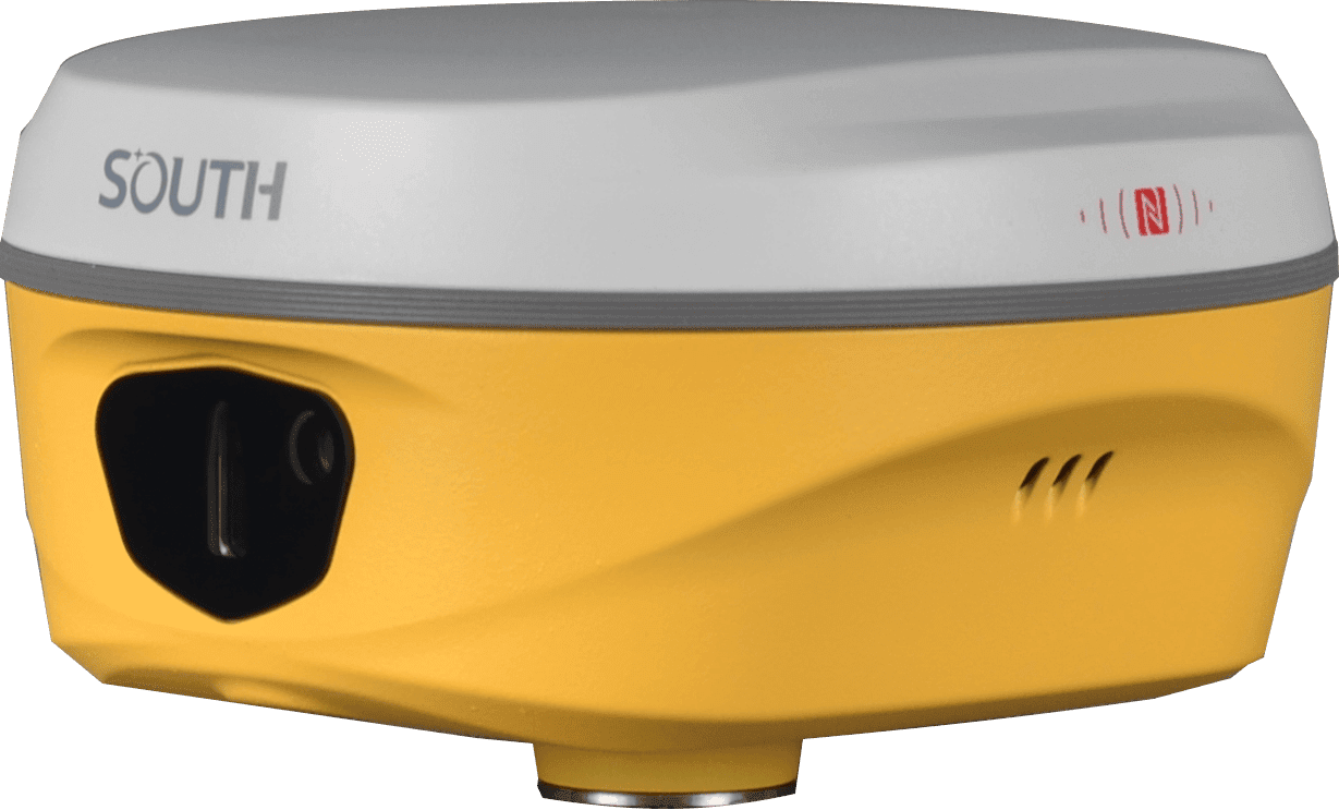
| Hardware Performance | Dimension | 134mm(φ)×79mm(H) |
| Weight | 860g (battery included) | |
| Material | Magnesium aluminum alloy shell | |
| Operating Temperature | -45℃~+75℃ | |
| Storage Temperature | -55℃~+85℃ | |
| Humidity | 100% Non-condensing | |
| Waterproof/Dustproof | IP68 standard | |
| Shock/Vibration | Withstand 2 meters pole drop onto the cement ground naturally | |
| Power Supply | 6-28V DC, overvoltage protection | |
| Battery | Inbuilt 7.4v 6800mAh rechargeable Lithiumion battery | |
| Battery Life*1 | 25h (static) | |
| 20h (rover mode, optimal condition) | ||
| Communications | I/O Port | 5-PIN LEMO interface (external power port + RS232) |
| Type-C interface (charge+OTG+Ethernet) | ||
| UHF antenna interface | ||
| Internal UHF | 2W Radio Tx&Rx | |
| Frequency Range | 410-470MHz | |
| Communication Protocol | Farlink, Trimtalk, SOUTH | |
| Communication Range | Typically 8-10km with Farlink protocol, (12-15km in optimal condition) | |
| Bluetooth | Bluetooth 5.0, Bluetooth 3.0/4.2 standard, | |
| Bluetooth 2.1 + EDR | ||
| NFC Communication | Support | |
| Modem | 802.11 b/g/n standard | |
| Data Storage/Transmission | Storage | 16GB SSD internal storage |
| Support automatic cycling storage | ||
| Support external USB storage (OTG) | ||
| The customizable sample interval is up to 20Hz | ||
| Data Transmission | Plug and play mode of USB data transmission | |
| Supports FTP/HTTP data download | ||
| Data Format | Static data format: STH, Rinex2.01, Rinex3.02, etc. | |
| Differential data format: RTCM 2.1, RTCM 2.3, RTCM 3.0, RTCM 3.1, RTCM 3.2 | ||
| GPS output data format: NMEA 0183, PJK plane coordinate, Binary code | ||
| Support: VRS, FKP, MAC, fully support NTRIP protocol | ||
| Sensors | IMU | Built-in IMU module, calibration-free, 60° |
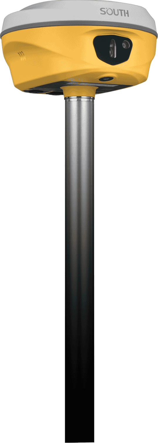
| Camera | Video Shooting Camera: 8MP (can be used in AR stakeout) | |
| AR stakeout camera: 2MP | ||
| Laser | 3R green laser, 30m working range | |
| Electronic Bubble | Controller software can display electronic bubble, checking leveling status of the carbon pole in real-time | |
| Thermometer | Built-in thermometer sensor, adopting intelligent temperature control technology, monitoring and adjusting the receiver temperature | |
| User Interaction | Operating System | Linux |
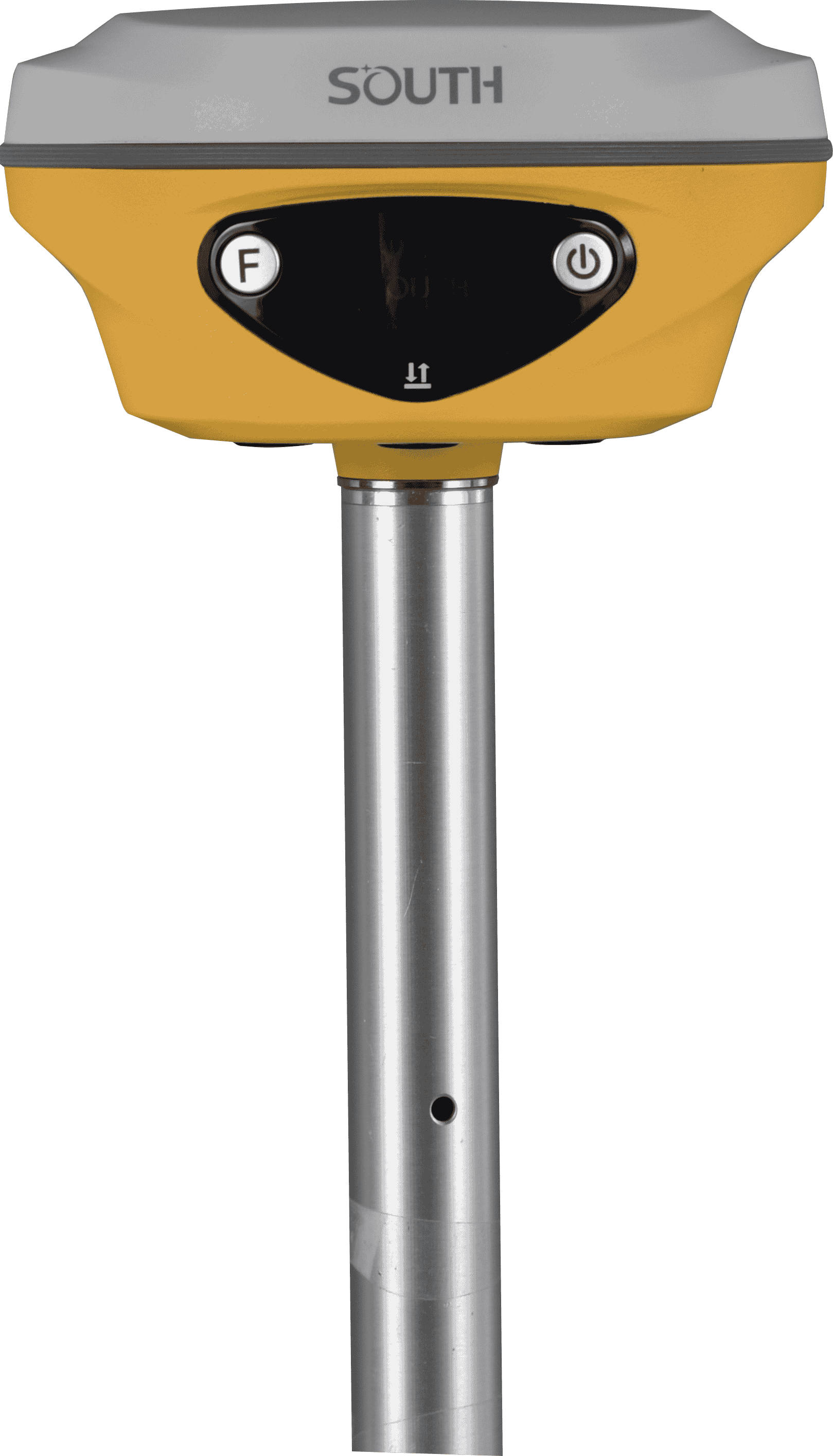
| Buttons | Dual buttons | |
| Indicators | Satellites, data and power indicators | |
| Display | 1.14”, 135*240 | |
| Web Interaction | With access to Web UI via WiFi or USB connection, users can monitor the receiver status and change the configurations | |
| Voice Guidance | Chinese/English/Korean/Spanish/Portuguese/Russian/Turkish/French/Italian/Arabic | |
| Secondary Development | Provides secondary development package, and opens the OpenSIC observation data format and interaction interface definition | |
| Cloud Service | The powerful cloud platform provides online services like remote management, firmware updates, online registers, etc. |
*Reserve for future upgrade. Remarks: Measurement accuracy and operation range might vary due to atmospheric conditions, signal multipath, obstructions, observation time, temperature, signal geometry and number of tracked satellites. Specifications subject to change without prior notice.
*1.Actual battery life can vary depending on usage patterns and other factors. The listed parameter was obtained under controlled testing conditions.
Created by Tomsher