Back

Out of stock
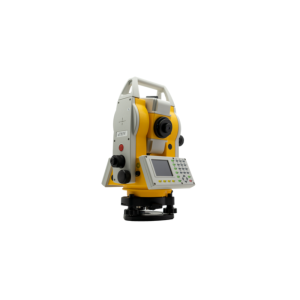
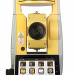
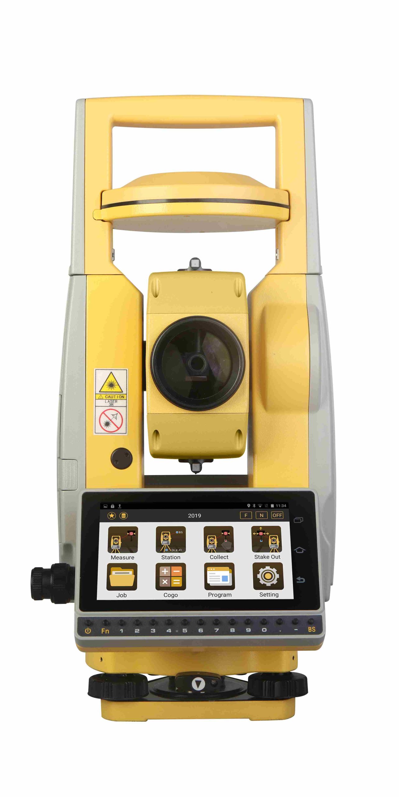
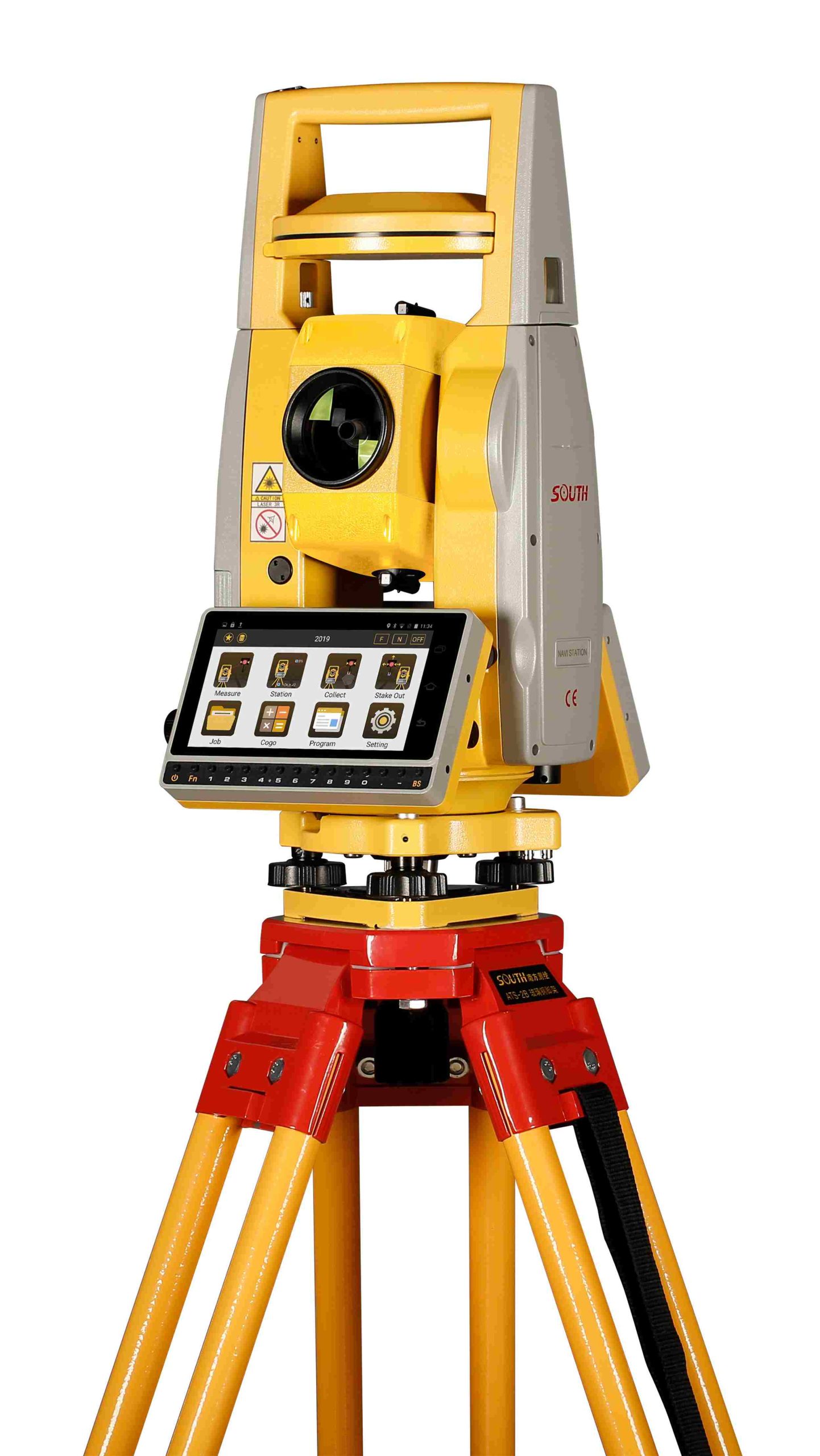
South NAVI STATION
- Fully Integrated GNSS
- Simply Setup the Station Wherever You Want
- Without the Limitation of Known Points
- Up to 2000m Reflectorless EDM
- Cable-free Connection by Bluetooth
- Intelligent Workflow under Android 6.0
Contact us for more information
-
Description
Total Station with Integrated GNSS
Features Android O.S, Navi Station provides an intelligent solution
that integrates GNSS receiver on Total Station. Simply setup and determine the position of occupied point by GNSS receiver to centimetre accuracy, among the range of 40 km from a reference station. Navi Station allows you to work quickly and effectively right from the beginning.
Dual Laser EDM
- 2000m Non-prism
- Stronger return signal due to Its dual laser technology
Stable Measurement
- Accuracy: 2+2ppm
- Extremely fast (0.3s) speed under fine mode
USB OTG, TF Card & Bluetooth
Flexible transfer of data via PC or PDA
WLAN & 4G Module
Quick access to Internet
5.0 Inch Color & Touch Screen
Built-in high resolution display
Numerical Keypad
Faster and easier input of data
Intelligent O.S
- Android 6.0 O.S
- User friendliness
- Free SDK package for developer
All Constellations
- Enable the satellite tracking from BDS, GPS, GLONASS and Galileo with 574 channels
- Horizontal: 10+1ppm Vertical: 20+1ppm
Specification
| Distance Measurement | Range *1 | 5000m |
| with Reflector | Accuracy | ±(2+2ppmxD)mm |
| Measure Interval | Fine: 0.3s, Tracking: 0.1s | |
| Distance Measurement | Range *2 | 2000m |
| without Reflector | Accuracy | ±(3+2ppmxD)mm |
| Measure Interval | 0.3-3s | |
| Angle Measurement | Accuracy | 2” |
| Measure Method (HZ/V) | Absolute Continuous, Diametrical | |
| Diameter of Encoder Disk | 79mm | |
| Display Resolution | 0.1” | |
| Compensation | Liquid, Dual Axis Compensation | |
| Compensator Setting Accuracy | 1” | |
| Compensator Range | ±4′ | |
| Telescope | Image | Erect |
| Tube Length | 154mm | |
| Effective Aperture | 45mm (EDM:50mm) | |
| Magnification | 30x | |
| Resolving Power | 3” | |
| Field of View | 1°30′ | |
| Focusing Range | 1.2m | |
| Reticle | Illuminated, 4 Brightness Level | |
| Vial | Plate Vial | 30″/2mm |
| Circular Vial | 8’/2mm | |
| Laser Plummet | Type | Laser Class 2/IEC60825-1; 4 Brightness Level |
| Accuracy | ±1.5mm at 1.5M Instrument Height | |
| System Config | Operating System | Android 6.0 |
| Processor | MT6753 | |
| Internal Memory | RAM: 3GB; ROM: 32GB | |
| Satellite Signals | Satellite Tracking | 574 Channels |
| Signal Tracking | BDS-2: B1, B2, B3 | |
| GPS: L1, L2C, L2P, L5 | ||
| GLONASS: L1, L2 | ||
| GALILEO: E1, E5a, E5b | ||
| SBAS | ||
| Performance Specification | Time to First Fix | Cold Start <50s, Warm Start <45s |
| Signal Re-acquisition | <3s | |
| RTK Initiation Time | <15s | |
| RTK Initiation Reliability | >99.9% | |
| Positioning Precision | Single Point Positioning | Single: H≤3m, V≤5m (1σ, PDOP≤4) |
| RTD Surveying | H: ±0.5m, V: ±1.0m | |
| Static Surveying | H: ±(2.5mm+1ppm x D), V: ±(5mm+1ppm x D) | |
| Real-time Kinematic Surveying | H: ±(10mm+1ppm x D), V: ±(20mm+1ppm x D) | |
| Communication | Interfaces | – Serial Port (6-Pin) |
| – Micro SIM | ||
| – USB Type C (OTG) | ||
| – TF Card | ||
| Network | 2G 900/1800 | |
| 3G 2100/900 CDMA BC0 TDSCDMA A/F | ||
| 4G LTE band1/3/7/38/39/40/41 | ||
| Bluetooth | Bluetooth 4.0 | |
| WLAN | Dual-Band Single Stream 802.11 a/b/g/n RF for Data Link | |
| Microphone / Speaker | Available | |
| Others | Display | TFT LCD Screen, Graphics, 720*1280 |
| Battery | Lithium-Ion, 7.4V, Operating 8-10 Hours | |
| Dimension | 200mm*170mm*350mm, 5.7kgs | |
| Protection | IP55 | |
| Temperature Range (Operation) | -20°C–+50°C |
* 1: Good conditions (good visibility approx.40km, overcast, twilight)
* 2: White objects with high reflectivity (KGC 90%)
Note: all information above is subject to change without any prior notice.