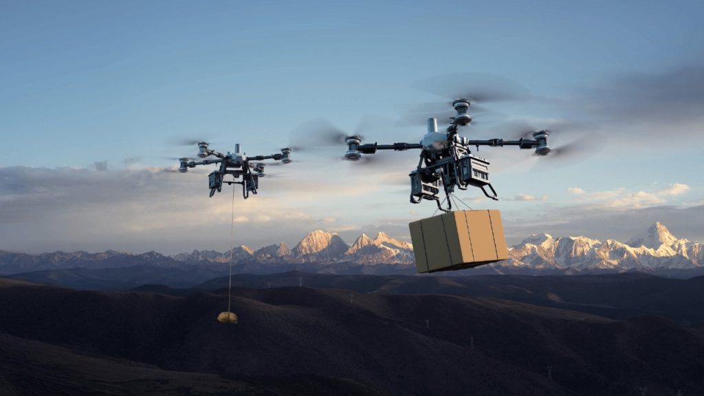
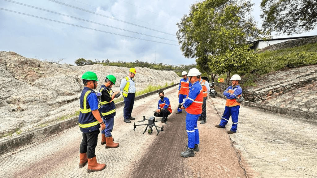
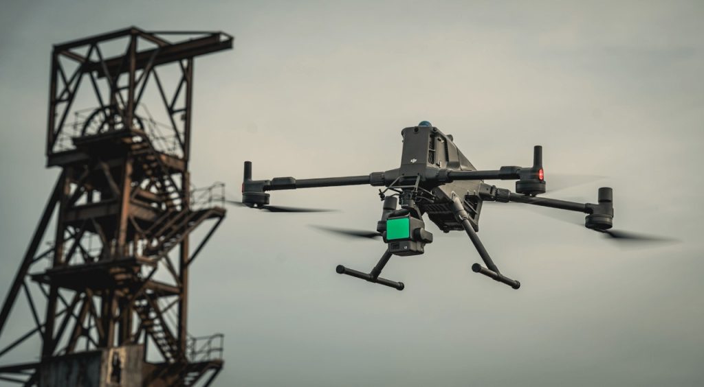
Industries that depend on precision and speed, such as large-scale surveying, post-disaster reconstruction and mining, have long relied on traditional ground-based methods. These methods can be slow, costly and limited in reach. The DJI Matrice 400 (M400) introduces a new level of capability for aerial data collection. With its advanced LiDAR payloads, extended 59-minute flight time and support for dual gimbals, the M400 delivers efficiency and versatility in a single platform.
The M400 is more than a drone. It is an integrated mapping and data acquisition system. Its smooth connection with DJI Terra allows users to quickly process LiDAR and photogrammetry data into usable 3D models, point clouds and maps. This shortens the time from field capture to actionable insights and helps teams make critical decisions faster, whether assessing a disaster area, measuring volumes in a mine or planning infrastructure maintenance.
By combining endurance, flexibility and powerful data tools, the DJI Matrice 400 sets a new benchmark for how industrial mapping and reconstruction are carried out in challenging environments.
LiDAR Payloads: A New Era for Data Collection
LiDAR, or Light Detection and Ranging, is a surveying method that measures distances by illuminating a target with pulsed laser light and measuring the reflected pulses with a sensor. Unlike traditional photogrammetry, which relies on visible light and can be hindered by poor lighting or dense vegetation, LiDAR can generate highly accurate 3D point clouds in almost any condition, including at night.
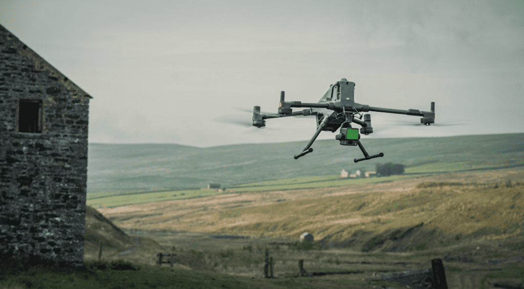
The true strength of the M400 is its synergy with advanced LiDAR payloads like the Zenmuse L2. This sensor is specifically designed to work with the M400, leveraging the drone’s incredible stability, endurance, and 360-degree obstacle avoidance to capture comprehensive data with a high point frequency of 520,000 points per second. The M400’s ability to fly for nearly an hour on a single charge means you can complete larger LiDAR scans in a single flight, significantly reducing field time and boosting productivity. This pairing is especially effective for complex terrain, where traditional methods fall short.
Seamless Data Processing with DJI Terra
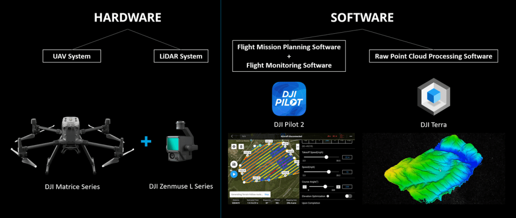
The DJI Matrice 400 is designed to work hand in hand with DJI Terra, which is DJI’s dedicated mapping and data processing platform. This combination allows survey teams to move quickly from flight operations to finished outputs without jumping between multiple software tools.
From Raw Data to Actionable Insights
After a flight, LiDAR scans and high-resolution imagery from the M400 can be imported directly into DJI Terra. The software then converts this raw information into detailed 2D maps, 3D models and dense point clouds. This streamlined process speeds up project timelines and allows decisions to be based on accurate, up-to-date information.
Streamlined Accuracy and Faster Decisions
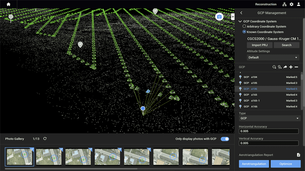
Because DJI Terra is built to work seamlessly with DJI hardware, the Matrice 400 can capture and process data with very little loss of detail. Integrating LiDAR and photogrammetry within the same system creates georeferenced datasets that meet the precision standards of demanding sectors like mining, infrastructure development and environmental monitoring.
This tight integration also allows field teams to capture data and office teams to process it inside a single ecosystem, reducing training needs, software costs and compatibility headaches. The result is a faster, more efficient workflow for even the most complex projects.
By shortening the gap between data collection and actionable results, the M400 paired with DJI Terra empowers organizations to react quickly to natural disasters, construction changes or operational shifts in industries like mining — turning aerial data into informed decisions on the ground.
Real-World Use Cases of the Matrice 400 with LiDAR Payloads
The power of the DJI Matrice 400 really shows when it is deployed in challenging, high-impact environments. Equipped with advanced LiDAR sensors, it becomes more than a mapping tool, it becomes an essential asset for decision-makers who need rapid, accurate data in critical situations.The DJI Matrice 400 with LiDAR is transforming geospatial mapping in disaster response, mining, infrastructure, and environmental applications.
- Post-Disaster Reconstruction
After earthquakes, typhoons or floods, ground teams often face damaged infrastructure and unsafe conditions. The M400 can quickly scan entire areas to create up-to-date 3D maps and digital terrain models. This helps emergency responders locate blocked roads, plan safe access routes and prioritize which structures need immediate attention. Because LiDAR can penetrate some types of vegetation and debris, it also reveals ground elevations and hidden features that traditional imaging might miss. - Mining and Quarry Operations
In open-pit mining and quarry management, regular surveys are essential to track volume changes, check slope stability and ensure worker safety. The M400 with a LiDAR payload allows operators to capture detailed point clouds of pits, stockpiles and haul roads in a fraction of the time required by ground surveys. These 3D datasets improve planning accuracy and reduce the need for personnel to enter hazardous zones. - Infrastructure and Urban Planning
Large-scale construction and infrastructure projects benefit from frequent aerial mapping to monitor progress. Using the M400, engineers can overlay LiDAR data with high-resolution imagery for a complete view of a project site. This integrated dataset supports better decision-making on design changes, compliance and resource allocation. - Environmental and Forestry Applications
LiDAR data from the M400 can be used to measure tree heights, canopy density and ground elevation in heavily forested areas. This is valuable for environmental monitoring, flood modeling and habitat studies where ground access is limited.
Why These Use Cases Matter
In each of these industries, the combination of extended flight time, dual payload support, and seamless integration with DJI Terra means teams can produce high-quality deliverables faster, with less manpower and risk. But the real impact goes beyond efficiency. With the DJI Matrice 400 and its LiDAR payloads, organizations can achieve consistent centimeter-level accuracy across complex terrain, even in conditions where traditional methods would struggle.
This reliability makes it a valuable tool not just for isolated projects, but for scaling geospatial mapping operations across larger regions. By reducing the time from data capture to actionable insights, the Matrice 400 empowers decision-makers in fields like disaster recovery, mining, and infrastructure planning to respond with speed and confidence. Ultimately, the ability to combine powerful LiDAR technology with DJI’s latest enterprise platform redefines how geospatial mapping is conducted in high-stakes, real-world environments.
Mapping the Future with the Matrice 400
The DJI Matrice 400 paired with LiDAR payloads represents a major step forward for industries that rely on accurate, timely spatial data. Its long flight time, heavy-lift capacity, dual-gimbal design and seamless integration with DJI Terra combine to deliver an end-to-end workflow that saves time and reduces risk. From post-disaster mapping to mining surveys and urban planning, the M400 proves that high-quality data collection no longer has to be slow or dangerous.
For organizations advancing geospatial mapping and analysis, the DJI Matrice 400 with LiDAR provides a scalable, reliable, and future-ready solution. By integrating the M400 into their operations and pairing it with the right LiDAR payload, teams can significantly enhance their mapping and inspection capabilities, producing precise and actionable insights at a scale that was once difficult or impossible with traditional methods.
If you are ready to streamline your aerial data collection, consider exploring the DJI Matrice 400 with a compatible LiDAR system today. At Dynatech Innovations, we don’t just provide cutting-edge drone solutions — we deliver complete support, from system setup and workflow optimization to full training for your team. Partner with us to unlock the true potential of geospatial mapping with confidence and expertise.