The landscape of aerial LiDAR is changing fast, and the latest generation of drone payloads is redefining what professionals can expect from airborne mapping. If you’ve ever wondered how much performance, accuracy, and efficiency can differ from one generation to the next, this comparison reveals everything.
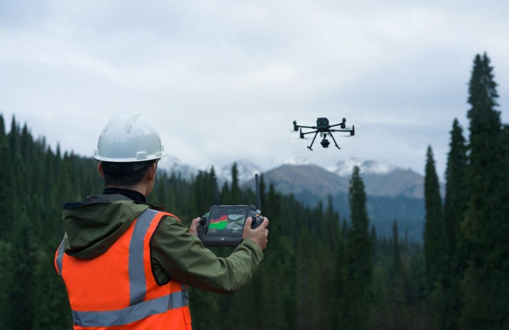
In aerial mapping, precision is everything. Whether surveying construction sites, mapping forests, or inspecting infrastructure, the quality of your LiDAR data determines project success. DJI’s Zenmuse series has long set the standard for drone-based LiDAR, and the arrival of the DJI Zenmuse L3 is raising that standard even higher.
Building on the proven performance of the DJI Zenmuse L2, the new DJI Zenmuse L3 offers greater range, sharper detail, and more powerful imaging for professionals who demand the best in aerial mapping. Both payloads combine LiDAR scanning with RGB imaging to capture accurate 3D point clouds and vivid visuals in a single flight.
Together, the Zenmuse L2 and L3 represent two stages in DJI’s continuous evolution of airborne LiDAR technology. Each brings unique advantages to the field, and comparing them side by side reveals how they complement different operational demands and mapping environments.

DJI Zenmuse L2 and L3: Two Generations of LiDAR Innovation
The DJI Zenmuse L2 and DJI Zenmuse L3 represent two generations of DJI’s LiDAR innovation, built to deliver accurate and efficient mapping for professionals. Both integrate advanced LiDAR technology with high-quality RGB cameras, but their performance and target users differ.
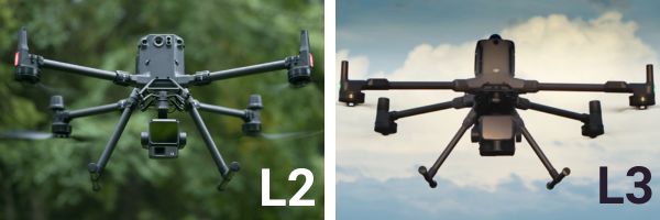
DJI Zenmuse L2: Reliable Power in a Compact Form
The DJI Zenmuse L2 offers precise, efficient LiDAR mapping through its 20 MP RGB camera and LiDAR module, achieving centimeter-level accuracy and clean point clouds. With a 450-meter detection range and lightweight design, it’s ideal for surveyors conducting small to medium projects who value portability and cost efficiency.
DJI Zenmuse L3: Pushing Performance Further
The DJI Zenmuse L3 builds on that foundation with a maximum detection range of up to 950 m at 10% reflectivity (100 kHz), dual 100 MP RGB cameras, and up to 16 returns per pulse returns for richer data even in dense terrain. Though heavier and more power-demanding, it delivers unmatched detail, range, and productivity for complex, large-scale missions.
Up next, let’s take a closer look at how both payloads compare in their core specifications and performance metrics, revealing what truly sets them apart in real-world use.
Precision and Power: Comparing the LiDAR Systems of the DJI Zenmuse L2 and L3
At the heart of every mapping payload lies its LiDAR sensor, which determines how far, how fast, and how precisely the system can capture 3D data. The DJI Zenmuse L2 and DJI Zenmuse L3 both deliver industry-grade accuracy, but the L3 takes a clear lead in detection range and detail density.
Detection Range and Coverage
The Zenmuse L2 features an impressive detection range of up to 450 meters, suitable for most standard surveying and inspection projects. This allows drone operators to efficiently cover small to mid-sized areas without sacrificing accuracy.
By comparison, the Zenmuse L3 doubles the capability with a maximum detection range of up to 950 m (at 10% reflectivity, 100 kHz). This means fewer flight passes, shorter mission time, and broader coverage per battery cycle. For corridor mapping, forestry analysis, or large infrastructure projects, the L3’s extended reach delivers a major efficiency advantage.
Accuracy and Point Density
Both systems maintain centimeter-level precision, but the L3 improves on point density and consistency at higher altitudes. The enhanced laser system reduces noise and improves vertical accuracy: < 3 cm @ 120 m; < 5 cm @ 300 m; < 10 cm @ 500 m, resulting in cleaner, more detailed point clouds even over complex terrain.
Multi-Return Capability
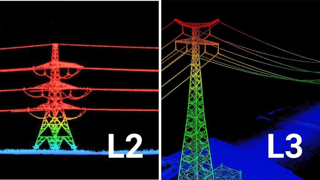
The Zenmuse L2 supports up to 5 returns per pulse, which is already sufficient for most vegetation and surface mapping applications. However, the L3 pushes this further to 16 returns, capturing multiple surface layers such as tree canopies, mid-level branches, and the ground beneath. This advanced return capability makes the L3 especially valuable in forestry, powerline inspection, and environmental monitoring.

Imaging Power: DJI Zenmuse L2 vs L3 RGB Camera Comparison
The true power of modern LiDAR lies in its ability to fuse with high-resolution imagery, delivering a colorized point cloud that is both dimensionally accurate and visually rich. While the DJI Zenmuse L2 includes a capable camera, the DJI Zenmuse L3 introduces a dual-camera setup that significantly elevates the visual component of mapping workflows.
Resolution and Sensor Fidelity
| Feature | DJI Zenmuse L2 | DJI Zenmuse L3 |
| Camera Configuration | Single 20 MP, 4/3 CMOS | Dual 100 MP, M4/3 CMOS |
| Max Photo Resolution | 20 MP | 100 MP (configurable to 25 MP) |
| Shutter | Mechanical | Mechanical |
| GSD at 300 m AGL | ≈ 7.5 cm | ≈ 3 cm |
The L3’s dual 100 MP M4/3 cameras provide a major boost in image fidelity, resulting in sharper, more accurate colorized LiDAR point clouds. This improved Ground Sample Distance (GSD) enables fine-scale feature extraction and infrastructure inspection from higher altitudes.
Coverage and Efficiency
| Feature | DJI Zenmuse L2 | DJI Zenmuse L3 |
| Combined Horizontal FOV | 84° | 107° |
| Minimum Capture Interval | 0.7 s | 0.5 s |
The dual-camera setup in the L3 covers more ground per flight line. Coupled with higher speed tolerance and faster capture intervals, the L3 reduces flight lines, flight time, and battery usage—boosting efficiency for large-area mapping projects.
Design, Build, and Power Efficiency
The design of a LiDAR payload affects flight performance, drone compatibility, and operational efficiency. The L2 is lightweight and versatile, weighing around 905 g, with typical power consumption of 28 W, IP54 rated, and operational from -20 °C to 50 °C. Its compact design is ideal for medium-sized drones and missions that require efficiency and multiple flights.
The L3, in contrast, is built for high-performance operations. It weighs about 1.6 kg, with typical power usage of 64 W, dual 100-MP cameras and long-range LiDAR sensors. This design supports extended range, higher precision, and superior imaging, making it perfect for large-scale surveys, complex terrain, and high-altitude missions.
Flight Speed, Coverage, and Scanning Flexibility: DJI Zenmuse L2 and L3 Compared
Operational efficiency is measured not just by data quality, but by the time it takes to go from setup to final product. The DJI Zenmuse L3, designed for the Matrice 400 (M400) platform, includes hardware and software refinements that simplify pre-flight routines and increase daily coverage capacity.
Inertial Measurement Unit (IMU) and Calibration
| Feature | DJI Zenmuse L2 | DJI Zenmuse L3 |
| IMU Performance | Standard precision | Higher-precision IMU, improved stabilization |
| Calibration Time | Manual calibration flight/warm-up | Auto-aligned IMU, reduced calibration time |
The L3’s upgraded IMU and system design yield cleaner data and fewer setup steps, reducing mission turnaround time.
Operational Speed and Daily Coverage
| Metric | DJI Zenmuse L2 | DJI Zenmuse L3 |
| Max Flight Speed | ≤ 15 m/s | ≤25 m/s, optimal ~17 m/s |
| Single-Flight Coverage | Up to 2.5 km² | Up to 10 km² at 300 m AGL |
| Max Daily Coverage | ~10 km² | Up to 100 km² |
Higher speed and altitude tolerance allow the L3 to cover four times the area per flight, ideal for large infrastructure projects, wide-area corridor mapping, and rapid regional assessments.
Advanced Scanning Flexibility
Both units offer repetitive and non-repetitive scanning modes. The L3 adds a “Star-Shaped Scanning” mode, balancing coverage and accuracy to maximize ground point capture under vegetation, enhancing terrain modelling and mapping accuracy.
Field Applications and Ideal Use Cases
Choosing the right LiDAR payload is not just about specifications—it is about how well the system fits your real-world projects. The L2 offers efficient, high-quality LiDAR data for standard mapping and medium-scale projects. In contrast, the L3 is built for professional-grade surveys where extended range, higher detail, and multi-layer data are critical.
The table below provides a direct side-by-side comparison of typical applications and key specifications, helping you quickly determine which payload fits your mapping workflow.
| Application | DJI Zenmuse L2 | DJI Zenmuse L3 |
| Construction Site Monitoring | 20 MP RGB camera, LiDAR range up to 450 m; efficient for small to medium sites | Dual 100 MP RGB cameras, LiDAR range up to 950 m; ideal for large sites with detailed coverage |
| Corridor Mapping | Up to 5 LiDAR returns per pulse; suited for medium-length roads, railways, utilities | Up to 16 LiDAR returns per pulse; perfect for long corridors with dense vegetation or complex terrain |
| Topographic Surveys | Centimeter-level accuracy; suitable for smaller areas | Centimeter-level accuracy, improved at high altitudes; ideal for large or complex terrain |
| Forestry & Environmental Monitoring | Captures basic canopy and terrain layers | Multi-layer LiDAR data for tree canopies, vegetation, and terrain |
| High-Altitude / Long-Range Missions | Max LiDAR range 450 m; compatible with moderate drones | Max LiDAR range 950 m; optimized for high-performance drones |
| Repeated Multi-Flight Missions | Lightweight 905 g, typical power 28 W; efficient for multiple flights | Heavier 1.6 kg, typical power 64 W; fewer flights needed due to extended coverage |
| Durability & Field Conditions | IP54, operational -20°C to 50°C | IP54, operational -20°C to 50°C |
The Zenmuse L2 delivers efficiency, lower operational costs, and reliable data for everyday projects.
The Zenmuse L3 maximizes productivity, reduces flight time for large areas, and produces richer, high-resolution datasets—ideal for professional surveyors and industrial applications.

Choosing the Right Payload
Selecting the right LiDAR payload is key to achieving efficiency, precision, and project success. The DJI Zenmuse L2 is a dependable choice for medium-scale projects, offering efficient data collection, portability, and cost-effective performance. It excels in construction site monitoring, corridor mapping, and standard topographic surveys.
For large-scale or complex missions, the DJI Zenmuse L3 delivers professional-grade performance. With dual 100-megapixel cameras, extended LiDAR range, and multi-return capability, it produces richer datasets, faster coverage, and higher detail. It is ideal for forestry analysis, high-altitude mapping, and infrastructure inspections.
Recommendation: Choose the DJI Zenmuse L2 for everyday mapping efficiency, and the DJI Zenmuse L3 for large-scale, high-precision projects.
Experience the future of aerial LiDAR. Connect with Dynatech Innovations today to learn how the new Zenmuse L3 can elevate your mapping capabilities and redefine what’s possible in your aerial missions.