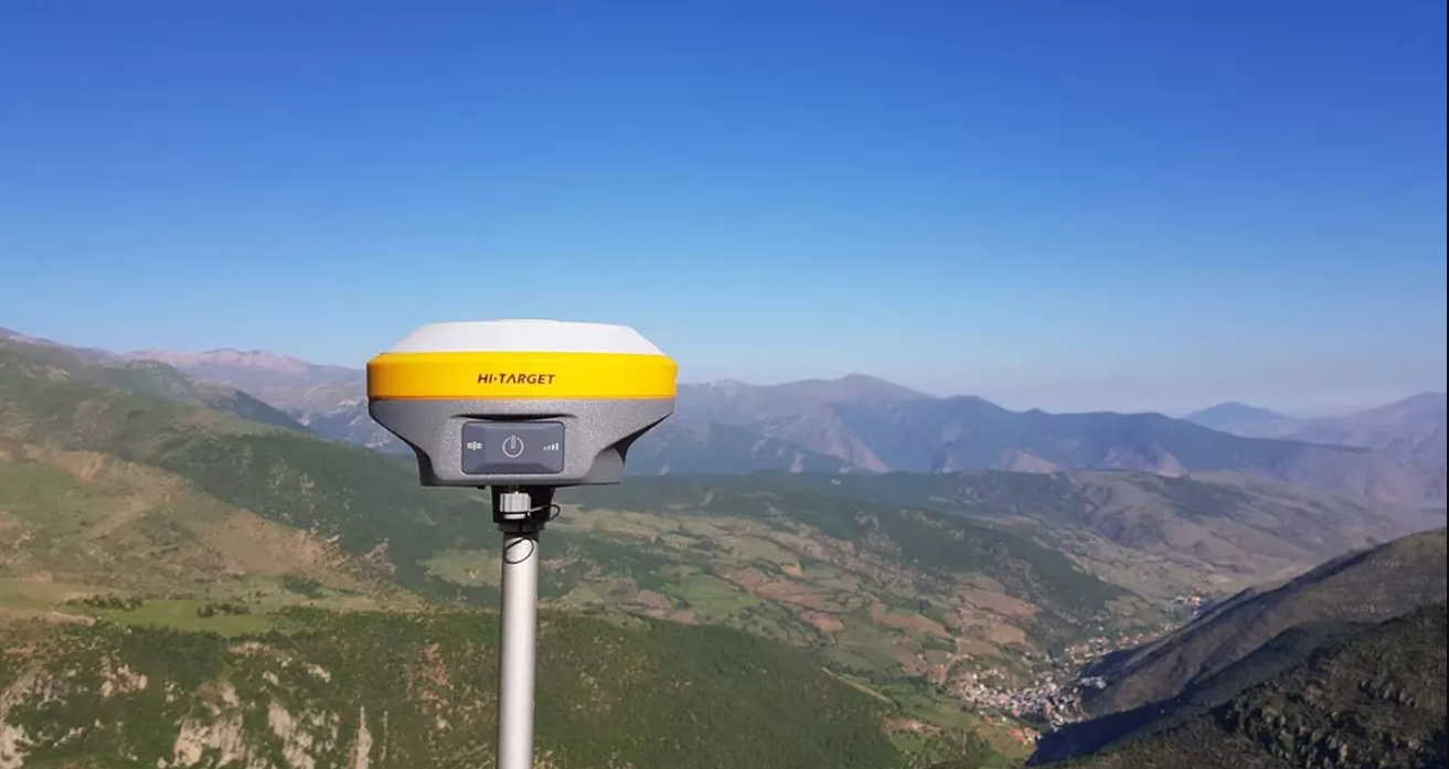
In the dynamic world of geospatial technology, Optimal precision is key. Whether you’re surveying a construction site, mapping a riverbed, or navigating a drone through complex terrain, accuracy can make or break your mission. The Hi-Target V30 Plus GNSS RTK System emerges as a beacon of accuracy and efficiency, reshaping surveying, mapping, and geospatial applications.
Understanding GNSS RTK Basics
What is GNSS?
The Global Navigation Satellite System (GNSS) is the invisible web that connects us to the skies. It comprises a constellation of satellites—GPS, GLONASS, Galileo, BDS, and QZSS—working in harmony to provide global coverage. From your smartphone’s navigation app to high-precision land surveying, GNSS is the silent guide we rely on.
What is RTK?
Real-Time Kinematic (RTK) takes GNSS accuracy to the next level. Imagine a surgeon’s scalpel—precise, swift, and unwavering. RTK achieves centimeter-level precision by correcting common errors in real time.
How Hi-Target V30 Plus GNSS RTK System Works
Built-in Multi-Constellation GNSS Engine
At the core of the Hi-Target V30 Plus GNSS RTK System lies its robust GNSS positioning algorithm. It adeptly tracks signals from multiple satellite constellations, including GPS, GLONASS, Galileo, BDS, and QZSS. Even in challenging environments, it consistently delivers reliable results.
Harnessing cutting-edge technology, the Hi-Target V30 Plus GNSS RTK System seamlessly integrates with various data communication channels, ensuring effortless data management and transfer. Its user-friendly web interface simplifies the process of data manipulation, while the system’s WIFI, Bluetooth connectivity, and 4G module facilitate wireless data transfer, whether you’re in the field or the office. By combining robust satellite tracking capabilities with efficient data communication features, the Hi-Target V30 Plus GNSS RTK System sets a new standard for precision and efficiency in geospatial applications.
Seamless Data Communication
Seamless data communication with the Hi-Target V30 Plus GNSS RTK System ensures effortless management and transfer of information, whether in the field or office, through its user-friendly web interface, WIFI, Bluetooth connectivity, and 4G module.
- Web User Interface (UI): Manage data effortlessly through the user-friendly web interface.
- WIFI and Bluetooth Connectivity: Whether you’re in the field or the office, transfer data wirelessly.
- 4G Module: Stay connected even when the world seems disconnected.
With its extensive transmission range and excellent electromagnetic adaptability, it seamlessly integrates with diverse communication protocols and effortlessly interfaces with various CORS systems.
Tilt Survey and Electronic Bubble
The Hi-Target V30 Plus GNSS RTK System incorporates tilt survey functionality, allowing users to accurately measure points on slopes and uneven terrain with ease. Additionally, its electronic bubble feature ensures precise leveling, enhancing the system’s overall efficiency and reliability in challenging surveying environments.

Applications of Hi-Target V30 Plus GNSS RTK System GNSS RTK
The Hi-Target V30 Plus GNSS RTK System revolutionizes a multitude of applications including land surveying, hydrographic surveying, and UAV navigation, offering unparalleled precision and efficiency in geospatial tasks.
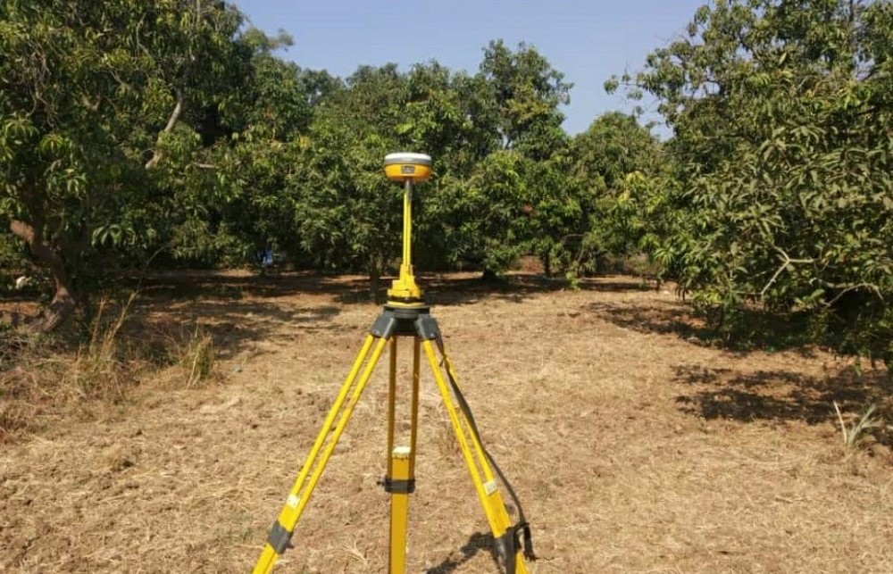
Land Surveying
Boundaries, topography, and land measurements—meet your new best friend. The Hi-Target V30 Plus GNSS RTK System simplifies complex tasks, allowing surveyors to focus on insights rather than technical hurdles.Where centimeters matter, the Hi-Target V30 Plus GNSS RTK System ensures your measurements hit the bullseye with the highest accuracy.
Hydrographic Surveying
Beneath the waves lies a world waiting to be mapped. The Hi-Target V30 Plus GNSS RTK System’s unparalleled accuracy makes underwater mapping, bathymetry, and coastal engineering a breeze. Errors vanish instantly. The Hi-Target V30 Plus GNSS RTK System corrects on the fly, saving time, resources, and sanity.
UAV Navigation
Drones are the eyes in the sky, and the Hi-Target V30 Plus GNSS RTK System ensures they see clearly. Achieve centimeter-level positioning accuracy during aerial surveys, whether you’re monitoring crops or inspecting infrastructure.
In various industries ranging from agriculture to construction, the Hi-Target V30 Plus GNSS RTK System’s adaptability extends seamlessly to regional geodesy projects and beyond, making it an indispensable tool for diverse geospatial applications.
Compatibility with Drones
The Hi-Target V30 Plus GNSS RTK System seamlessly integrates with several drones, creating a symphony of precision in aerial applications. Let’s explore these harmonious partnerships:
1. DJI Matrice 350 RTK: A match made in geospatial heaven. The V30 Plus and Matrice 350 RTK dance together, creating precise aerial symphonies, leveraging its centimeter-level positioning accuracy for precise aerial mapping and surveying tasks.
2. DJI Mavic 3 Enterprise:The Mavic 3E spreads its wings, powered by the V30 Plus. DJI Mavic 3 Enterprise utilizes the positioning data provided by the Hi-Target V30 Plus GNSS RTK System to enhance its flight capabilities and accuracy, while the latter is providing precise positioning information that enables the Mavic 3 Enterprise to navigate more accurately and efficiently during aerial operations.
3. Autel Evo II Pro RTK V3:The EVO II Pro RTK V3 dances to the V30 Plus’s precision beat. The Autel Evo II Pro RTK V3 seamlessly integrates with the Hi-Target V30 Plus, leveraging its precise RTK capabilities for centimeter-level accuracy in aerial surveying and mapping tasks, thereby enhancing the overall effectiveness and precision of the drone’s operations.
The Hi-Target V30 Plus GNSS RTK System collaborates seamlessly with other geospatial tools and technologies, enhancing its capabilities. Whether you’re using total stations, laser scanners, or digital levels, the Hi-Target V30 Plus GNSS RTK System plays well with its geospatial companions. It’s like a symphony where each instrument contributes to the harmonious result.
Combine GNSS data with other sensor inputs—IMU (Inertial Measurement Unit), odometers, and environmental sensors. The Hi-Target V30 Plus GNSS RTK System thrives on data fusion, creating a richer tapestry of information. It’s not just about coordinates; it’s about context.
Conclusion
The Hi-Target V30 Plus GNSS RTK System stands as more than just a tool; it emerges as a vital partner in precision, translating coordinates into actionable insights across various applications. Its value lies in its multifaceted capabilities: boasting centimeter-level accuracy, it ensures meticulous measurements, be it delineating property boundaries, mapping underwater features, or guiding drones with exactitude. Moreover, its real-time error correction functions akin to a personal GPS wizard, consistently refining data accuracy on the fly, while also adeptly navigating obstacles such as line-of-sight requirements and atmospheric interference, thereby converting challenges into opportunities for heightened data reliability.
The system’s seamless integration with an array of drones, including the DJI Matrice 350 RTK, Mavic 3 Enterprise, and Autel Evo II Pro RTK V3, elevates aerial operations to new heights, blending precision seamlessly with flight capabilities. Beyond its numerical prowess, the V30 Plus offers invaluable insights into landscape understanding, change prediction, and decision-making, enabling users to navigate uncharted territories with unwavering confidence. As users venture forth into exploration and mapping endeavors, the Hi-Target V30 Plus GNSS RTK System remains a steadfast companion, empowering them to navigate, map, and explore with unmatched precision and reliability.