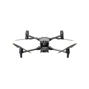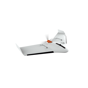
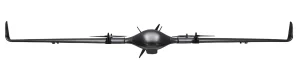
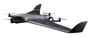
DeltaQuad Pro #MAP
Key Features
✔ Fully autonomous from takeoff to landing
✔ Control, change and pause missions or redirect the vehicle to areas of interest during flight.
✔ Tool-less 1 minute field assembly
✔ No pre-flight calibrations required
✔ Covering up to 150KM / 160 minutes in a single flight
✔ DSPS Advanced safety system
✔ DeltaQuad Simulator
✔ Online mission validation & log analysis tools
-
Description
Industry leading VTOL mapping UAV
Our mapping UAV offers smart technology and powerful performance that enables easy and productive mapping & surveying.
Key Features
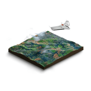
Coverage up to 1200HA (3000AC)
A 61 MP mapping sensor together with a flight time of 110 minutes, adds up to an coverage of 1200Ha at 3/CM per pixel in one flight.
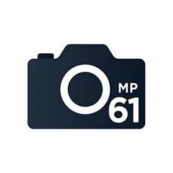
Highest image resolution: 61 megapixel camera
We provide an option to add the highest resolution camera. Using the 61MP camera ensures you get the maximum possible coverage.
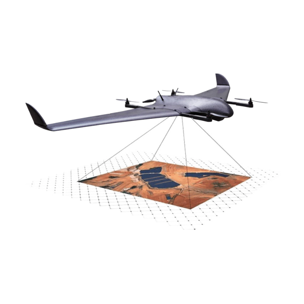
Corridor scans up to 50 kilometer
Long range corridor scans are possible up to 50KM. If available, a 4G/LTE network can enable unlimited range and provide redundancy.

In-flight quality assessment through live video
Live video is available on the DeltaQuad controller. This way you can assess the quality of your mapping data during the flight.
![]()
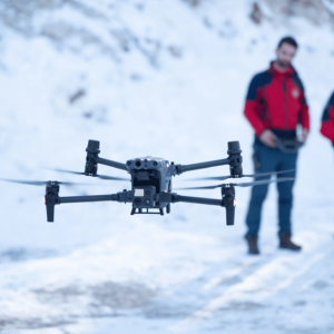
Deployable in rain or snow
Smart technology gives the DeltaQuad the unique ability to safely fly in rain & snow.
![]()
Swappable payloads
Camera mounts & payloads are swappable. This enables you to save on your investment by not having to buy multiple UAVs.
![]()
Airborne within 2 minutes
No pre-flight calibrations are necessary, this allows the DeltaQuad to be airborne in under 2 minutes.
![]()
Fully autonomous
Fully autonomous missions from takeoff to landing, even beyond communication range
High quality components & payload options
Customize your UAV with your choice of sensors and options.
- Platform
- Mapping payloads
- Ground Control
- PPK & base station
- Specifications & documentation
1200 Hectares
At 3CM/px
Dimensions: |
|
| Wingspan | 235 cm |
| Length | 90 cm |
| Wing area | 90 sq. dm. |
| Flightcase dimensions | 122 x 45 x 51 cm |
| Payload bay | 20 x 12 x 8 cm |
Weight and Payload: |
|
| Empty weight | 3.3 Kg |
| Empty weight including battery | 5 Kg |
| Maximum takeoff weight | 6.2 Kg |
| Payload capacity | 1.2 Kg |
Flight Characteristics without payload |
|
| Cruise speed | 18 m/s (65 Km/h) |
| Maximum speed | 28 m/s (100 Km/h) |
| Stall speed | 12 m/s (43 Km/h) |
| Maximum flight time* | 2+ hours |
| Range through air* | 120 km |
Flight Characteristics at 1KG payload: |
|
| Cruise speed | 16 m/s (60 Km/h) |
| Maximum speed | 25 m/s (90 Km/h) |
| Stall speed | 13 m/s (47 Km/h) |
| Maximum flight time* | 1 hour 50 minutes |
| Range through air* | 100 km |
Flight Characteristics with Auxiliary LiPo: |
|
| Payload capacity | 400 g |
| Maximum flight time* | 2 hour 45 minutes |
| Range through air* | 150 km |
Power |
|
| Battery type | LiPo |
| Battery cells | 4s |
| Battery capacity | 23Ah |
Tolerances |
|
| Maximum takeoff/landing wind** | 9 m/s (33 Km/h) |
| Maximum wind in cruise flight ** | 14 m/s (50 Km/h) |
| Maximum precipitation | Drizzle |
| Operating temperature | Between -20 and +45 Celsius |
| Maximum altitude | 13.000ft (4000m) |
100 Kilometers
Flight range
61 Megapixel
Image resolution
50 Kilometers
Video & Control range
Platform specifications
All flight characteristics are based on optimized settings at sea level
* These values assume 90% battery usage, low wind conditions and include a low altitude vertical takeoff and landing at sea level. For countries that did not sign the Wassenaar Agreement, a separate export permit is required or the models are locked to 59 minutes.
** These values are based on measurements at flight altitude, levels measured at ground level are usually 20% lower. Requires both a front and back transition into the wind
Every purchase of the DeltaQuad Pro #MAP platform includes:
A license for the DeltaQuad e-Course
1 year warranty program
Lifetime software upgrades
Payload options
The DeltaQuad Pro #MAP is available with the following mapping payloads

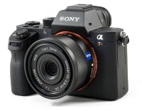
Sony A7R mark IV
The Sony A7R mark IV combined with the Sonnar T 35mm lens offers 61MP resolution, fast shutter speeds and a high dynamic range. The speed of this system allows for < 1 CM/pixel resolution and this makes it our
recommended mapping sensor.
✔ 61 megapixel 9504 x 6336
✔ Full frame sensor (35.9 x 24 mm)
✔ 35 mm Focal length
Sony A7R mark III
The Sony A7R mark III combined with the Sonnar T 35mm lens offers 42MP resolution, fast shutter speeds and a high dynamic range. The speed of this system allows for < 1 CM/pixel resolution.
✔ 42 megapixel 7952 x 5304
✔ Full frame sensor (35.9 x 24 mm)
✔ 35 mm Focal length
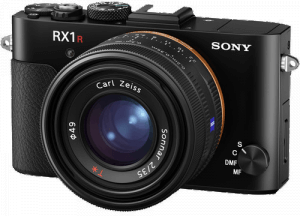
42MP Sony Cybershot RX1R mark II
The Sony Cybershot DSC-RX1R mark II camera combined with the Carl Zeiss 35mm lens offers 42MP full frame sensor.
✔ 42 megapixel 7952 x 5304
✔ Full frame sensor (35.9 x 24 mm)
✔ 35 mm Focal length

Sony A6000
The Sony A6000 24MP sensor with 35mm lens provides an affordable, high resolution mapping sensor.
✔ 24 megapixel 6000 x 4000
✔ APS-C (23.5mm x 15.6mm)
✔ 35 mm Focal length

Micasense Rededge MX
This professional multispectral sensor kit captures 5 narrow spectral bands to analyze crop health
✔ Blue, Green, Red, Red edge, and Near-infrared
✔ Generates plant health indexes and RGB (color) images from one flight
✔ Embedded GPS for direct geo-referencing