No products in the cart.
Back
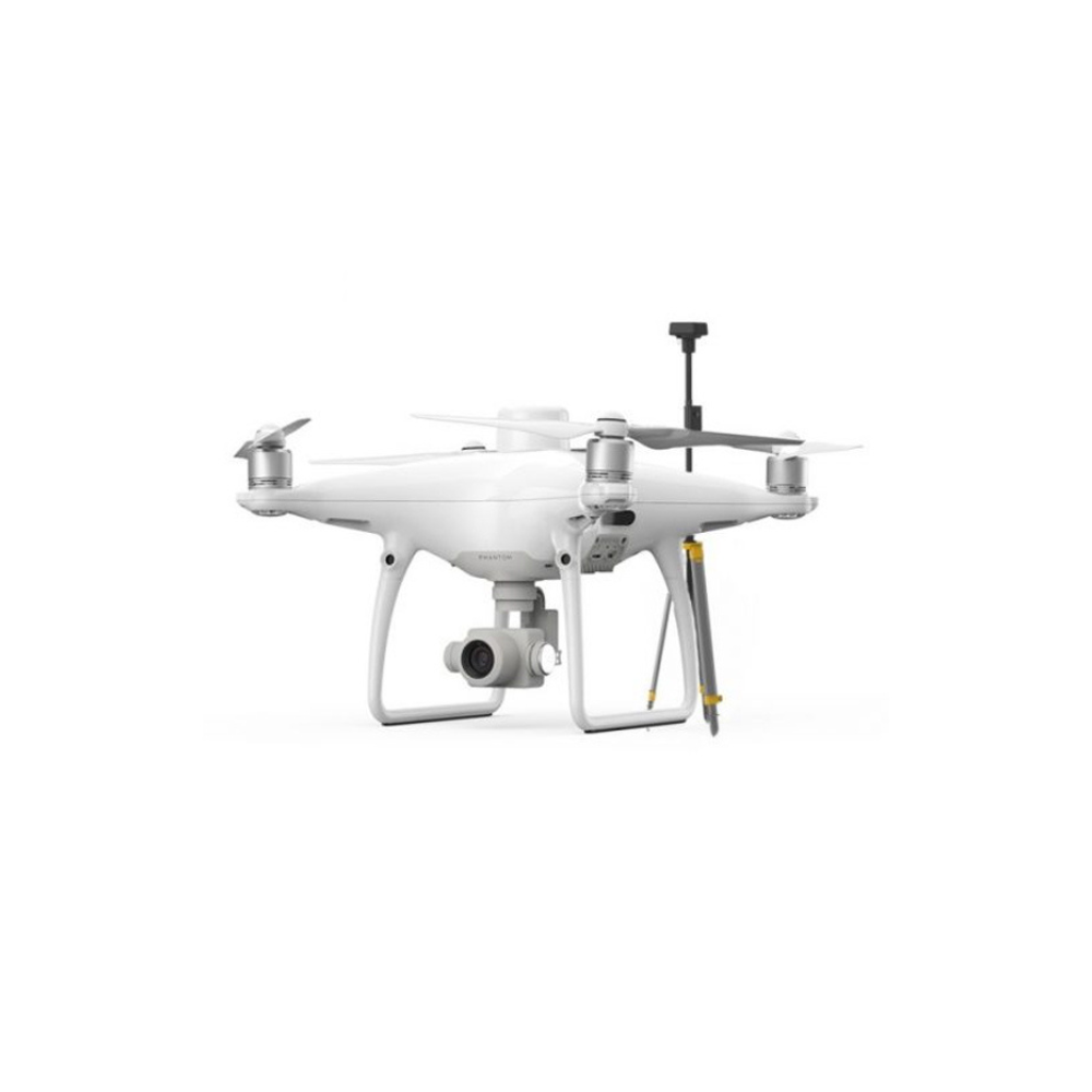
![]() A new RTK module is integrated directly into the Phantom 4 RTK, providing real-time, centimeter-level positioning data for improved absolute accuracy on image metadata. In addition to optimized flight safety and precise data collection, the Phantom 4 RTK stores satellite observation data to be used for Post Processed Kinematics (PPK)(coming to the US soon), which can be conducted using DJI Cloud PPK Service. Fit the Phantom 4 RTK to any workflow, with the ability to connect this positioning system to the D-RTK 2 High Precision GNSS Mobile Station or your local RTK Network or Base Station using NTRIP and a 4G dongle or WiFi hotspot.
A new RTK module is integrated directly into the Phantom 4 RTK, providing real-time, centimeter-level positioning data for improved absolute accuracy on image metadata. In addition to optimized flight safety and precise data collection, the Phantom 4 RTK stores satellite observation data to be used for Post Processed Kinematics (PPK)(coming to the US soon), which can be conducted using DJI Cloud PPK Service. Fit the Phantom 4 RTK to any workflow, with the ability to connect this positioning system to the D-RTK 2 High Precision GNSS Mobile Station or your local RTK Network or Base Station using NTRIP and a 4G dongle or WiFi hotspot.


Out of stock
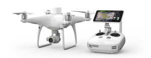
DJI Phantom 4 RTK SE + D-RTK 2 Mobile Station Combo
AED20,300.00 VAT Excl
- RTK Module
- 1″ CMOS Sensor
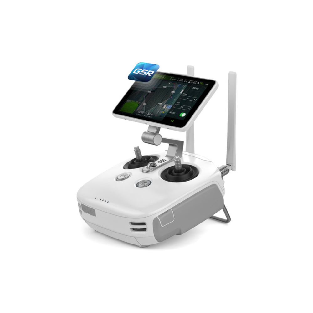
- GS RTK APP
- TimeSync
- OcuSync
- D-RTK 2 GNSS Mobile Station
Contact us for more information
-
Description
Intro
DJI Phantom 4 RTK in combo with DJI D-RTK 2 Mobile Station
Save 16% compared to buying the two products separately.
A complete solution
This kit contains both the DJI Phantom 4 RTK and the D-RTK 2 Mobile Station, allowing you to save about 16% compared to buying the two products separately.
PHANTOM 4 RTK + D-RTK 2 MOBILE BASE STATION COMBO KIT
Visionary Intelligence. Elevated Accuracy.
Upgrade your next mapping mission with the Phantom 4 RTK – the most compact and accurate low altitude mapping solution.
Key Features
- Built on the proven Phantom 4 Pro mapping platform
- Survey-grade RTK GNSS (L1/L2)
- 1cm horizontal; 1.5cm vertical accuracy
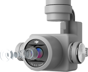
- 20 megapixel; 1″ CMOS camera (Every camera calibrated by the factory before shipping)
- 30-minute battery
- Use any RTK base station or VRS via NTRIP
- D-RTK 2 GNSS Mobile Station
Next Generation Mapping
DJI has rethought its drone technology from the ground-up, revolutionizing its systems to achieve a new standard for drone accuracy – offering the Phantom 4 RTK customers with centimeter-accurate data while requiring fewer ground control points.
- 1cm RTK Horizontal Positioning Accuracy
- 1.5cm RTK Vertical Positioning Accuracy
- 5cm Absolute Horizontal Accuracy of Photogrammetric Models (when flying at 100m height, 2.7cm GSD, sunny)
Centimeter-Level Positioning System
Gather Accurate Data with TimeSync
To take full advantage of the Phantom 4 RTK’s positioning modules, the new TimeSync system was created to continually align the flight controller, camera and RTK module. Additionally, TimeSync ensures each photo uses the most accurate metadata and fixes the positioning data to optical center of the lens – optimizing the results from photogrammetric methods and letting the image achieve centimeter-level positioning data.
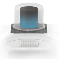
Precise Imaging System
Capture the best image data with a 1-inch, 20-megapixel CMOS sensor. Mechanical shutter makes mapping missions or regular data capture seamless as the Phantom 4 RTK can move while taking pictures without the risk of rolling shutter blur. Due to the high resolution, the Phantom 4 RTK can achieve a ground sample distance (GSD) of 2.74cm at 100 meters of flight altitude. To ensure each Phantom 4 RTK offers unparalleled accuracy, every single camera lens goes through a rigorous calibration process, with parameters saved into each image’s metadata, letting post-processing software adjust uniquely for every user.
Built for Surveyors
Offering a range of control schemes and complementary technologies, the DJI Phantom 4 RTK is developed to provide survey-grade results with greater efficiency than ever before.
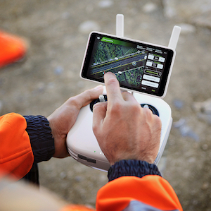
Purpose-Built Application
A new DJI GS RTK app and Remote Controller with a built-in screen, giving users a streamlined control scheme for surveying missions and other data acquisition scenarios. The GS RTK app allows pilots to intelligently control their Phantom 4 RTK, with multiple planning modes, including Photogrammetry (2D and 3D), Waypoing Flight, Terrain Awareness, and more. Users can also import KML/KMZ files to optimize the workflow for their missions. With the built-in screen, pilots can clearly view and plan their missions on an ultra-bright, 5.5-inch HD display.
Access a Variety of 3rd Party Applications
Pilots with experience using 3rd party apps on DJI drones can access the world’s leading drone app ecosystem for their Phantom 4 RTK with the SDK Remote Controller. Users can plug in a compatible Android or iOS device and install any compatible DJI Mobile SDK-enabled app to harness the full power of their Phantom 4 RTK.
OcuSync Transmission System
Enjoy stable and reliable HD image video transmission at distances of up to 7km, great for mapping larger sites*.
*Requires unobstructed, free of interference, when FCC compliant. Maximum flight range specification is a proxy for radio link strength and resilience. Always fly your drone within visual line of sight unless otherwise permitted.
Seamless Compatibility with D-RTK 2 Mobile Station
Support your Phantom 4 RTK missions with the D-RTK 2 Mobile Station – providing real-time differential data to the drone and forming an accurate surveying solution. The Mobile Station’s rugged design and OcuSync transmission system ensure you can gain centimeter-level accurate data with your Phantom 4 RTK in any condition.
Start Mapping Today
With a built-in flight planning app (GS RTK) and an easy method to collect RTK data (RTK Network or D-RTK2 Mobile Station), pilots have a full solution for any surveying, mapping, or inspection workflow – right out of the box.
Applications
Environmental Monitoring and Inspection
Routine inspections and maintenance involving plants or revegetation work can be made smarter and more efficient when using the Phantom 4 RTK. Leverage its actionable aerial insights to monitor forest health, measure biomass, map shorelines, or manage riparian vegetation while protecting habitats or ecosystems, and much more.
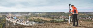
Precision Mapping
Utilize the Phantom 4 RTK’s high-level accuracy to reduce the number of Ground Control Points (GCP) needed for creating beautiful accurate orthomosaics with the 1-inch, 20-megapixel CMOS sensor utilizing a mechanical shutter. Map large work sites to provide detailed, precise data for architects and contractors.
Engineering
Take advantage of the RTK accuracy of the Phantom 4 RTK to capture data and create topographic maps of work sites.
Mining
Increase operational efficiency by gaining fundamental insights captured by the Phantom 4 RTK. Rapid surveying with GCPs allow for 1cm accuracy for stockpile calculations to provide real-world data on operational output.
Forestry
Use the Phantom 4 RTK for mapping tree stands; monitoring and planning; easy access to areas of difficult terrain; early pest detection; wildfire prevention monitoring for maintenance; surveys for illegal logging or land occupation.
3D Modeling
Use the higher positional accuracy of the Phantom 4 RTK to build better 3D models for any type of work.
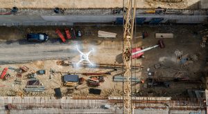
Construction
Better manage construction projects by tracking their progress in real-time with accurate and actionable 3D or 2D maps of large sites. Eliminate project waste with full-site awareness using regular, shareable site maps. Track every step of the construction process for years – even across multiple owners.
Related products
-
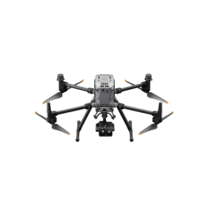
DJI Matrice 350 RTK
AED23,200.00 VAT Excl -
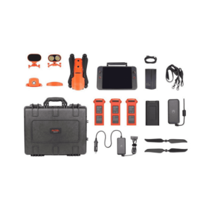
Autel EVO II 640T Enterprise Bundle V3
AED25,750.00 VAT Excl