For surveying, mapping, and BIM professionals today, the core problem is clear: how can you gather large amounts of high density 3D information quickly without losing locational precision? Older stationary scanners (TLS) are precise but become slow and bulky in difficult spots like busy downtown areas, factories, or deep underground. The industry requires a truly mobile answer that is both rapid and dependable for professionals.
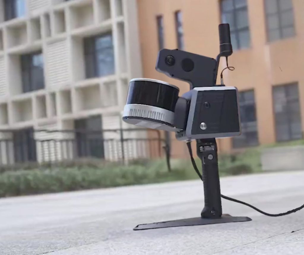
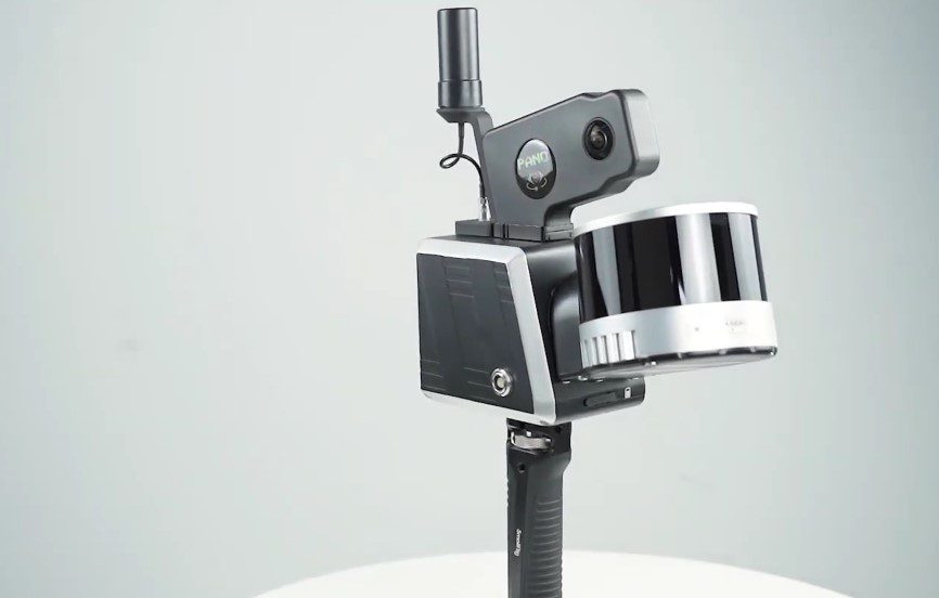
Introducing the SOUTH RobotSLAM Handheld Laser Scanner. This instrument changes the way work is done. It uses advanced Simultaneous Localization and Mapping (SLAM) technology to create massive data files while the operator walks. With Basic, Standard, Professional, and Plus series variants available, the RobotSLAM gives users a specific tool for every requirement, from very fast point cloud creation to completely georeferenced RTK accuracy.
The Core Technology: SLAM, Platform Flexibility, and Model Choice
The RobotSLAM is not just a sensor; it is a versatile data acquisition system built on innovative spatial technology. The cornerstone of its performance is Simultaneous Localization and Mapping (SLAM), which solves a classic challenge in robotics and surveying.
SLAM allows the scanner to build a complex map of its surroundings while simultaneously tracking its exact position within that newly created map. Traditional methods rely on external references or static setups. SLAM eliminates these constraints, enabling high speed, continuous data capture as the operator walks.
Why SLAM Matters
- High Efficiency: Scans that once took hours are now completed in minutes.
- Reliable Indoors and Underground: Perfect for tunnels, basements, and factories.
- Comprehensive Coverage: Reduces shadows and blind spots from static setups.
Choosing Your Scanner: A Model Comparison
Selecting the right RobotSLAM model means matching key features to your project’s demands, especially concerning absolute georeferencing and data density.
- Basic Model: Optimized for standalone SLAM mapping; lightweight and cost-effective for confined environments.
- Standard and Professional Models: Add GNSS differential capability with GPS, Glonass, Beidou, and Galileo tracking. These models provide global georeferencing and include an 18 MP panoramic camera for visually enriched point clouds.
- Plus Series (Standard / Professional): Equipped with an upgraded 16-channel laser sensor capturing 640,000 points per second, ideal for large-scale, high-speed mapping.
Professional Edge
By combining advanced SLAM algorithms with GNSS hybrid positioning, RobotSLAM achieves both speed and precision. It allows professionals to produce dense, globally accurate 3D data in complex settings—whether indoors, outdoors, or in motion.
| Feature | Basic Model | Standard/Professional Models | Plus Series (Standard/Professional) |
| GNSS and RTK | No | Yes (Multiconstellation Differential) | Yes (Multiconstellation Differential) |
| Max Point Rate | 320,000 points/sec | 320,000 points/sec | 640,000 points/sec (Highest Density) |
| Panoramic Camera | No | Yes (18 MP) | Yes (18 MP) |
| Ideal For | Pure SLAM, interiors, tunnels, localized capture | Hybrid outdoor/indoor, georeferenced survey | Large scale mapping, vehicle use, maximum speed |

Platform Flexibility
The RobotSLAM’s “Backpack 3 in 1” design ensures seamless adaptation to any site. It can instantly switch between three primary modes: Handheld Mode for quick, detailed scanning; Backpack Mode for comfortable, long time indoor or outdoor area mapping; and Storage/Transit Mode for easy transport.
Beyond the handheld or backpack setup, the system is designed for comprehensive data collection across specialized platforms:
- USV based: Integrated onto Unmanned Surface Vessels for Shoreside Survey and Bathymetry.
- SUV based: Mounted on vehicles for Automobile Mapping and highway surveys.
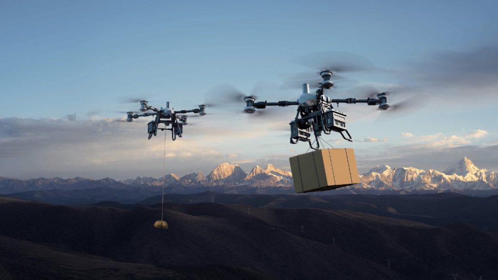
- UAV based: Attached to aerial platforms for rapid Aerial Building Scan and facade capture.
- AI Robot Dog: Deployed in potentially hazardous or restricted zones, maximizing safety and data coverage.
Key Specs on Data Collection
The core sensor specifications highlight the scanner’s professional capability:
- Measurement Rate: The system delivers high speed data capture, up to 320,000 points per second (up to 640,000 pts/sec on Plus Series).
- Scanning Range and FOV: It boasts a measuring range up to 120 meters and offers a wide Field of View (FOV) of 360∘×285∘, ensuring complete scene capture in a single pass.
Seamless Workflow: From Field to Finish
The RobotSLAM system is designed for a smooth transition from data capture to final deliverables. Its integrated software tools, RobotSLAM Palm for field control and RobotSLAM Engine for post processing, work together to create a fast and efficient workflow for professional users.
RobotSLAM Palm: Field Control Made Simple
The RobotSLAM Palm mobile app connects through Wi-Fi or Ethernet, giving users direct control of the scanner using a smartphone or tablet. It allows operators to start and monitor scans, check device diagnostics, and preview data in real time.
Essential functions include:
• CORS and RTK configuration for instant GNSS connectivity
• Battery and task status monitoring to manage power and efficiency
• Instant scan previews to verify coverage before leaving the site
This setup removes the need for bulky field computers and makes on site adjustments fast and convenient.
RobotSLAM Engine: Turning Data into Deliverables
After scanning, data is processed using the RobotSLAM Engine software on a computer. The program automates key steps such as loop closure correction, coordinate transformation, and global registration, ensuring consistent accuracy. Users can refine scans manually, classify point clouds, and extract critical measurements.
With a built in 512 GB SSD and 18 MP panoramic camera, the system captures both geometric and true color detail. The result is a clean, georeferenced point cloud ready for CAD, BIM, or GIS applications.
Together, RobotSLAM Palm and RobotSLAM Engine form a complete data chain from capture to computation, allowing professionals to produce accurate, colorized 3D models more quickly and with greater confidence.
Real-World Applications
The strength of the RobotSLAM system lies not only in its technical precision but also in its adaptability to a wide range of field conditions. Whether indoors, outdoors, or underground, the scanner performs consistently, producing clean and reliable data across diverse surveying and mapping projects.
Underground and Confined Environments
The RobotSLAM excels in spaces where GPS signals cannot reach, such as tunnels, basements, and underground facilities. Using pure SLAM computation, it continuously tracks movement and builds a complete three dimensional model of the environment. This makes it ideal for underground mining surveys, drainage system inspections, and basement digitization where traditional instruments face signal loss and restricted mobility.
Construction and Infrastructure
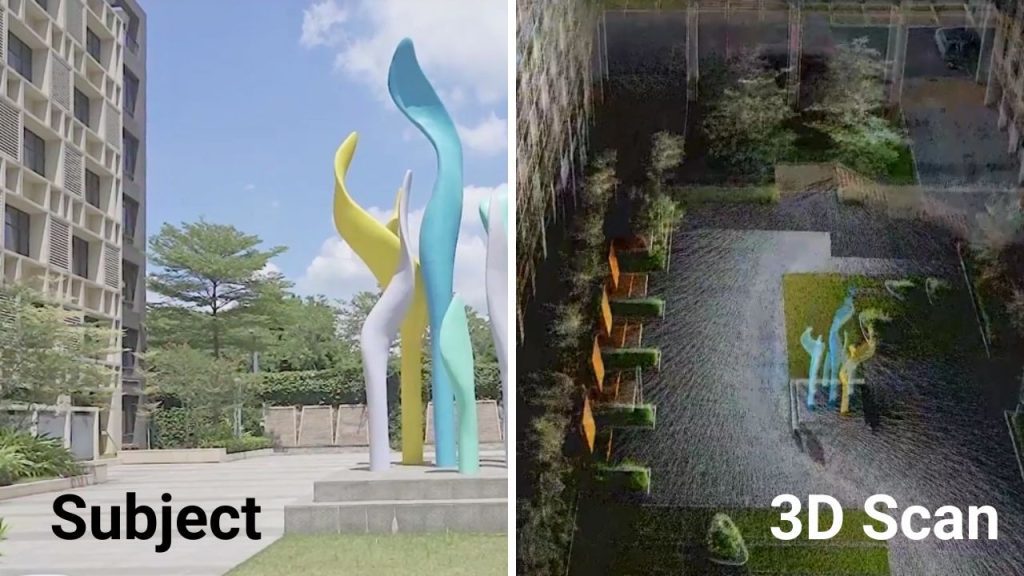
For building and infrastructure professionals, the RobotSLAM provides fast and accurate as built documentation. Operators can walk through construction sites, industrial plants, or high rise interiors while capturing millions of points in minutes. The resulting point cloud enables quick floor plan extraction, elevational mapping, and volume calculations such as stockpile assessment. The images you provided show exactly this context: field engineers using the RobotSLAM to scan complex areas and produce high density models for verification and planning.
Environmental and Specialized Surveys
Mounted on different platforms, the RobotSLAM extends its capabilities beyond handheld use. It can be attached to UAVs for aerial scanning, USVs for bathymetric mapping, or vehicles for corridor surveys. In forestry or coastal studies, it efficiently captures topography and vegetation structure for ecological analysis.
BIM and Digital Twin Development
In architecture and facility management, the RobotSLAM supports the creation of digital twins for renovation, monitoring, or asset documentation. It provides detailed geometric and colorized data that integrates seamlessly into BIM (Building Information Modeling) workflows.
The Future is Handheld 3D
The SOUTH RobotSLAM is redefining how professionals collect and process 3D spatial data. By combining advanced SLAM mapping, GNSS precision, and a lightweight design, it brings speed, mobility, and accuracy to every project.
Surveyors and engineers can now capture high density point clouds in real time without complex setups. From confined underground areas to wide outdoor spaces, the RobotSLAM delivers consistent and reliable results while greatly reducing field time.
This innovation proves that the future of 3D scanning belongs to portable systems that move with the user. It replaces traditional static workflows with an intelligent, mobile solution built for today’s demanding environments.
With the RobotSLAM, SOUTH sets a new standard for professional data capture that is faster, more precise, and ready for the next generation of geospatial work.
Take your 3D scanning projects to the next level.
📩 Get in touch with Dynatech Innovations today to explore the SOUTH RobotSLAM and see what handheld precision can do for you.