No products in the cart.
Back

Out of stock
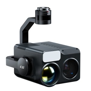
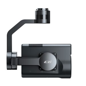
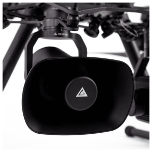
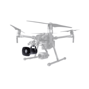
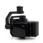
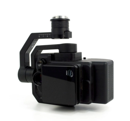
FS-50/180 Multi Spectral Camera
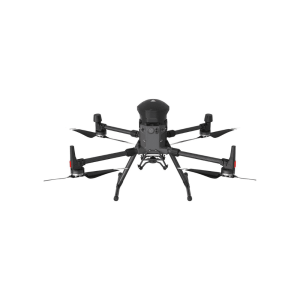
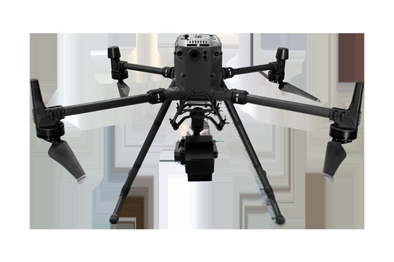
- Compatible with DJI Matrice 350/ 300 RTK
- 400-1000nm Spectral Range
- Number of Spectral Channels: 180 per 3.3nm Output Wavelength
- 2.5nm Spectral Resolution/ Halfwave Width
Contact us for more information
- Description
The FigSpec® FS-50 series is a new generation of unmanned multispectral cameras from Color Spectrum Technology Company, adapted to the DJI M350/M300RTK flight platform, with 30-180 spectral channels and 2K resolution.
It can meet the application needs of precision agriculture, military defense and homeland security, disaster prevention
and forestry monitoring, river and lake ecology, target identification and other industries.
- Ultra-high spectral channels: 30-180 spectral channels (different models)
- 2K spatial resolution
- Global shutter, 12bit high precision sampling data
- Ground station real-time preview data acquisition
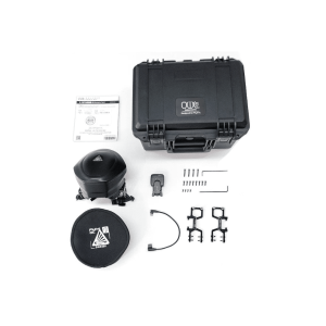
- DJI X-Port control and power supply, 512GSSD mass storage
- DJI M350/M300 RTK UAV customization, plug and play
- FIGSPEC UAV real-time flight control software, FIGSPEC
- Merge puzzle software, FIGSPEC Studio image analysis software
PARAMETERS
| Number of Spectral Channels | 180 |
| Spectral Channel Wavelength | 400-1000nm Per 3.3nm Output a Wavelength |
| Spectral Resolution/ Half Wave width | 2.5nm |
| Spatial Resolution | 1920 |
| Sampling Rate | 128 line/S |
| Image Sensor | 1/1.1 inch CMOS |
| Effective Pixel | 1920 |
| Shutter Type | Global shutter |
| Quantization Number | 12bit |
| Visual Field | 25.36 ° |
| Ground Resolution | 2.8 cm @ h120m |
| Covering Width | 54m@h120m |
| Optical Window | High Transmittance Optical Glass Window |
| Main Engine Size | ≤155*95*119mm |
| Main Engine Weight | ≤840g |
| Installation/ Power Supply Port | X-Port |
| Work Loss | 45w |
| Picture Format | 12bit.SPE (compatible with third party analysis software such as envi) |
| Data Storage Space | 512SSD |
| Application Software | FIGSPEC UAV real-time flight control software, FIGSPEC Merge puzzle software, FIGSPEC Studio image analysis software |
| Shooting Method | Real-Time Acquisition |
TYPICAL APPLICATIONS
Crop Growth Assessment
FigSpec Studio software is built with NDVI and other vegetation factors to accurately quantify the state of vegetation canopy at different spatial scales, quantitatively assess the health, stress and growth of crops and vegetation, and provide data support for crop growth assessment, yield prediction, disease and pest detection, etc.
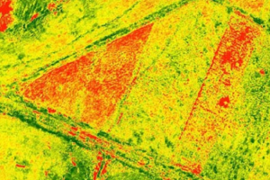
Coverage Evaluation
Based on the spectral fingerprint information of plants, accurate classification of plants in the region and crop area statistics are carried out to provide quantitative vegetation canopy data to provide data support for scientific research and production of agriculture and forestry ecological industry.
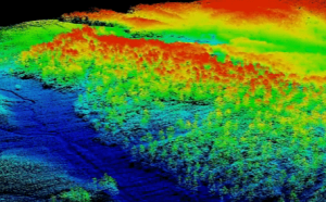
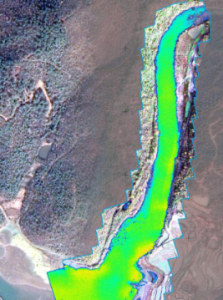
Water Quality Analysis and Monitoring
Using the spectral data and chemical analysis results, the analysis model is constructed to realize the inversion of the classification and water quality parameters of black and odorous water bodies. Combined with spatial information to monitor the impact of domestic sewage and industrial wastewater on surrounding water bodies, help pollution source investigation and water environment assessment.
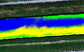
Water Eutrophication Monitoring
Spectral data are used to form a classification index to monitor water eutrophication and conduct spatial information statistics. Following the evaluation standards of water eutrophication status, it assists in analyzing water pollution sources such as farmland, aquaculture and fishery, and provides data and powerful data collection tools for pollution source investigation and water environment assessment.