-
1× AED10,500.00
Subtotal: AED10,500.00
Subtotal: AED10,500.00

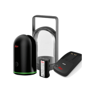
When surveyors have a high-quality internet connection, they can process image data online through the network and cloud servers. INNO8 can obtain coordinate data for image measurements with 2cm accuracy in just a few minutes. This processing mode balances high accuracy and fast processing speed.
When outside the coverage area of internet, surveyors can achieve offline processing of image data through the data controller app. This processing mode boosts the fastest processing speed by saving me of uploading image data, providing 4cm accuracy results within 30 seconds.
Sometimes, surveyors have limited me for fieldwork and need to collect the maximum amount of data in the shortest possible me. In such cases, they can choose not to process data on-site but instead use desktop data post-processing software to process image data a er returning to the office. This working mode offers richer measurement and calculation functionalities, comprehensive data applications, allowing users to focus on data collection outdoors, achieving the highest point acquisition speed, and making the most of their me.
With INNO8, single-user standalone opera on is sufficient to achieve 3D modeling, visually presenting geographic information data such as coordinates, areas, and volumes. Model data can be transformed into different formats and applied with various coordinate parameters based on actual needs, making it adaptable to a wider range of application scenarios.
SOUTH’s 3D modeling technology are fully utilized and transformed in INNO8. The results of image measurements by INNO8, can be seamlessly integrated with data outcomes from DJI and other brand UAV. UAV surveys often face challenges of data gaps, leading to incomplete model outcomes. In such cases, surveyors can use INNO8 to collect image data on the ground and incorporate it into aerial survey data as a supplement, thereby enhancing the overall model outcome.
Surveyors can import the data outcomes from INNO8 into SOUTH UAV and other third-party modeling software for 3D modeling. SGO (PC version) and SurvStar (Android App) will also support 3D modeling function in the future. Users can choose the software that best suits the current scenario and task requirements to achieve the highest work efficiency.
Experience INNO8 AR stakeout by following the real- me, real-scene guidance on the data controller display without continuously watching on the compass or leveling the pole. In addition to points, INNO8 can handle staking out lines and curves with AR, which broaden its applications and is suitable for more complex work demands. With AR stakeout, you can now achieve quick and precise stakeouts with ease.
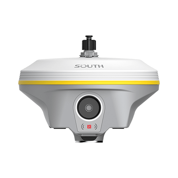
| GNSS Performances | Signal Tracking(1598) | 1598 channels GPS: L1, L1C, L2C, L2P, L5 GLONASS: L1C/A,L1P,L2C/A,L2P,L3 BDS: BDS-2: B1I, B2I, B3I, BDS-3: B1I, B3I, B1C, B2a, B2b* GALILEO: E1, E5A, E5B, E6C, AltBOC* SBAS(WAAS/MSAS/EGNOS/GAGAN): L1* IRNSS: L5* QZSS: L1, L2C, L5* MSS L-Band: BDS-PPP, Galileo HAS |
| Signal Tracking(1698) | 1698 channels GPS: L1, L1C, L2C, L2P, L5 GLONASS: G1, G2, G3 BDS: B1I, B2I, B3L, B1C, B2A, B2B* GALILEO: E1, E5A, E5B, E6C* SBAS(WAAS/MSAS/EGNOS/GAGAN): L1C, L1A* Navic/IRNSS: L5* QZSS: L1, L2C, L5* MSS L-Band: BDS-PPP, GALILEO-HAS |
|
| Signal Tracking(1760) | 1760 channels GPS: L1C/A, L1C, L2C, L2P, L5 GLONASS: L1C/A, L2C/A, L2P, L3 CDMA BDS: B1I, B1C, B2I, B2a, B3 GALILEO: E1, E5A, E5B, E5AltBOC, E6 SBAS: EGNOS, WAAS, GAGAN, MSAS, SDCM(L1,L5) Navic: L5 QZSS: L1C/A, L1C, L2C, L5, L6 MSS L-Band: BDS-PPP, Galileo HAS* |
|
| Other Features | Initialization Time: <10s Initialization reliability: >99.99% Positioning output rate: 1Hz~20Hz |
|
| Positioning Precision | Code differential GNSS positioning | H: 0.25m+1 ppm RMS V: 0.50m+1 ppm RMS |
| Static(long observations) | H: 2.5mm+0.1 ppm RMS V: 3mm+0.4 ppm RMS |
|
| Static | H: 2.5 mm + 0.5 ppm RMS V: 5 mm + 0.5 ppm RMS |
|
| Rapid static | H: 2.5 mm + 0.5 ppm RMS V: 5 mm + 0.5 ppm RMS |
|
| PPK | H: 3 mm + 1 ppm RMS V: 5 mm + 1 ppm RMS |
|
| RTK(UHF) | H: 8 mm + 1 ppm RMS V: 15 mm + 1 ppm RMS |
|
| RTK(NTRIP) | H: 8 mm + 0.5 ppm RMS V: 15 mm + 0.5 ppm RMS |
|
| RTK initialization time | 2-8s | |
| SBAS positioning | Typically<5m 3DRMS | |
| BDSPPP | H:10cm V: 20cm |
|
| Galileo HAS | H: 20cm V: 40cm |
|
| IMU | Update Rate | 200Hz |
| Tilt Angle | 0-60° | |
| Initialization Way | Shake or Walk | |
| Type | Calibration Free | |
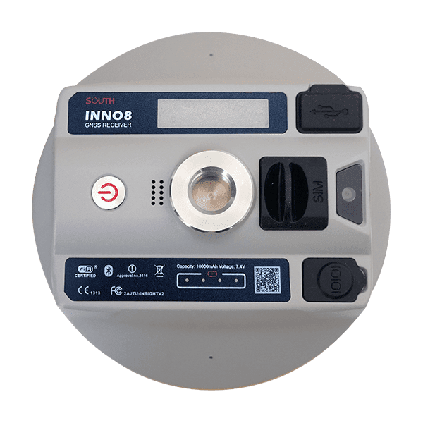
| User Interface | Keys | Power key |
| Touch Screen | HD 1.39inches color circle touch screen | |
| LED | Power Indicator | |
| WEB UI | Supported | |
| Voice Guidance | Supported | |
| Language Supported | Chinese, English, Korean, Russian, Spanish, Portuguese, Turkish, French, Italian | |
| Operating System | Linux | |
| Secondary Development | Provides secondary development package and opens the OpenSIC observation data format and interaction interface definition | |
| Cloud Service | Cloud service The powerful cloud platform provides online services like remote management, firmware update, online register, etc. | |
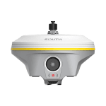
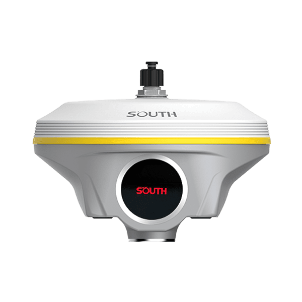
| Hardware | Dimension | 155mm(Φ) *98.5mm(H) |
| Weight | 1.2kg | |
| Material | Magnesium aluminum alloy shell | |
| Temperature | Working: -45℃ to +75℃ Storage: -55℃ to +85 ℃ |
|
| Humidity | 100% Non-condensing | |
| Waterproof/Dustproof Shock/Vibration | IP68 standard; Withstand 2m pole drop onto the cement ground naturally | |
| Power supply | 6-18V DC, overvoltage protection | |
| Battery | Built-in 7.4V 10000mAh, PD quick charge protocol; rover data collector internet mode>20h | |
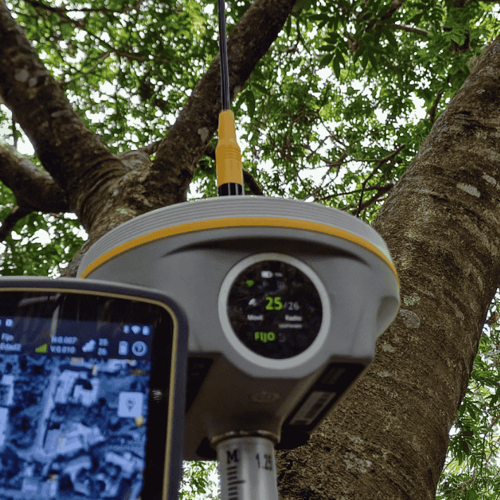
| Electronic Bubble | Controller software can display electronic bubble, checking leveling status of the carbon pole in real-time | |
| Thermometer | Built-in thermometer sensor, adopting intelligent temperature control technology, monitoring and adjusting the receiver temperature | |
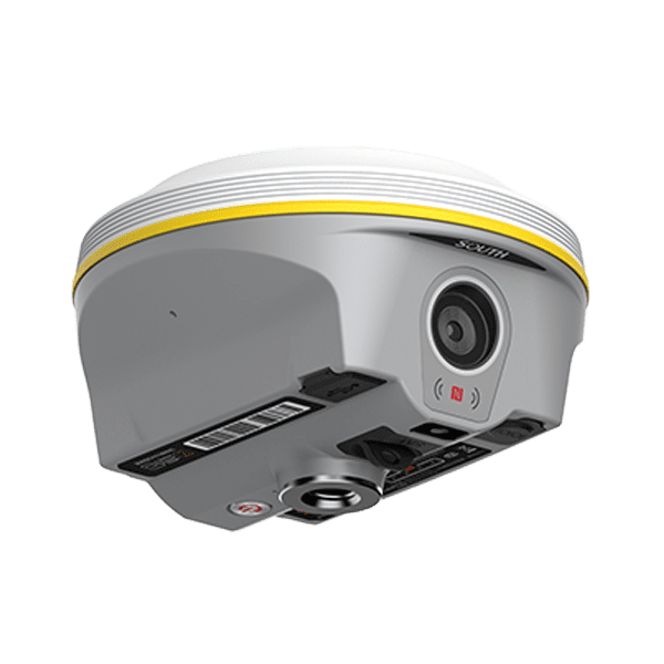
| AR Stakeout Camera | Pixel | 2M |
| Visual Angle | 75° | |
| Visual Positioning Camera | ||
| Pixel | 8M | |
| Communication | I/O Ports | 5-PIN LEMO (external power port + RS232) Type-C(charge+USB+OTG+Ethernet) UHF antenna interface |
| Radio | 1W/2W/3W Radio receiver and transmitter Frequency range: 410-470MHz Protocol: Farlink, SOUTH, TrimTalk, Hi-target, HUACE Radio router, Radio repeater Range: With Farlink protocol, up to 15km |
|
| WIFI | 802.11b/g/n Support AP mode and Client mode |
|
| Cellular Network | 4G LTE, 3G WCDMA, 2G GPRS, GSM |
|
| NFC | Automatic pair between receiver and controller (controller requires NFC wireless communication module) | |
| BT | Bluetooth 4.0 standard, Bluetooth 2.1+EDR |
|
| Data Storage/Transmission | Storage | 64GB SSD internal storage Automatic cycle storage Support external USB storage The customizable sample interval is up to 50Hz |
| Data Transmission | Plug and play mode of USB data transmission Supports FTP/HTTP data download |
|
| Data Format | Static data format: STH, Rinex2.01, Rinex3.02 and etc. Differential data format: RTCM 2.1, RTCM 2.3, RTCM 3.0, RTCM 3.1, RTCM 3.2 GPS output data format: NMEA 0183, PJK plane coordinate, Binary code Network model support: VRS, FKP, MAC, fully support NTRIP protocol |
|
*Reserve for future upgrade. Remarks: Measurement accuracy and operation range might vary due to atmospheric conditions, signal multipath, obstructions, observation time, temperature, signal geometry and number of tracked satellites. Specifications subject to change without prior notice.
1.Actual battery life can vary depending on usage patterns and other factors. The listed parameter was obtained under controlled testing conditions.
Created by Tomsher